2022 Map of Walstonburg
USGS Topo · Published 2022About this map
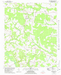
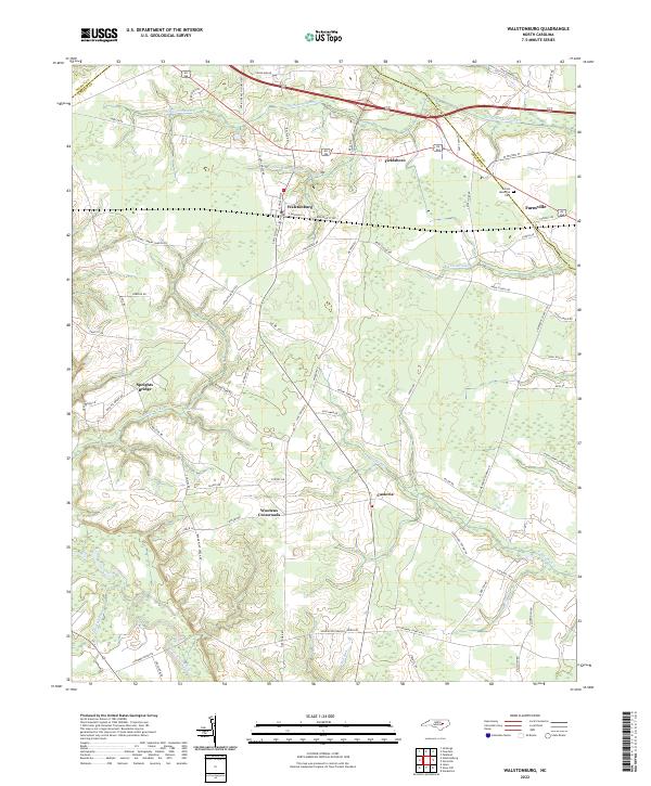
Walstonburg serves as the central hub for this corner of the Coastal Plain, where Greene, Pitt, and Wilson counties meet along a network of low-lying wetlands. The landscape is defined by its drainages, notably Thompson Swamp and Lighter Knot Swamp in the north, and the significant Contentnea Creek corridor in the southwest. These water systems historically shaped the placement of rural crossroads and settlements such as Castoria and Wootens Crossroads. The eastern edge of the survey captures the outskirts of Farmville, including Sunset Memorial Park, while small hamlets like Fieldsboro and Speights Bridge mark the intersection of long-established country roads. The transition from the dense swamp bottomlands of Nahunta Swamp to the upland agricultural fields reflects the area's long reliance on its complex hydrology for both navigation and field drainage.
Find a feature on this map
76 named features on this map. Tap any name to fly to it.
Don’t see what you’re looking for? This feature index may not catch every label — zoom into the map to look around manually.
Map Details
Editions of this 2022 Walstonburg Map
This is the sole edition of this map. No revisions or reprints were ever made.