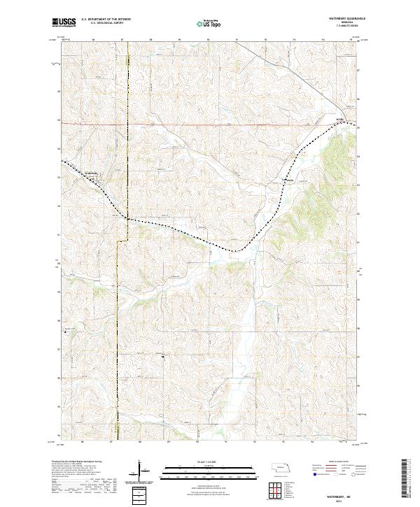
2021 Map of Waterbury
USGS Topo · Published 2021About this map
Waterbury sits at the heart of this landscape where the boundary between Dixon and Dakota Counties meets a network of creek drainages. The area is defined by the winding paths of Otter Creek and Pigeon Creek, which carve through the undulating terrain typical of this Nebraska region. Small clusters of settlement at Goodwin and Willis are connected by a grid of rural roads like West Sarpy Road and Pioneer Trail. For those tracing local families, the map identifies specific burial sites such as Marquis Cemetery and Woods Cemetery, which serve as quiet landmarks among the expansive agricultural plots and section lines of the Public Land Survey System. The presence of State Spur 26 highlights the infrastructure supporting these rural communities as they navigate the ridges and valleys between Badger Creek and Minnow Creek.
Find a feature on this map
45 named features on this map. Tap any name to fly to it.
Don’t see what you’re looking for? This feature index may not catch every label — zoom into the map to look around manually.
Map Details
Editions of this 2021 Waterbury Map
This is the sole edition of this map. No revisions or reprints were ever made.
Other maps of this area

1898 · Elk Point
USGS Topo · 1:125,000

1901 · Elk Point
USGS Topo · 1:125,000

1907 · Elk Point
USGS Topo · 1:125,000

1955 · Sioux City
USGS Topo · 1:250,000

1958 · Sioux City
USGS Topo · 1:250,000

1959 · Sioux City
USGS Topo · 1:250,000

1963 · Jefferson
USGS Topo · 1:24,000
1964 · Ponca
USGS Topo · 1:24,000
1964 · Martinsburg
USGS Topo · 1:24,000

1967 · Waterbury
USGS Topo · 1:24,000