Loading...
Loading map...2022 Map of Weston
USGS Topo · Published 2022About this map
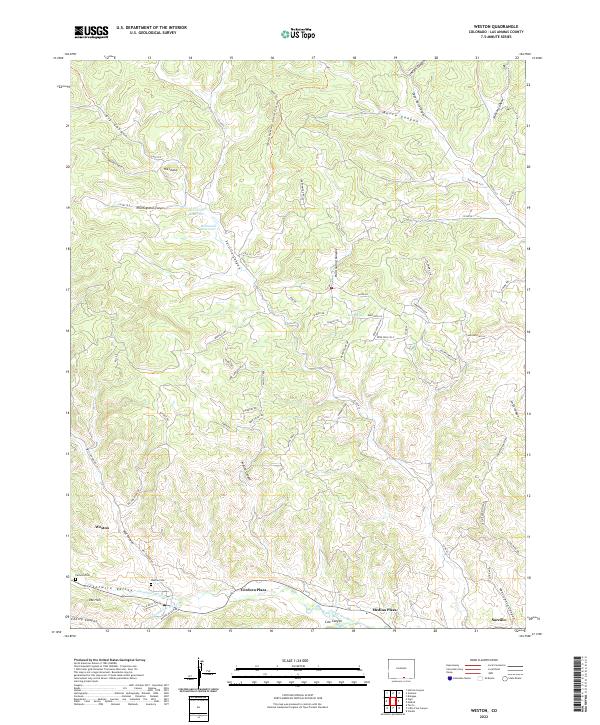
Weston and the surrounding riverfront communities along the Purgatoire River anchor this topographic study of Las Animas County. The map details a network of plazas and small settlements including Cordova Plaza, Medina Plaza, and Sarcillo, reflecting the traditional valley settlement patterns of southern Colorado. In the Picketwire Valley, local genealogy is grounded by the presence of Weston Cem and Pacheca Cem, located near the junction of the river and its southern fork.
Find a feature on this map
74 named features on this map. Tap any name to fly to it.
Don’t see what you’re looking for? This feature index may not catch every label — zoom into the map to look around manually.
Map Details
Date Portrayed2022
Date Published2022
PublisherU.S. Geological Survey
Map TypeTopographic
Scale1:24000
Physical Dimensions24 x 29 inches
Editions of this 2022 Weston Map
This is the sole edition of this map. No revisions or reprints were ever made.
Historical Maps of Cordova Plaza Through Time
Featured Locations
Source Details
SourceU.S. Geological Survey
CopyrightPublic Domain