2023 Map of Williamsburg
USGS Topo · Published 2023About this map
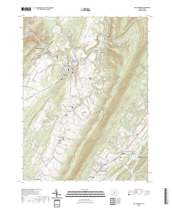
The Frankstown Branch Juniata River carves a winding path through this portion of Blair and Huntingdon Counties, anchoring a landscape defined by parallel ridges like Tussey Mountain and Warrior Ridge. Williamsburg serves as a central hub, surrounded by smaller settlements such as Robeson Extension, Shelltown, and Ganister. This 2023 survey reveals a dense concentration of historical religious sites and family burial grounds, including the Old Stone Church Cem and the Bowers Family Cem near Larke. The terrain is marked by significant geological and industrial features, from the Arch Spring Natural Bridge to the Ganister Blue Hole. Southward, the map details the community of Marklesburg near the foothills of Backbone Ridge, illustrating how local infrastructure like Cove Valley Airport and the Lower Trl has integrated into the older settlement patterns of the valley.
Find a feature on this map
129 named features on this map. Tap any name to fly to it.
Don’t see what you’re looking for? This feature index may not catch every label — zoom into the map to look around manually.
Map Details
Editions of this 2023 Williamsburg Map
This is the sole edition of this map. No revisions or reprints were ever made.
Historical Maps of Marklesburg Through Time
Featured Locations
- Penn Township, PA
- Marklesburg, PA
- Frankstown Township, PA
- Williamsburg, PA
- Franklin Forge, Woodbury Township