2021 Map of Winchester
USGS Topo · Published 2021About this map
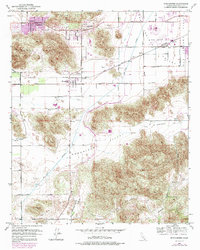
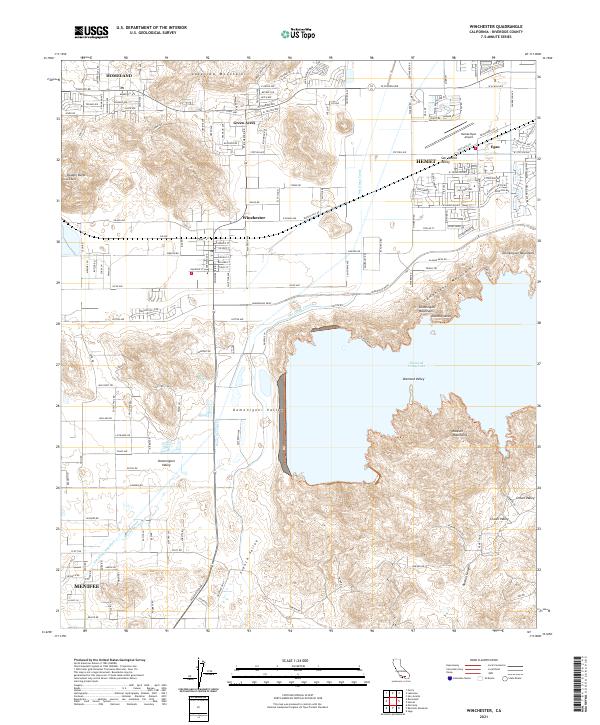
Diamond Valley Lake dominates the central landscape of this 2021 survey, a massive reservoir framed by the Domenigoni Mountains and Rawson Mountains. The map illustrates the contemporary expansion of communities like Menifee and Winchester, where residential street grids intersect with the agricultural and hydrological legacy of the Domenigoni Valley. This area is defined by its water infrastructure, tracing the paths of the San Diego Canal and the San Diego Aqueduct as they move through the San Jacinto Valley. Between the established settlements of Hemet and Homeland, the terrain transitions from the rocky peaks of Double Butte and the Lakeview Mountains to the spreading development of Green Acres. The presence of French Valley and Crown Valley in the south highlights the topographical diversity of this inland region.
Find a feature on this map
95 named features on this map. Tap any name to fly to it.
Don’t see what you’re looking for? This feature index may not catch every label — zoom into the map to look around manually.
Map Details
Editions of this 2021 Winchester Map
This is the sole edition of this map. No revisions or reprints were ever made.