2024 Map of Yachats
USGS Topo · Published 2024About this map
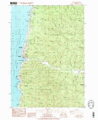
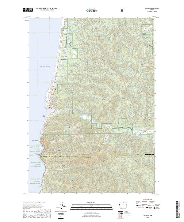
The town of Yachats sits at the dramatic meeting of the Yachats River and the Pacific, surrounded by the protected expanses of the Siuslaw National Forest. This modern 2024 map illustrates a landscape defined by significant conservation areas, including the Oregon Islands National Wildlife Refuge and the Cummins Creek Wilderness. The topography rises sharply from the coast to heights like Blodgett Peak and Yachats Mtn, dissected by numerous waterways such as Vingie Creek and Starr Creek.
Find a feature on this map
81 named features on this map. Tap any name to fly to it.
Don’t see what you’re looking for? This feature index may not catch every label — zoom into the map to look around manually.
Map Details
Editions of this 2024 Yachats Map
This is the sole edition of this map. No revisions or reprints were ever made.