Old Maps of Bayamón
Explore 32 old maps of Bayamón, spanning from 1941 to today. These high-resolution historic maps reveal how streets, neighborhoods, landmarks, and natural features evolved over time — perfect for genealogy, metal detecting, research, and local history exploration.
What you can do with these maps:
- See how Bayamón changed over time: Compare historical maps to modern-day views to trace roads, homesites, rail lines & more.
- View detailed metadata: Each map includes creators, publishers, year, scale, and archive source.
- Overlay maps with satellite & LiDAR: Visualize the past alongside modern tools to explore terrain & human change.
- Trusted historical sources: Maps sourced from the USGS, Library of Congress, and other archives.
- Access maps your way: View online, download high-res files, or order prints for personal or research use.
Start exploring old maps of Bayamón to uncover forgotten places, hidden landmarks, and the deep history beneath your feet.
Bayamón maps
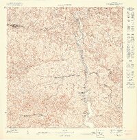
(32)- 1941 Map of Bayamon
 1941 Bayamon1941 Print · USGSBayamón and the northern coast of Puerto Rico appear here in the early 1940s as a landscape of sugar centrales and rail lines. Genealogists and historians can trace family locations through numerous named colonias and landmarks like Central Juanita, Colonia La Monserrate, and Iglesia Cristo Rey.2 unique versions available
 - 1941 Map of San Juan
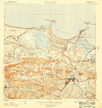
 1941 San Juan1941 Print · USGSSan Juan and its surrounding municipios are captured here in the early 1940s, showing the capital's expansion before the post-war industrial boom. Researchers can trace the layout of early suburbs like Hato Rey, locate landmarks like the Universidad de Puerto Rico, or study the historic fortifications at Morro Castle.2 unique versions available
 - 1946 Map of Naranjito
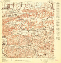
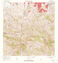
 1946 Naranjito1946 Print · USGSNaranjito and the surrounding mountains of central Puerto Rico appear in the mid-1940s as a landscape of agricultural colonias and emerging utilities. Researchers can locate numerous rural chapels like the Iglesia Guadiana and trace the path of the Acueducto de San Juan through the hills.3 unique versions available
 - 1947 Map of Naranjito SO
 1947 Naranjito SO1947 Print · USGSNaranjito and the central highlands of Puerto Rico appear here in the 1940s, revealing a landscape shaped by the Rio de la Plata. Genealogists and local historians can trace parish sites like Iglesia Parroquial Corazon de Jesus and industrial sites like the Represa de Comerio.
 - 1947 Map of Naranjito SE
 1947 Naranjito SE1947 Print · USGSThe rural interior of Puerto Rico comes into focus during the late 1940s, showing a landscape defined by sharp ridges and winding river valleys. Genealogists and researchers can trace local congregations and infrastructure including the Iglesia Juan Ascencio and the Acueducto de San Juan.
 - 1947 Map of Bayamon
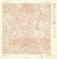
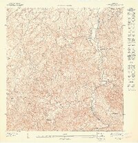
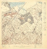
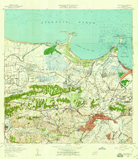
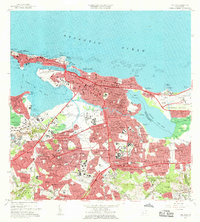
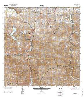
 1947 Bayamon1947 Print · USGSBayamon and the San Juan coastline are seen here in the late 1930s as a landscape of sugar central mills and coastal colonies. Researchers can trace the American RR line to Central Juanita or locate old community anchors like Pueblo Viejo and El Cañuelo.4 unique versions available
 - 1947 Map of Naranjito NO
 1947 Naranjito NO1947 Print · USGSToa Alta and Naranjito are shown here in the mid-1940s as a patchwork of mountain agriculture and rural faith. Genealogists can trace family footprints near Primera Iglesia de Cristo, the Colonia Piña, and along the winding Rio De La Plata.
 - 1947 Map of Naranjito NE
 1947 Naranjito NE1947 Print · USGSBayamón and Guaynabo appear in high detail during the late 1940s, highlighting a landscape of rural colonias and steep mountain ridges. Genealogists and historians can trace the footpaths and properties around Colonia Tió, Iglesia de Minillas, and the Río Bayamón.
 - 1947 Map of San Juan
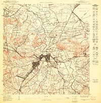
 1947 San Juan1947 Print · USGSSan Juan is captured in the mid-forties as it expands from the historic islet toward the inland hills and the university grounds. Genealogists and historians can trace early neighborhoods like Barriada Eleanor Roosevelt and landmarks such as Las Ruinas de Caparra and the American Railroad.3 unique versions available
 - 1949 Map of San Juan, 1952 Print
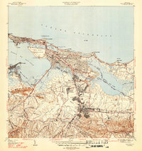
 1949 San Juan1952 Print · USGSSan Juan and its surrounding barrios were undergoing significant expansion during the late 1940s as urbanization pushed south and east from the old city. Genealogists and historians can trace institutional landmarks like the Universidad de Puerto Rico, the historic walls of Fort Brook, and neighborhood developments in Barriada Eleanor Roosevelt.2 unique versions available
 - 1950 Map of Bayamon SO
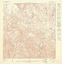
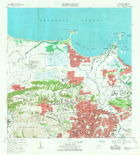
 1950 Bayamon SO1950 Print · USGSCoastal plains meet the limestone hills south of San Juan at mid-century, before modern urbanization transformed the landscape. Trace the boundaries of the Reservacion Naval and locate family homesteads near Toa Alta, Sabana Seca, and the Iglesia Evangelica.
 - 1950 Map of San Juan SO
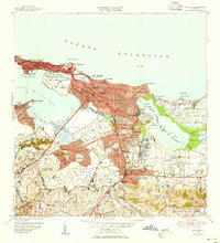
 1950 San Juan SO1950 Print · USGSSan Juan's southwestern suburbs were undergoing a massive transformation at mid-century, transitioning from rural barrios to major urban hubs. Genealogists and historians can trace family roots through emerging neighborhoods like Barriada Eleanor Roosevelt and institutions such as the Sanatorio Insular.
 - 1950 Map of Bayamon SE
 1950 Bayamon SE1950 Print · USGSBayamón was a rapidly evolving municipal center at mid-century, where agricultural heritage and industrial infrastructure met. Genealogists and historians can trace family roots through the dense urban grids of Bayamón and Vista Alegre or find long-standing landmarks like Central Juanita and the Cem Nacional de Puerto Rico.
 - 1952 Map of Naranjito, 1953 Print
 1952 Naranjito1953 Print · USGSNaranjito and the central highlands are captured here in the early fifties, showing a landscape of traditional agricultural colonias and developing barrios. Genealogists can locate specific family landmarks and local institutions like Iglesia de Minillas, Escuela Don Manolo, and the Represa de Comerio.2 unique versions available
 - 1957 Map of Naranjito, 1959 Print
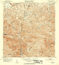
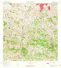
 1957 Naranjito1959 Print · USGSNaranjito and the central highlands of Puerto Rico appear in detail during the late 1950s, showing a landscape defined by sharp ridges and deep river valleys. Researchers can trace rural life through landmarks like Iglesia de la Monserrate and the Represa de San Juan reservoir.
 - 1957 Map of Bayamon, 1959 Print
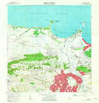
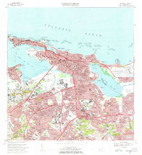
 1957 Bayamon1959 Print · USGSBayamón and its coastal surroundings are captured here in the late fifties, showing the area as industrial centers and new suburbs began to reshape the landscape. Researchers can trace family roots in Pueblo Viejo or locate landmarks like Central Juanita and Isla de Cabras.
 - 1957 Map of San Juan, 1959 Print
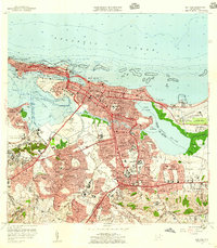 1957 San Juan1959 Print · USGSSan Juan and its surrounding barrios are seen here in the midst of mid-century modernization, from the old city walls to the emerging international airport. Genealogists and historians can locate family sites across Santurce, the grounds of the Universidad de Puerto Rico, and historic landmarks like La Fortaleza.
 - 1963 Map of Bayamon, 1965 Print
 1963 Bayamon1965 Print · USGSBayamón and the surrounding coastal barrios are captured during a period of rapid development and military importance in the early sixties. Researchers can trace family roots through the Puerto Rico National Cemetery or locate historic industrial sites like Central Juanita and the Planta Termelectrica De Palo Seco.
 - 1963 Map of Naranjito, 1965 Print
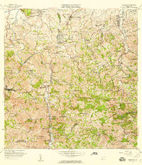
 1963 Naranjito1965 Print · USGSNaranjito and the Puerto Rican interior are shown here during a period of rapid development in the 1960s. Researchers can trace rural school locations like Escuela Dajaos Sexto or explore the early power network at Planta Hidroeléctrica Comerío No 2.
 - 1963 Map of San Juan, 1965 Print
 1963 San Juan1965 Print · USGSSan Juan and its surrounding barrios are shown in detail during the early sixties, capturing the city as it matured into a modern Caribbean hub. Researchers can locate family landmarks such as Cementerio Maria Magdalena, schools like Escuela Luchetti, and the expanding Aeropuerto de Isla Grande.
 - 1969 Map of Bayamon, 1971 Print
 1969 Bayamon1971 Print · USGSBayamón and Toa Baja are seen in a period of intense suburban growth and industrial development during the late sixties. Researchers can trace the layout of Levittown, locate the Puerto Rico National Cemetery, and see the vast US Naval Radio Station (R) Sabana Seca.4 unique versions available
 - 1969 Map of San Juan, 1972 Print
 1969 San Juan1972 Print · USGSSan Juan entered a period of rapid modernization in the late sixties as its urban footprint expanded across the lagoons. You can trace the development of barrios like Condado and locate landmarks such as the Universidad de Puerto Rico and Estadio Municipal Hiram Bithorn.3 unique versions available
 - 1969 Map of Naranjito, 1972 Print
 1969 Naranjito1972 Print · USGSThe Naranjito and Bayamón regions undergo significant growth in the late sixties as residential developments meet industrial river infrastructure. Researchers can trace the development of Royal Town or locate the Planta Hidroeléctrica Comerio Num 1 and Escuela Miguel Cervantes Saavedra.3 unique versions available
 - 2013 Map of Naranjito, 2013 Print
 2013 Naranjito2013 Print · USGSCovers Bayamón, including Naranjito, Villas del Olimpo, and other nearby areas
 - 2013 Map of San Juan, 2013 Print
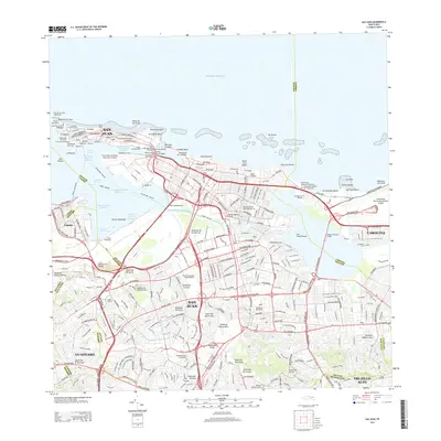 2013 San Juan2013 Print · USGSCovers Bayamón, including San Juan, Cataño, and other nearby areas
Showing maps 1-25 of 32
Frequently asked questions
- What are the different types of historical maps available for Bayamón?
- What is the oldest map of Bayamón?
- Where can I purchase historical maps of Bayamón for my home or office?
- Where can I download high-res historical maps of Bayamón?
- Are there historical topographic maps available for Bayamón?
- Is there historical aerial imagery available for Bayamón?
- Where are historical maps of Bayamón sourced from?