Old Maps of Bajura, Isabela
Explore 7 old maps of Bajura, spanning from 1941 to today. These high-resolution historic maps reveal how streets, neighborhoods, landmarks, and natural features evolved over time — perfect for genealogy, metal detecting, research, and local history exploration.
What you can do with these maps:
- See how Bajura changed over time: Compare historical maps to modern-day views to trace roads, homesites, rail lines & more.
- View detailed metadata: Each map includes creators, publishers, year, scale, and archive source.
- Overlay maps with satellite & LiDAR: Visualize the past alongside modern tools to explore terrain & human change.
- Trusted historical sources: Maps sourced from the USGS, Library of Congress, and other archives.
- Access maps your way: View online, download high-res files, or order prints for personal or research use.
Start exploring old maps of Bajura to uncover forgotten places, hidden landmarks, and the deep history beneath your feet.
Bajura, Isabela maps
(7)- 1941 Map of Isabela
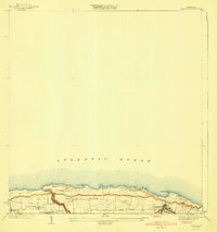 1941 Isabela1941 Print · USGSThe northern coast of Puerto Rico is captured here in the late thirties, when rail travel was still the backbone of local transit. Genealogists and historians can trace the early layout of Isabela, the route of the RR of PR, and local landmarks like San Antonio.5 unique versions available
 - 1950 Map of Isabela SO
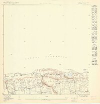 1950 Isabela SO1950 Print · USGSNorthwest Puerto Rico at the midpoint of the century reveals a coastal landscape of traditional barrios and growing infrastructure. Genealogists can trace family footprints through the settlements of Aguacate and San Antonio or locate the Iglesia Católica and local schools.
 - 1950 Map of Isabela SE
 1950 Isabela SE1950 Print · USGSCoastal Puerto Rico at the midpoint of the century reveals a landscape of traditional barrios and growing rail infrastructure. Trace the early layout of Isabela and the path of the American R. R. of P. R. near Pta Sardina.
 - 1960 Map of Isabela, 1961 Print
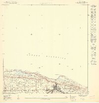
 1960 Isabela1961 Print · USGSThe northwestern coast of Puerto Rico is captured here in the early sixties, showing the intersection of local town life and major military installations. Researchers can trace the perimeter of Ramey Air Force Base and locate family homesites within Jobos, Bejucos, and the Isabela town center.4 unique versions available
 - 2013 Map of Isabela, 2013 Print
 2013 Isabela2013 Print · USGSCovers Bajura, including Isabela, Sector Quique Bravo, and other nearby areas
 - 2018 Map of Isabela, 2018 Print
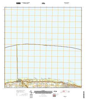 2018 Isabela2018 Print · USGSCovers Bajura, including Isabela, Sector Quique Bravo, and other nearby areas
 - 2024 Map of Isabela, 2024 Print
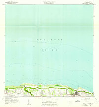
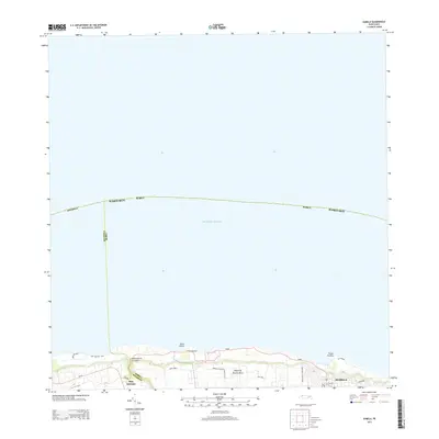
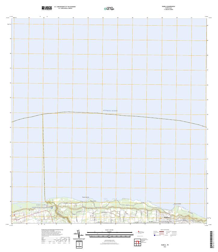 2024 Isabela2024 Print · USGSThe northern coast of Puerto Rico is captured here in the contemporary era, showcasing the coastal settlement of Isabela. Researchers can trace the scientific footprint of the Ramey AF Solar Observatory Research Site and coastal features like Punta Sardina.
End of results
Showing maps 1-7 of 7
Frequently asked questions
- What are the different types of historical maps available for Bajura?
- What is the oldest map of Bajura?
- Where can I purchase historical maps of Bajura for my home or office?
- Where can I download high-res historical maps of Bajura?
- Are there historical topographic maps available for Bajura?
- Is there historical aerial imagery available for Bajura?
- Where are historical maps of Bajura sourced from?