Old Maps of El Papayo, Lajas for Genealogy
Trace your family roots with 7 historic maps of El Papayo. These high-res maps reveal old neighborhoods, homesites, landmarks, and streets — helping you uncover where your ancestors lived and how the area evolved over time.
- Explore historic neighborhoods: Identify where your relatives may have lived in the 1800s or 1900s.
- Compare maps over time: Trace the changes in streets, buildings, and landmarks for multi-generational research.
- Perfect for genealogy & ancestry research: Used by family historians and researchers to map out lineage and migration.
These maps are an incredible resource for exploring your personal connection to El Papayo's past.
El Papayo, Lajas maps
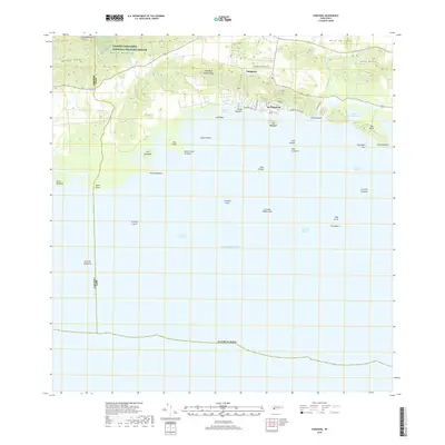
(7)- 1938 Map of Parguera
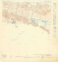
 1938 Parguera1938 Print · USGSThe southwestern coast of Puerto Rico is mapped here in the late thirties, before the expansion of its coastal villages. Local historians can trace the early layout of Parguera, the footprint of the Escuela Ramon Baldorioty de Castro, and traditional sites like Salinas El Papayo.4 unique versions available
 - 1949 Map of Parguera NE
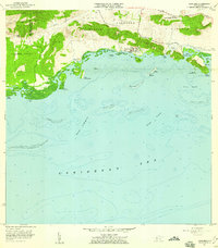
 1949 Parguera NE1949 Print · USGSThe Lajas coast of southwest Puerto Rico is captured here in the late 1940s, showing the early layouts of coastal settlements and salt flats. Genealogists and historians can locate family sites near Parguera or Papayo and trace landmarks like the Escuela Ramón Baldorioty de Castro.
 - 1957 Map of Parguera, 1959 Print
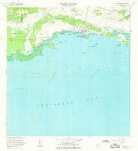
 1957 Parguera1959 Print · USGSThe Lajas coastline comes alive in the late fifties, showing the interplay between salt production and sea. Trace the shoreline of Bahía Fosforescente, locate the Escuela Ramón Baldorioty de Castro, and explore reefs like Arrecife Coral.
 - 1966 Map of Parguera, 1969 Print
 1966 Parguera1969 Print · USGSCoastal Lajas and Cabo Rojo are captured in the 1960s just as marine research and conservation were being formalized. Historians can trace the development of Parguera and locate regional landmarks like the NIH Research Facility or the Bahía Fosforescente shoreline.2 unique versions available
 - 2013 Map of Parguera, 2013 Print
 2013 Parguera2013 Print · USGSCovers El Papayo, including Villa Caribe, Lajas, and other nearby areas
 - 2018 Map of Parguera, 2018 Print
 2018 Parguera2018 Print · USGSCovers El Papayo, including Villa Caribe, Lajas, and other nearby areas
 - 2024 Map of Parguera, 2024 Print
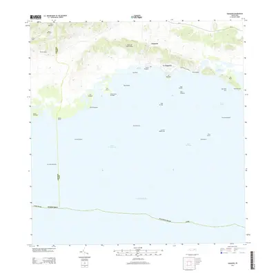
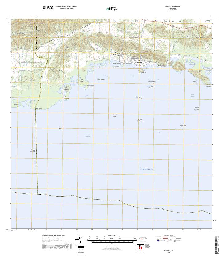 2024 Parguera2024 Print · USGSThe southwestern coast of Puerto Rico comes alive in this contemporary survey of the Lajas shoreline and its famous bioluminescent waters. Maritime researchers and locals can trace the intricate reef systems from Arrecife Media Luna to the keys surrounding La Parguera.
End of results
Showing maps 1-7 of 7
Frequently asked questions
- What are the different types of historical maps available for El Papayo?
- What is the oldest map of El Papayo?
- Where can I purchase historical maps of El Papayo for my home or office?
- Where can I download high-res historical maps of El Papayo?
- Are there historical topographic maps available for El Papayo?
- Is there historical aerial imagery available for El Papayo?
- Where are historical maps of El Papayo sourced from?