1900s (20th Century) Maps of Montoso, Maricao
Explore 10 historic maps of Montoso from the 1900s (20th Century). These maps offer a rare glimpse into what life looked like during the 1900s — showing old roads, neighborhoods, homes, and landmarks that have changed or disappeared over time.
Whether you're researching your family's past, planning a metal detecting trip, or studying how Montoso's landscape evolved across the 1900s, these high-resolution maps are a powerful tool for exploring the history of this region.
- Focus on a specific era: All maps on this page are from the 1900s, giving you a focused view of this time period.
- See what’s changed: Compare century-old streets, trails, and buildings to today's modern landscape using overlays and satellite layers.
- Research with precision: Use these maps for genealogy, historical research, land use analysis, or educational projects.
- View, download, or print: Maps are fully viewable online in high resolution, and can be downloaded or printed for your own records.
Start exploring Montoso's history through authentic maps from the 1900s. This is your window into the past.
Montoso, Maricao maps
(10)- 1941 Map of Rosario, 1952 Print
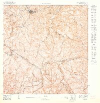
 1941 Rosario1952 Print · USGSWestern Puerto Rico's mountain interior comes alive in this mid-century survey of the Rosario region. Researchers can trace ancestral lands through numerous named estates like Hacienda Juanita and Hacienda Esperanza, or locate early community centers such as Limon and Iglesia de San Jose.2 unique versions available
 - 1942 Map of Rosario
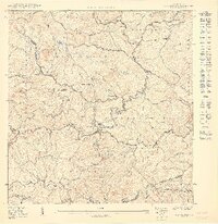
 1942 Rosario1942 Print · USGSWestern Puerto Rico is captured here in the era before widespread urbanization, showing the mountainous agricultural estates and early rail infrastructure. Genealogists can trace family holdings at Hacienda Esperanza or locate landmarks like the Hospital de Tuberculosis and American R. R.3 unique versions available
 - 1946 Map of Maricao
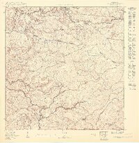
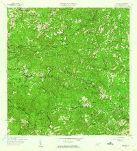
 1946 Maricao1946 Print · USGSMaricao and the western ridges of the Cordillera Central are shown in detail during the 1940s, highlighting the island's traditional plantation culture. Researchers can locate numerous family estates like Hacienda San Antonio and schools such as the Segunda Unidad Escuela Vocacional Francisco Vicenty.3 unique versions available
 - 1947 Map of Maricao SO
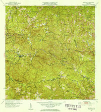
 1947 Maricao SO1947 Print · USGSMaricao and the high Cordillera Central are captured here in the late 1940s, highlighting a landscape of steep coffee-growing ridges and mountain camps. Trace the heritage of old estates like Hacienda Santa Rita and the isolated Campamento Santana.
 - 1950 Map of Rosario NE
 1950 Rosario NE1950 Print · USGSMid-century Mayagüez and Las Marías come alive through this 1950 topography of the island's interior coffee-growing regions. Researchers can trace the heritage of old estates like Hacienda Esperanza and Hacienda Juanita or locate landmarks like Pico San Bernardo.
 - 1950 Map of Rosario SE
 1950 Rosario SE1950 Print · USGSSan Germán and Maricao are shown here at mid-century, defined by steep mountain barrios and traditional agricultural estates. Genealogists and historians can trace family locations near Hacienda Córcega, the settlement of Las Vegas, and the watershed of the Río Rosario.
 - 1952 Map of Maricao, 1953 Print
 1952 Maricao1953 Print · USGSWestern Puerto Rico’s coffee country is mapped in the early fifties, showing a landscape defined by traditional haciendas and emerging mid-century infrastructure. Genealogists and historians can trace family-named estates like Hacienda Lealtad and Hacienda Santa Rita alongside landmarks like the Criadero Insular de Peces.2 unique versions available
 - 1955 Map of Rosario, 1958 Print
 1955 Rosario1958 Print · USGSMid-century San Germán and Maricao are shown here during a time when the highland economy still revolved around traditional haciendas. Genealogists and historians can locate family estates like Hacienda Juanita and community centers such as Rosario or the Iglesia de San Jose.
 - 1960 Map of Maricao, 1961 Print
 1960 Maricao1961 Print · USGSThe mountains of western Puerto Rico are captured here in the early sixties, showing the agricultural heritage of Maricao. Genealogists can trace family lands across Hacienda Lealtad, Hacienda Santa Rita, and Pueblo Nuevo.3 unique versions available
 - 1964 Map of Rosario, 1968 Print
 1964 Rosario1968 Print · USGSThe hill country of western Puerto Rico in the mid-sixties reveals a landscape of historic haciendas and emerging institutions. Genealogists and historians can locate family estates like Hacienda Retiro and community landmarks such as Capilla de Santa Ana or Escuela Mariano Abril.2 unique versions available
End of results
Showing maps 1-10 of 10
Frequently asked questions
- What are the different types of historical maps available for Montoso?
- What is the oldest map of Montoso?
- Where can I purchase historical maps of Montoso for my home or office?
- Where can I download high-res historical maps of Montoso?
- Are there historical topographic maps available for Montoso?
- Is there historical aerial imagery available for Montoso?
- Where are historical maps of Montoso sourced from?