Old Maps of Villas Centroamericanas, Mayagüez for Metal Detecting
Plan your next treasure hunt with 8 historic maps of Villas Centroamericanas. Find old homesites, ghost towns, trails, and gathering spots that may be lost to time — perfect for identifying promising metal detecting locations.
- Locate forgotten sites: Uncover places like long-lost settlements, abandoned rail lines, or gathering spots.
- Plan better hunts: Use map overlays combined with LiDAR or satellite views to narrow in on historically rich areas.
- Made for detectorists: Thousands of hobbyists use these maps to discover relics, coins, and hidden history.
Use these historic maps to boost your research and find new opportunities beneath the surface of Villas Centroamericanas.
Villas Centroamericanas, Mayagüez maps
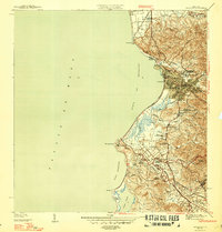
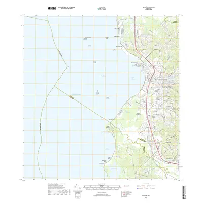
(8)- 1939 Map of Mayaguez
 1939 Mayaguez1939 Print · USGSCoastal western Puerto Rico appears in detail during the late 1930s, documenting the vital rail and sugar networks of the era. Genealogists and historians can trace family locations near Colonia Estebanía, visit the Central Rochelaise mill, or follow the American Railroad of Porto Rico.
 - 1947 Map of Mayaguez
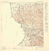
 1947 Mayaguez1947 Print · USGSMayagüez and its thriving coastal economy are documented here in the late thirties, featuring the vital rail links of the American Railroad of Puerto Rico. Trace ancestral roots in Poblado Sabalos, Hormigueros, and along the sugar-rich Colonia Cornelia.4 unique versions available
 - 1950 Map of Mayaguez NE
 1950 Mayaguez NE1950 Print · USGSMayagüez and its coastal marinas are captured in detail during the mid-century period of island growth. Researchers can trace the American Railroad line and locate local landmarks like the Capilla de Perpetuo Socorro and the Escuela Miradero No 1.
 - 1955 Map of Mayaguez, 1957 Print
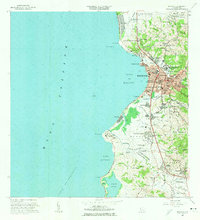
 1955 Mayaguez1957 Print · USGSThe western coast of Puerto Rico comes alive in this mid-century survey of the island's third-largest city. Genealogists and historians can trace the development of Candelaria, locate the Central Rochelaise, or find family sites in Poblado Sábalos.
 - 1964 Map of Mayaguez, 1966 Print
 1964 Mayaguez1966 Print · USGSMayagüez and its surrounding coastal barrios are shown here in the mid-1960s as the region transitioned through industrial and academic growth. Trace the roots of local institutions like the University or find family landmarks in Hormigueros and Sabanetas.3 unique versions available
 - 2013 Map of Mayaguez, 2013 Print
 2013 Mayaguez2013 Print · USGSCovers Villas Centroamericanas, including Mayagüez, Hormigueros, and other nearby areas
 - 2018 Map of Mayaguez, 2018 Print
 2018 Mayaguez2018 Print · USGSCovers Villas Centroamericanas, including Mayagüez, Hormigueros, and other nearby areas
 - 2024 Map of Mayaguez, 2024 Print
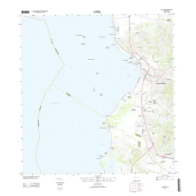
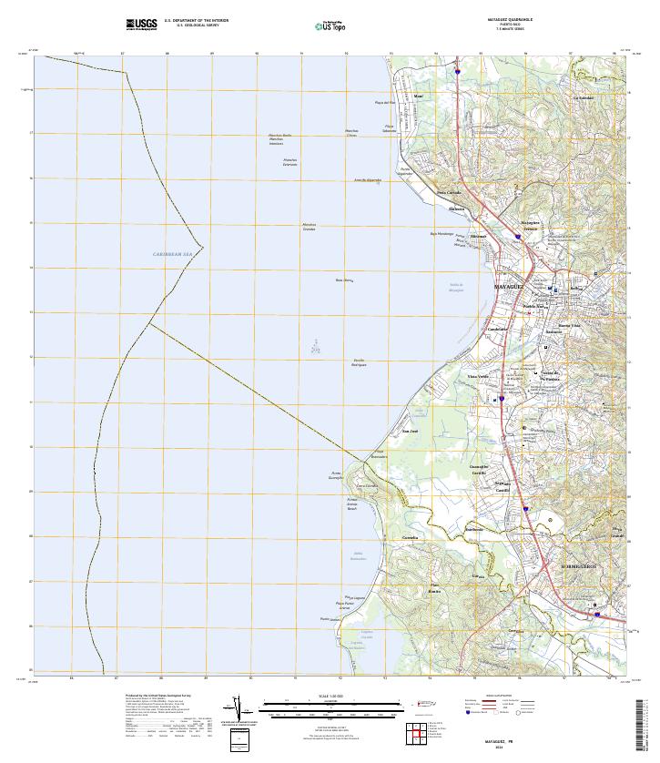 2024 Mayaguez2024 Print · USGSWestern Puerto Rico's coastal urban centers and river valleys are captured here in modern detail. Local historians can trace the growth of Mayagüez and Hormigueros, or locate the Cementerio Municipal de Mayagüez and Laguna Joyuda.
End of results
Showing maps 1-8 of 8
Frequently asked questions
- What are the different types of historical maps available for Villas Centroamericanas?
- What is the oldest map of Villas Centroamericanas?
- Where can I purchase historical maps of Villas Centroamericanas for my home or office?
- Where can I download high-res historical maps of Villas Centroamericanas?
- Are there historical topographic maps available for Villas Centroamericanas?
- Is there historical aerial imagery available for Villas Centroamericanas?
- Where are historical maps of Villas Centroamericanas sourced from?