Old Maps of Pueblo, Moca for Academic Research
Study the evolution of Pueblo with 26 high-resolution historic maps. Whether you're teaching, researching, or modeling changes in land use, these maps provide essential visual documentation of urban, environmental, and geographic change.
- Analyze long-term change: Track patterns in development, transportation, and natural features.
- Ideal for environmental or urban studies: Support academic projects with primary historical map data.
- Use in the classroom or lab: Educators and researchers rely on these maps to bring historical context to life.
These maps are a powerful tool for teaching, research, and visualizing how Pueblo has changed over the decades.
Pueblo, Moca maps
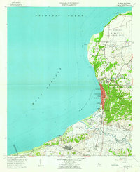
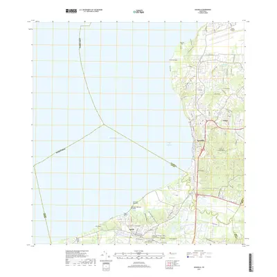
(26)- 1937 Map of Aguadilla
 1937 Aguadilla1937 Print · USGSNorthwestern Puerto Rico during the late 1930s reveals a landscape of coastal settlements and industrial rail lines. Genealogists and historians can trace the foundations of local communities through landmarks like the Iglesia de la Conception and the American railroad route through Coloso.
 - 1937 Map of Moca
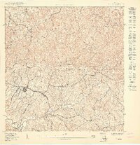
 1937 Moca1937 Print · USGSNorthwestern Puerto Rico in the late thirties reveals a landscape defined by rail transit and a remarkably dense network of rural schools. Family historians can trace ancestral roots through dozens of local sites like Escuela Aceituna No 1, Iglesia Presbiteriana, and the American RR of Porto Rico stations.2 unique versions available
 - 1938 Map of Alto Sano
 1938 Alto Sano1938 Print · USGSWestern Puerto Rico is captured here in the late 1930s as a landscape of rural schoolhouses and family estates. Genealogists can trace property names like Hacienda Esperanza or locate community centers such as the Barrio Espino Medical Center.
 - 1941 Map of Moca
 1941 Moca1941 Print · USGSNorthwestern Puerto Rico is captured here in the early 1940s, showing a landscape where the coastal railroad meets the high ridges of the Cordillera. Researchers can trace the American RR of Porto Rico line through Estacion Santiago and find local landmarks like the Iglesia de la Virgen del Rosario.
 - 1942 Map of Moca
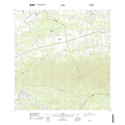
 1942 Moca1942 Print · USGSNorthwestern Puerto Rico during the early forties shows a landscape transitioning between coastal rail industry and the rural interior. Genealogists can trace family footprints near Jobos and the American R. R. of Porto Rico or at the Escuela Segunda Unidad de Voladoras.5 unique versions available
 - 1942 Map of Central La Plata
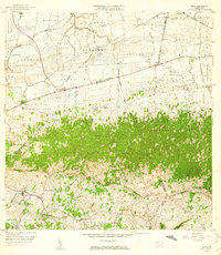
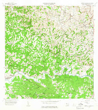
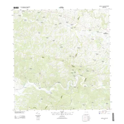
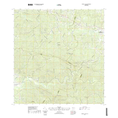
 1942 Central La Plata1942 Print · USGSWestern Puerto Rico during the early 1940s reveals a landscape of sugar production and family estates centered around the Rio Grande de Añasco. Researchers can trace the industrial footprint of Central La Plata and locate traditional plantations such as Hacienda Esperanza and Hacienda Casen.6 unique versions available
 - 1942 Map of Aguadilla
 1942 Aguadilla1942 Print · USGSCoastal life in northwest Puerto Rico during the early 1940s centered on the rail lines and rivers of the Aguadilla region. Genealogists and historians can trace family roots through the numerous railroad stops of the American Railroad or locate historical landmarks like the Pta Borinquen L H and the Iglesia Aguadilla.5 unique versions available
 - 1946 Map of Ciales
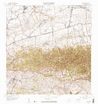
 1946 Ciales1946 Print · USGSIn the mid-1940s, the mountainous interior between Ciales and Morovis remained a world of coffee estates and remote parishes. Genealogists can locate specific rural landmarks like Hacienda Maria, the Escuela Segunda Unidad de Pesas, and Iglesia San Antonio.3 unique versions available
 - 1950 Map of Moca SO
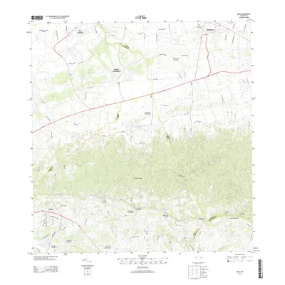
 1950 Moca SO1950 Print · USGSMid-century Moca and its surrounding barrios are captured here during a period of infrastructure growth in northwest Puerto Rico. Genealogists and researchers can locate family homes and landmarks across Caimital Alto, the Escuela Segunda Unidad de Voladoras, and along the Río Culebrinas.
 - 1950 Map of Central La Plata NO
 1950 Central La Plata NO1950 Print · USGSMoca's interior highlands are mapped here at mid-century, showing the dense rural settlement patterns of western Puerto Rico. Genealogists can trace family footprints across the barrios of Cerro Gordo and Voladoras along the winding Río Culebrinas.
 - 1950 Map of Aguadilla SE
 1950 Aguadilla SE1950 Print · USGSCoastal life in northwest Puerto Rico at mid-century is meticulously detailed where the mountains meet the Bahía de Aguadilla. Genealogists and historians can trace family locations through neighborhoods like Tamarindo, the path of the American Railroad, and rural schools like Escuela Segunda Unidad Espinal.
 - 1953 Map of Ciales
 1953 Ciales1953 Print · USGSCentral Puerto Rico’s mountainous interior comes alive in this mid-century survey of the rugged Ciales and Morovis highlands. Genealogists and historians can trace family roots through named barrios like Jaguas and Pesas, and locate rural landmarks such as Hacienda Maria and the Iglesia Ascensión.
 - 1955 Map of Central La Plata, 1958 Print
 1955 Central La Plata1958 Print · USGSThe mountainous interior of western Puerto Rico is captured here in the mid-fifties, dominated by the industrial site of Central La Plata. Genealogists and historians can trace numerous family-named landmarks and coffee-era estates, including Hacienda Morales, Hacienda Lambert, and Mata y Orsini.
 - 1956 Map of Moca, 1959 Print
 1956 Moca1959 Print · USGSMoca and the surrounding northwest highlands are shown here in the mid-fifties, during a period of transition between traditional agriculture and modern infrastructure. You can trace the Antigua Vía del Ferrocarril through the karst hills or locate family landmarks like Central Isabel No 2 and the Cementerio de Isabela.
 - 1960 Map of Aguadilla, 1962 Print
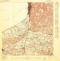
 1960 Aguadilla1962 Print · USGSCoastal Aguadilla and the surrounding municipios are shown during a period of significant growth at the start of the 1960s. Researchers can trace the layout of Ramey Air Force Base, find local landmarks like Colegio San Carlos, or follow the Via Del Ferrocarril through Aguada.5 unique versions available
 - 1964 Map of Central La Plata, 1966 Print
 1964 Central La Plata1966 Print · USGSThe river valleys of western Puerto Rico are shown here in the mid-1960s as the traditional sugar economy transitioned. Genealogists can locate family-named estates like Hacienda Lamberti or trace the Via Ferrocarril Antigua through the hills.3 unique versions available
 - 1964 Map of Moca, 1967 Print
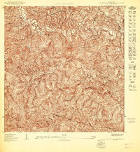
 1964 Moca1967 Print · USGSNorthwestern Puerto Rico in the mid-sixties shows a landscape defined by the rugged Cordillera Jaicoa and vital water infrastructure. Genealogists can trace family footprints near Moca and find landmarks like the Iglesia Ceiba Alta or the Antigua Via del Ferrocarril.3 unique versions available
 - 2013 Map of Aguadilla, 2013 Print
 2013 Aguadilla2013 Print · USGSCovers Pueblo, including Aguadilla, Aguada, and other nearby areas
 - 2013 Map of Central La Plata, 2013 Print
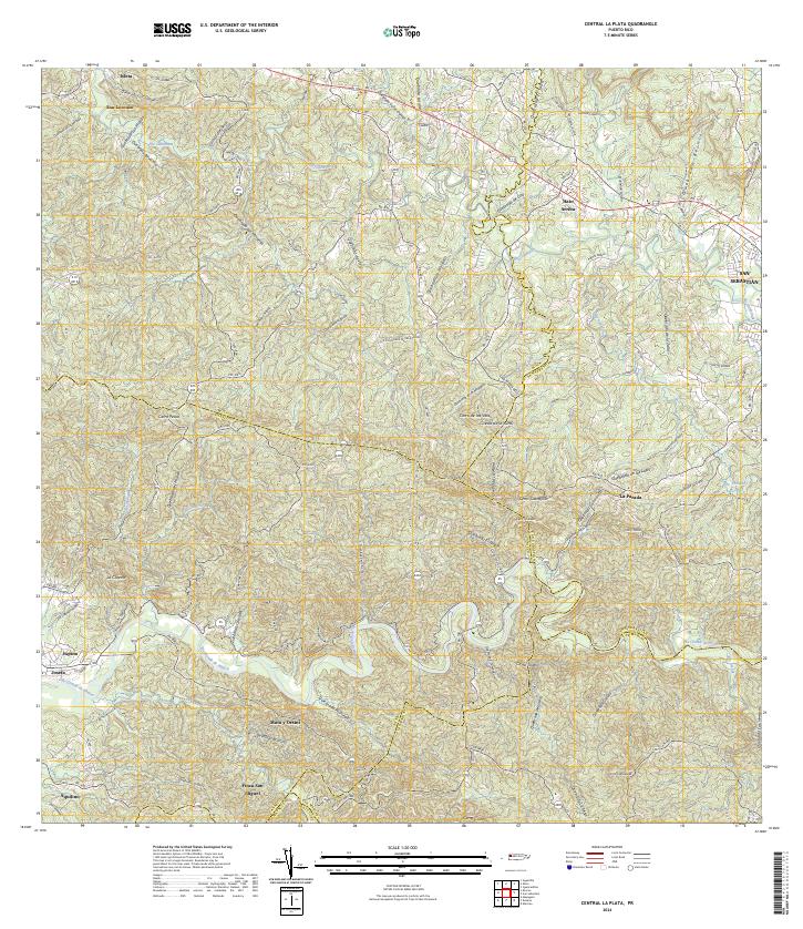
 2013 Central La Plata2013 Print · USGSCovers Pueblo, including Sector Los Crespos, Sector La Grúa, and other nearby areas
 - 2013 Map of Moca, 2013 Print
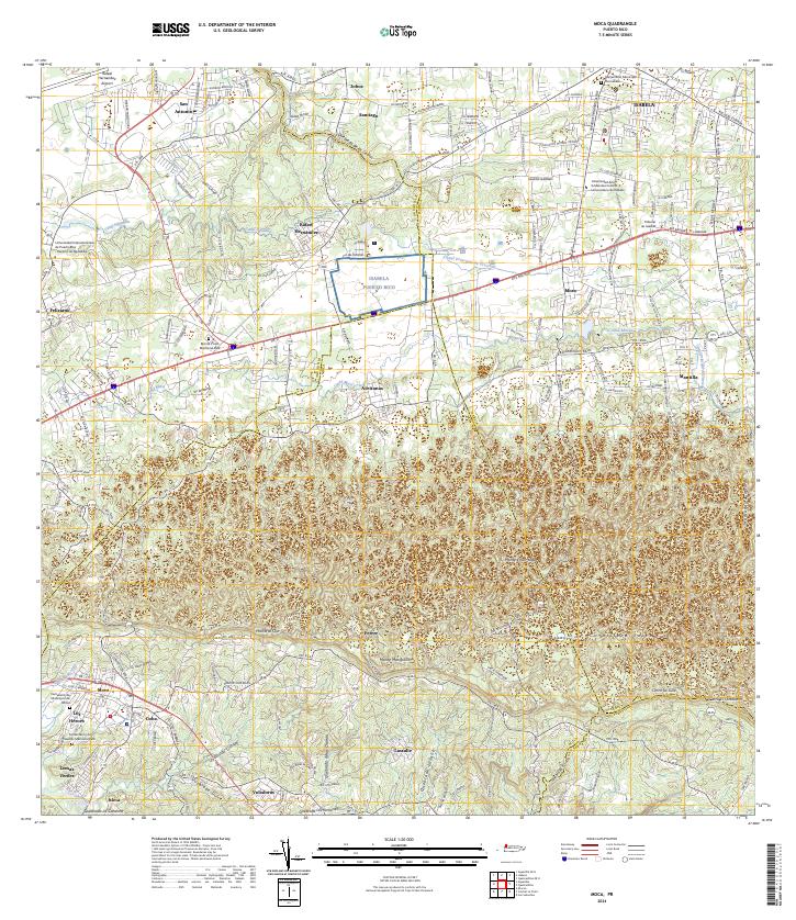
 2013 Moca2013 Print · USGSCovers Pueblo, including Moca, Sector Nieves, and other nearby areas
 - 2018 Map of Moca, 2018 Print
 2018 Moca2018 Print · USGSCovers Pueblo, including Moca, Sector Nieves, and other nearby areas
 - 2018 Map of Central La Plata, 2018 Print
 2018 Central La Plata2018 Print · USGSCovers Pueblo, including Sector Los Crespos, Sector La Grúa, and other nearby areas
 - 2018 Map of Aguadilla, 2018 Print
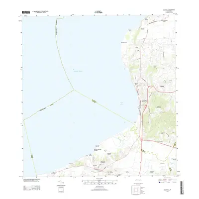
 2018 Aguadilla2018 Print · USGSCovers Pueblo, including Aguadilla, Aguada, and other nearby areas
 - 2024 Map of Moca, 2024 Print
 2024 Moca2024 Print · USGSNorthwestern Puerto Rico is documented here in the present day, showing the developed corridors between the coast and the mountain foothills. Genealogists and historians can locate family sites near Cementerio de Municipio de Moca, San Antonio, and Lomas Verdes.
 - 2024 Map of Central La Plata, 2024 Print
 2024 Central La Plata2024 Print · USGSWestern Puerto Rico is captured here in a period of modern connectivity, showing the transition from river valleys to high interior peaks. Genealogists and locals can trace family-named sectors like LOS BARRETO and small communities such as Hato Arriba or Mata y Orsini.
Showing maps 1-25 of 26
Frequently asked questions
- What are the different types of historical maps available for Pueblo?
- What is the oldest map of Pueblo?
- Where can I purchase historical maps of Pueblo for my home or office?
- Where can I download high-res historical maps of Pueblo?
- Are there historical topographic maps available for Pueblo?
- Is there historical aerial imagery available for Pueblo?
- Where are historical maps of Pueblo sourced from?