Old Maps of Barro Blanco, Patillas for Genealogy
Trace your family roots with 7 historic maps of Barro Blanco. These high-res maps reveal old neighborhoods, homesites, landmarks, and streets — helping you uncover where your ancestors lived and how the area evolved over time.
- Explore historic neighborhoods: Identify where your relatives may have lived in the 1800s or 1900s.
- Compare maps over time: Trace the changes in streets, buildings, and landmarks for multi-generational research.
- Perfect for genealogy & ancestry research: Used by family historians and researchers to map out lineage and migration.
These maps are an incredible resource for exploring your personal connection to Barro Blanco's past.
Barro Blanco, Patillas maps
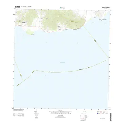
(7)- 1945 Map of Punta Tuna
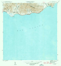 1945 Punta Tuna1945 Print · USGSCoastal Maunabo and Patillas appear here just after the war, showing the southeastern shoreline before modern development. Genealogists and historians can locate the Faro lighthouse at Pta Tuna, the Hacienda San Isidro, and the Escuela Segunda Unidad de Guardarraya.4 unique versions available
 - 1947 Map of Punta Tuna NO
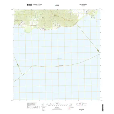
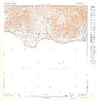 1947 Punta Tuna NO1947 Print · USGSThe southern coast of Puerto Rico during the 1940s reveals a landscape of agricultural estates and mountain ridges. Researchers can trace the legacy of Hacienda San Isidro or locate the Escuela Segunda Unidad de Guardarraya near the Rio Jacaboa.
 - 1952 Map of Punta Tuna, 1953 Print
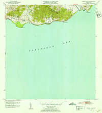 1952 Punta Tuna1953 Print · USGSMaunabo's rugged coastline and the high peaks of the Sierra Palo Seco are captured here during the early fifties. Genealogists and researchers can locate the Faro at Pta Tuna, the Hacienda San Isidro, and several named barrios and schools along the coast.2 unique versions available
 - 1960 Map of Punta Tuna, 1961 Print
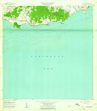 1960 Punta Tuna1961 Print · USGSSoutheast Puerto Rico meets the sea in the early sixties, showing the transition from mountain ridges to the Caribbean coast. Genealogists and historians can trace the estates of Hacienda San Isidro, the landmark Faro Punta Tuna, and the village of Recio.2 unique versions available
 - 2013 Map of Punta Tuna, 2013 Print
 2013 Punta Tuna2013 Print · USGSCovers Barro Blanco, including Sector Higuero, Sector Bordaleza, and other nearby areas
 - 2018 Map of Punta Tuna, 2018 Print
 2018 Punta Tuna2018 Print · USGSCovers Barro Blanco, including Sector Higuero, Sector Bordaleza, and other nearby areas
 - 2024 Map of Punta Tuna, 2024 Print
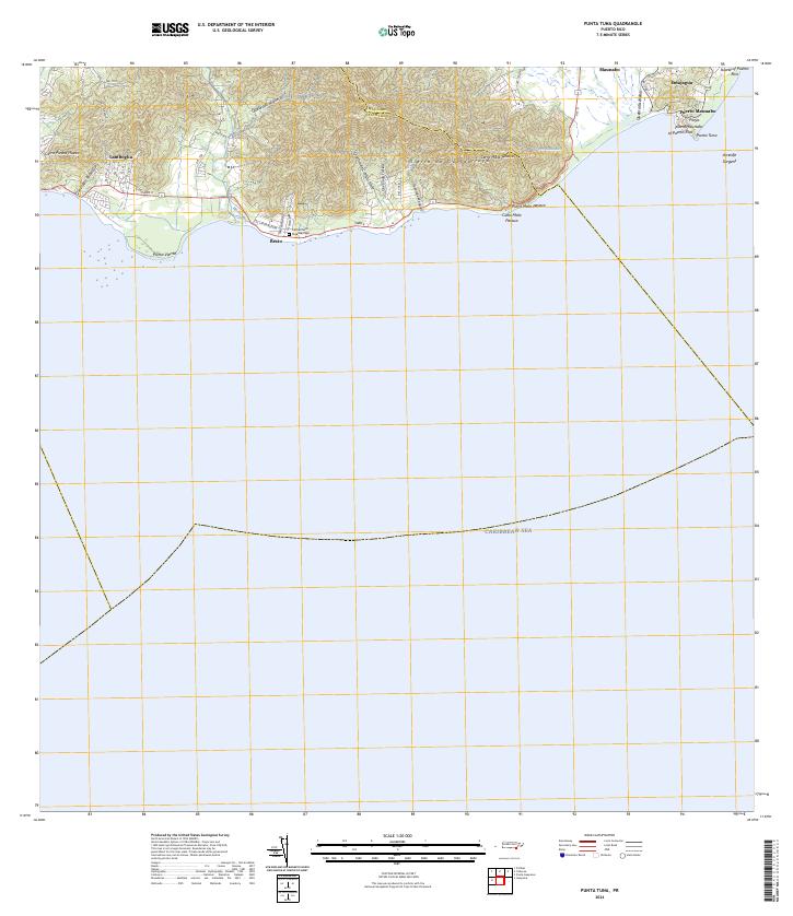 2024 Punta Tuna2024 Print · USGSSoutheastern Puerto Rico is mapped here in the modern era as the mountains meet the sea. Researchers can trace coastal settlements like Emajagua, visit the Cementerio Guardarraya, or locate the maritime landmark at Punta Tuna.
End of results
Showing maps 1-7 of 7
Top cities near Barro Blanco
- Guayama historical maps
- Humacao historical maps
- Cayey historical maps
- San Lorenzo historical maps
- Arroyo historical maps
- Yabucoa historical maps
See more
Frequently asked questions
- What are the different types of historical maps available for Barro Blanco?
- What is the oldest map of Barro Blanco?
- Where can I purchase historical maps of Barro Blanco for my home or office?
- Where can I download high-res historical maps of Barro Blanco?
- Are there historical topographic maps available for Barro Blanco?
- Is there historical aerial imagery available for Barro Blanco?
- Where are historical maps of Barro Blanco sourced from?