Old Maps of Valle de Providencia, Patillas for Metal Detecting
Plan your next treasure hunt with 8 historic maps of Valle de Providencia. Find old homesites, ghost towns, trails, and gathering spots that may be lost to time — perfect for identifying promising metal detecting locations.
- Locate forgotten sites: Uncover places like long-lost settlements, abandoned rail lines, or gathering spots.
- Plan better hunts: Use map overlays combined with LiDAR or satellite views to narrow in on historically rich areas.
- Made for detectorists: Thousands of hobbyists use these maps to discover relics, coins, and hidden history.
Use these historic maps to boost your research and find new opportunities beneath the surface of Valle de Providencia.
Valle de Providencia, Patillas maps
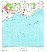
(8)- 1946 Map of Guayama
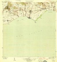 1946 Guayama1946 Print · USGSThe southern coast of Puerto Rico appears in the mid-1940s as a bustling center of sugar production and rail transport. Genealogists and historians can trace the estates of the day, from Central Machete to numerous family-named colonias like Hacienda Felicia.4 unique versions available
 - 1947 Map of Guayama NE
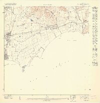 1947 Guayama NE1947 Print · USGSCoastal Puerto Rico in the late forties is defined here by the sugar industry and the vital waterways of the southeast shore. Genealogists and historians can trace the rail lines connecting Central Lafayette to rural outposts like Colonia Concordia and Cuatro Calles.
 - 1952 Map of Guayama, 1953 Print
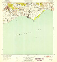 1952 Guayama1953 Print · USGSCoastal Puerto Rico in the early fifties reveals a landscape shaped by sugar production and maritime trade. Local researchers can find named estates and industrial sites like Central Lafayette, Colonia Algarrobo, and the Faro Pta Figuras lighthouse.2 unique versions available
 - 1960 Map of Guayama, 1962 Print
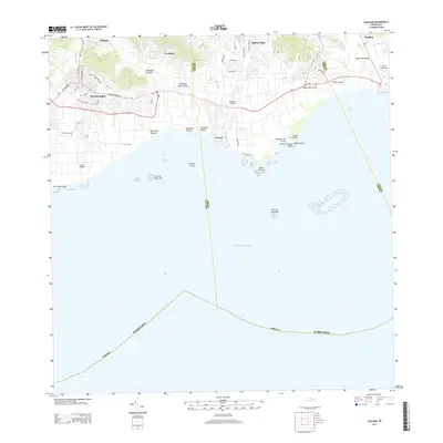
 1960 Guayama1962 Print · USGSThe south coast of Puerto Rico in the 1960s reveals a region defined by its sugar industry and maritime trade. Researchers can trace family ties to landmarks like Central Lafayette, Hacienda Felicia, and the coastal lighthouse at Punta Figuras.2 unique versions available
 - 1970 Map of Guayama, 1972 Print
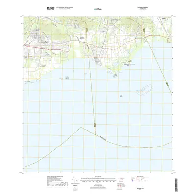
 1970 Guayama1972 Print · USGSThe southern coast of Puerto Rico thrived as a sugar and maritime hub in the early seventies. Genealogists and historians can trace the irrigation canals and residential expansion of Guayama or locate old industrial sites like Central Machete and Central Lafayette.4 unique versions available
 - 2013 Map of Guayama, 2013 Print
 2013 Guayama2013 Print · USGSCovers Valle de Providencia, including Guayama, Arroyo, and other nearby areas
 - 2018 Map of Guayama, 2018 Print
 2018 Guayama2018 Print · USGSCovers Valle de Providencia, including Guayama, Arroyo, and other nearby areas
 - 2024 Map of Guayama, 2024 Print
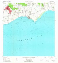
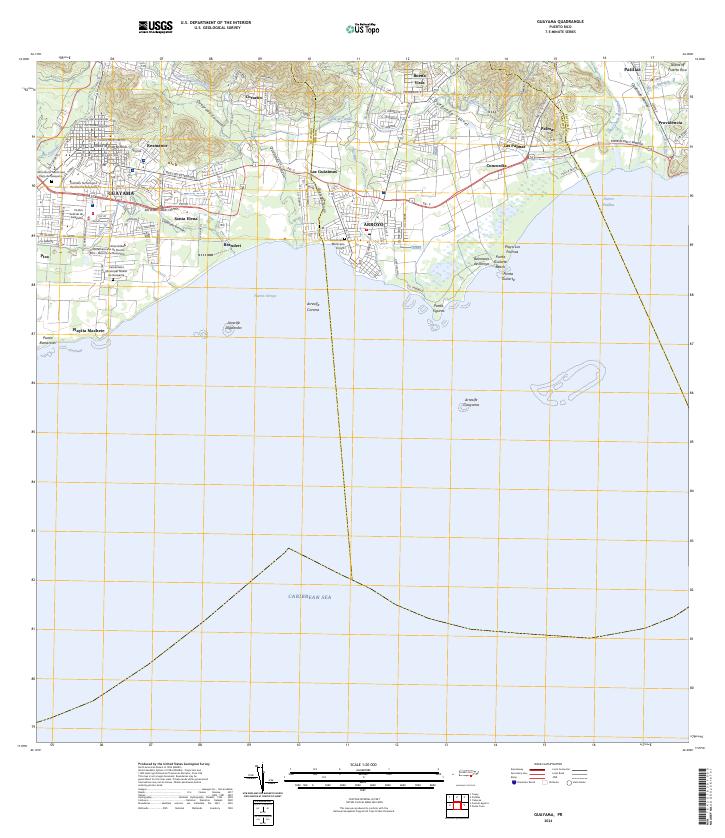 2024 Guayama2024 Print · USGSThe south-central coast of Puerto Rico is revealed in the mid-2020s, showing the urban development of Guayama and Arroyo. Trace the coastal geography through Punta Figuras, local landmarks like Balneario de Arroyo, and the historic Canal de Patillas.
End of results
Showing maps 1-8 of 8
Frequently asked questions
- What are the different types of historical maps available for Valle de Providencia?
- What is the oldest map of Valle de Providencia?
- Where can I purchase historical maps of Valle de Providencia for my home or office?
- Where can I download high-res historical maps of Valle de Providencia?
- Are there historical topographic maps available for Valle de Providencia?
- Is there historical aerial imagery available for Valle de Providencia?
- Where are historical maps of Valle de Providencia sourced from?