1900s (20th Century) Maps of Villa Laramia, Peñuelas
Explore 5 historic maps of Villa Laramia from the 1900s (20th Century). These maps offer a rare glimpse into what life looked like during the 1900s — showing old roads, neighborhoods, homes, and landmarks that have changed or disappeared over time.
Whether you're researching your family's past, planning a metal detecting trip, or studying how Villa Laramia's landscape evolved across the 1900s, these high-resolution maps are a powerful tool for exploring the history of this region.
- Focus on a specific era: All maps on this page are from the 1900s, giving you a focused view of this time period.
- See what’s changed: Compare century-old streets, trails, and buildings to today's modern landscape using overlays and satellite layers.
- Research with precision: Use these maps for genealogy, historical research, land use analysis, or educational projects.
- View, download, or print: Maps are fully viewable online in high resolution, and can be downloaded or printed for your own records.
Start exploring Villa Laramia's history through authentic maps from the 1900s. This is your window into the past.
Villa Laramia, Peñuelas maps
(5)- 1946 Map of Punta Cuchara
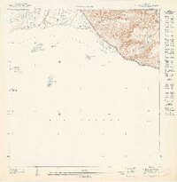
 1946 Punta Cuchara1946 Print · USGSThe southern coast of Puerto Rico appears here during the mid-1940s, showing the vital maritime and rail corridors near Ponce. Researchers can locate the American Railroad line and trace agricultural estates like Hacienda Matilde or the old Faro on Cayo Cardona.3 unique versions available
 - 1947 Map of Punta Gughara NO
 1947 Punta Gughara NO1947 Print · USGSThe southern coast of Puerto Rico during the 1940s is captured here, showing the intricate shoreline and offshore islands. Local history enthusiasts can locate coastal landmarks like Cayo Caribe and the mouth of the Rio Tallaboa near Peñon de Ponce.
 - 1952 Map of Punta Cuchara
 1952 Punta Cuchara1952 Print · USGSThe southern coast of Puerto Rico appears here at mid-century as a landscape of coastal railroads and colonial estates. Local historians can trace the Porto Rico American Railroad and identify old sites like Hacienda Matilde and Tallaboa Poniente.2 unique versions available
 - 1958 Map of Punta Cucharas, 1961 Print
 1958 Punta Cucharas1961 Print · USGSThe southern coast of Puerto Rico is captured here in the late fifties as the harbor at Playa de Ponce thrived. Researchers can trace the path of the Ferrocarril de Puerto Rico and locate local landmarks like Hacienda Matilde and Cayo Cardona.2 unique versions available
 - 1962 Map of Punta Cucharas, 1964 Print
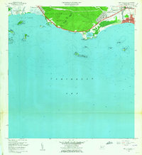 1962 Punta Cucharas1964 Print · USGSThe southern coast of Puerto Rico comes into focus during the early sixties as urban expansion reaches toward the sea. Researchers can trace the heritage of Playa de Ponce, the site of Hacienda Matilde, and the route of the Antigua Vía del Ferrocarril.4 unique versions available
End of results
Showing maps 1-5 of 5
Top cities near Villa Laramia
- Ponce historical maps
- Yauco historical maps
- Juana Díaz historical maps
- Peñuelas historical maps
- Guánica historical maps
- Adjuntas historical maps
See more
Frequently asked questions
- What are the different types of historical maps available for Villa Laramia?
- What is the oldest map of Villa Laramia?
- Where can I purchase historical maps of Villa Laramia for my home or office?
- Where can I download high-res historical maps of Villa Laramia?
- Are there historical topographic maps available for Villa Laramia?
- Is there historical aerial imagery available for Villa Laramia?
- Where are historical maps of Villa Laramia sourced from?