Old Maps of Quebradillas
Explore 16 old maps of Quebradillas, spanning from 1938 to today. These high-resolution historic maps reveal how streets, neighborhoods, landmarks, and natural features evolved over time — perfect for genealogy, metal detecting, research, and local history exploration.
What you can do with these maps:
- See how Quebradillas changed over time: Compare historical maps to modern-day views to trace roads, homesites, rail lines & more.
- View detailed metadata: Each map includes creators, publishers, year, scale, and archive source.
- Overlay maps with satellite & LiDAR: Visualize the past alongside modern tools to explore terrain & human change.
- Trusted historical sources: Maps sourced from the USGS, Library of Congress, and other archives.
- Access maps your way: View online, download high-res files, or order prints for personal or research use.
Start exploring old maps of Quebradillas to uncover forgotten places, hidden landmarks, and the deep history beneath your feet.
Quebradillas maps
(16)- 1938 Map of San Sebastian
 1938 San Sebastian1938 Print · USGSSan Sebastian and the surrounding highlands are captured in the late 1930s during a time of rural growth and agricultural production. Researchers can locate dozens of country schools, family estates like Hacienda Buena Vista, and the path of the Central Soller RR.
 - 1938 Map of Quebradillas
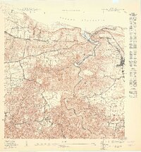
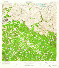
 1938 Quebradillas1938 Print · USGSNorthern Puerto Rico in the late 1930s reveals a landscape of winding rivers and densely mapped rural schools. Genealogists and historians can trace family roots through named sites like Pueblito de Ponce, the American Porto Rico rail line, and Iglesia Virgen del Carmen.2 unique versions available
 - 1941 Map of San Sebastian
 1941 San Sebastian1941 Print · USGSWestern Puerto Rico is captured here in the early 1940s, highlighting the agricultural heartbeat and social centers of the interior. Researchers can trace historic family-named estates like Hacienda San Pedro and Hacienda Espino or locate the industrial Central Soler.5 unique versions available
 - 1950 Map of San Sebastian NE
 1950 San Sebastian NE1950 Print · USGSThe northern hills of San Sebastián appear here at mid-century, centered around the industrial and agricultural life of the sugar economy. Researchers can trace the footprint of Central Soller, locate the Campamento Guajataca by the lake, and find local landmarks like Iglesia Santa Ana.
 - 1950 Map of Quebradillas NO
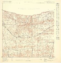
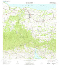
 1950 Quebradillas NO1950 Print · USGSMid-century Isabela and Quebradillas are defined here by the coastal path of the American Railroad and the deep gorge of the Río Guajataca. Genealogy researchers can locate family sites near San Antonio, the Iglesia Virgen del Carmen, or Estación Quebradillas.
 - 1950 Map of Quebradillas SO
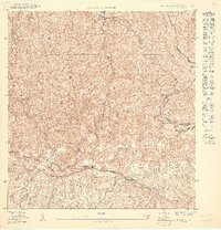 1950 Quebradillas SO1950 Print · USGSNorthwestern Puerto Rico’s interior barrios are captured here in the mid-twentieth century, showing a landscape of steep ridgelines and isolated agricultural settlements. Researchers can trace rural life and land use around Pueblito de Ponce and the high peaks of Cerro de la Bandera and Cerro del Judío.
 - 1950 Map of Quebradillas SE
 1950 Quebradillas SE1950 Print · USGSNorthwestern Puerto Rico’s interior is revealed in the early fifties, showing the rural life and infrastructure surrounding the Lago de Guajataca. Researchers can trace old mountain roads and local schools like the Escuela Segunda Unidad Baldorioty de Castro.
 - 1950 Map of Quebradillas NE
 1950 Quebradillas NE1950 Print · USGSQuebradillas and the North Coast of Puerto Rico are captured in the mid-twentieth century as the rail era remained vital. Genealogists and historians can trace family locations across barrios like Terranova, locate the Escuela Segunda Unidad Rivera, or follow the route of the American Railroad.
 - 1957 Map of Quebradillas, 1961 Print
 1957 Quebradillas1961 Print · USGSCoastal Puerto Rico in the late fifties shows a landscape defined by traditional barrios and the winding Rio Guajataca. Genealogy researchers can locate rural schools like Escuela José de Diego and landmarks such as the Iglesia Virgen del Carmen.2 unique versions available
 - 1958 Map of San Sebastian, 1960 Print
 1958 San Sebastian1960 Print · USGSSan Sebastián and the surrounding highlands are captured in the late fifties during a period of industrial and agricultural transition. Researchers can trace ancestral lands through numerous named estates like Hacienda Esperanza or visit the grounds of Central Soller.3 unique versions available
 - 1972 Map of Quebradillas, 1974 Print
 1972 Quebradillas1974 Print · USGSThe northwestern coast of Puerto Rico is revealed here in the early seventies, from the urban center of Quebradillas to the heights of Planas. Genealogists can locate family landmarks like Pueblito de Ponce and La Casa de Piedra.2 unique versions available
 - 2013 Map of San Sebastian, 2013 Print
 2013 San Sebastian2013 Print · USGSCovers Quebradillas, including San Sebastián, Lares, and other nearby areas
 - 2013 Map of Quebradillas, 2013 Print
 2013 Quebradillas2013 Print · USGSCovers Quebradillas, including Urbanización Vista al Calvario, Brisas de la Sabana, and other nearby areas
 - 2018 Map of Quebradillas, 2018 Print
 2018 Quebradillas2018 Print · USGSCovers Quebradillas, including Urbanización Vista al Calvario, Brisas de la Sabana, and other nearby areas
 - 2024 Map of Quebradillas, 2024 Print
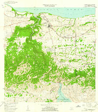
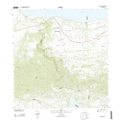
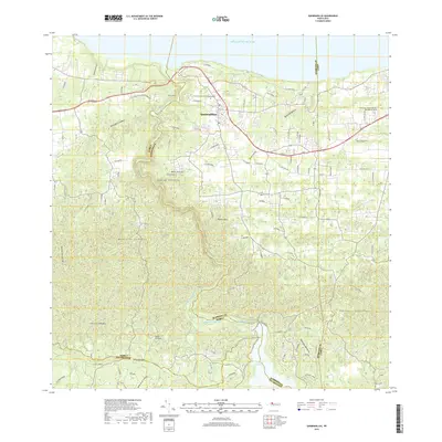
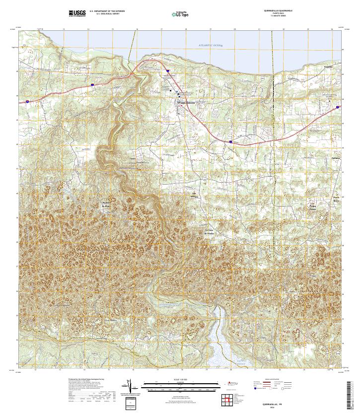 2024 Quebradillas2024 Print · USGSThe northern coast of Puerto Rico meets the limestone hills of the interior in this recent survey. Genealogists can trace family landmarks and burial sites like Hacienda la Sabana and the Cementerio Municipal de Quebradillas.
 - 2024 Map of San Sebastian, 2024 Print
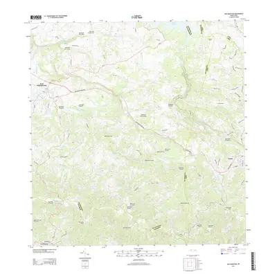
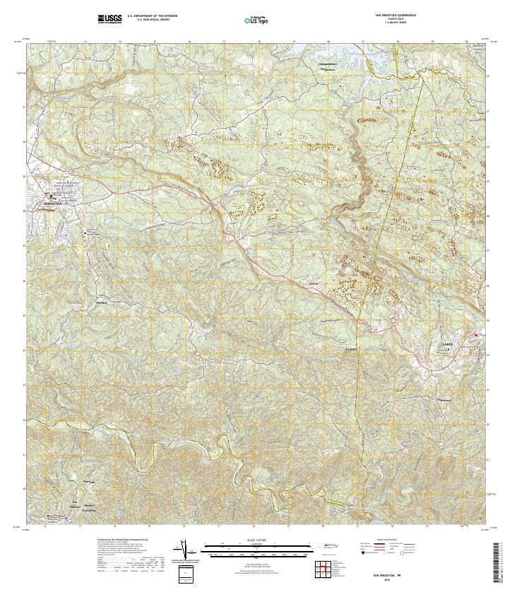 2024 San Sebastian2024 Print · USGSWestern Puerto Rico is captured here in the contemporary era, showing the intersection of urban San Sebastián and the rural highlands. Genealogists can locate family landmarks like Muñoz Torruellas or several local cemeteries, including the Cementerio Municipal de Lares.
End of results
Showing maps 1-16 of 16
Frequently asked questions
- What are the different types of historical maps available for Quebradillas?
- What is the oldest map of Quebradillas?
- Where can I purchase historical maps of Quebradillas for my home or office?
- Where can I download high-res historical maps of Quebradillas?
- Are there historical topographic maps available for Quebradillas?
- Is there historical aerial imagery available for Quebradillas?
- Where are historical maps of Quebradillas sourced from?