2020s Maps of Río Grande
Explore 4 historic maps of Río Grande from the 2020s. These maps offer a rare glimpse into what life looked like during the 2020s — showing old roads, neighborhoods, homes, and landmarks that have changed or disappeared over time.
Whether you're researching your family's past, planning a metal detecting trip, or studying how Río Grande's landscape evolved across the 2020s, these high-resolution maps are a powerful tool for exploring the history of this region.
- Focus on a specific era: All maps on this page are from the 2020s, giving you a focused view of this time period.
- See what’s changed: Compare century-old streets, trails, and buildings to today's modern landscape using overlays and satellite layers.
- Research with precision: Use these maps for genealogy, historical research, land use analysis, or educational projects.
- View, download, or print: Maps are fully viewable online in high resolution, and can be downloaded or printed for your own records.
Start exploring Río Grande's history through authentic maps from the 2020s. This is your window into the past.
Río Grande maps
(4)- 2024 Map of Fajardo, 2024 Print
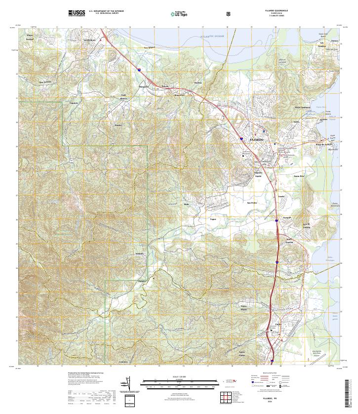 2024 Fajardo2024 Print · USGSNortheast Puerto Rico is shown in great detail here, from the heights of the national forest to the bustling coastal docks. Researchers can locate specific neighborhoods like Espanta Sueño, trace the Quebrada Fajardo, or find the Cementerio De Ceiba.
 - 2024 Map of El Yunque, 2024 Print
 2024 El Yunque2024 Print · USGSEastern Puerto Rico's tropical highlands are mapped here in the modern era, showing the intersection of coastal settlements and mountain wilderness. Researchers can trace local landmarks like Cementerio Municipal Palmer and Campamento Eliza Colberg alongside the peaks of Pico El Yunque.
 - 2024 Map of Rio Grande, 2024 Print
 2024 Rio Grande2024 Print · USGSCoastal Puerto Rico comes alive in this contemporary survey of the area between the Atlantic and the northern foothills. Trace the development of Río Grande and its outlying barrios, from the riverside community of Blasina to the heights of Cerro El Faro.
 - 2024 Map of Gurabo, 2024 Print
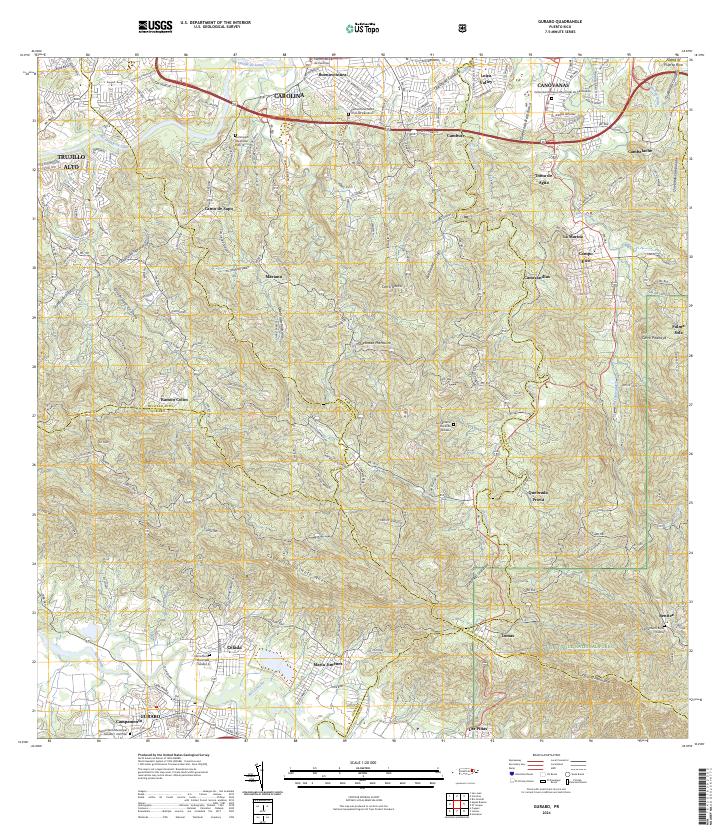 2024 Gurabo2024 Print · USGSThe foothills of northeast Puerto Rico meet the edge of the national rainforest in this recent survey. Local historians can trace the growth of Carolina and Canóvanas or locate local landmarks like Cementerio Rural de Gurabo and Cerro Gordo.
End of results
Showing maps 1-4 of 4
Frequently asked questions
- What are the different types of historical maps available for Río Grande?
- What is the oldest map of Río Grande?
- Where can I purchase historical maps of Río Grande for my home or office?
- Where can I download high-res historical maps of Río Grande?
- Are there historical topographic maps available for Río Grande?
- Is there historical aerial imagery available for Río Grande?
- Where are historical maps of Río Grande sourced from?