Old Maps of Mameyes II, Río Grande for Academic Research
Study the evolution of Mameyes II with 25 high-resolution historic maps. Whether you're teaching, researching, or modeling changes in land use, these maps provide essential visual documentation of urban, environmental, and geographic change.
- Analyze long-term change: Track patterns in development, transportation, and natural features.
- Ideal for environmental or urban studies: Support academic projects with primary historical map data.
- Use in the classroom or lab: Educators and researchers rely on these maps to bring historical context to life.
These maps are a powerful tool for teaching, research, and visualizing how Mameyes II has changed over the decades.
Mameyes II, Río Grande maps
(25)- 1941 Map of Rio Grande
 1941 Rio Grande1941 Print · USGSCoastal Puerto Rico in the early 1940s reveals a landscape of tidal marshes and agricultural estates. Genealogists and researchers can trace family lands through the numerous named colonias like Colonia Blasini and Colonia Dolores, or locate early settlements such as Poblado Honduras.2 unique versions available
 - 1945 Map of El Yunque
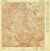
 1945 El Yunque1945 Print · USGSThe peaks of the Luquillo range rise sharply in the mid-1940s, showing the interior of the Caribbean National Forest before modern expansion. Genealogists and historians can trace old community sites like Mameyes (Palmer), the Escuela Casiano Cepeda, and the localized activity at La Mina.
 - 1946 Map of El Yunque
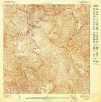
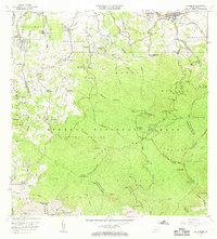
 1946 El Yunque1946 Print · USGSNortheastern Puerto Rico is depicted here in the mid-1940s, showcasing the mountainous interior as it rises from the coast. Researchers can trace the trails and summits of the Luquillo National Forest or locate rural landmarks like Mameyes (Palmer) and the Escuela Casiano Cepeda.3 unique versions available
 - 1946 Map of Fajardo
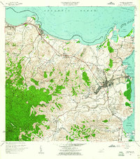
 1946 Fajardo1946 Print · USGSNortheast Puerto Rico is shown just after the war, highlighting a landscape of sugar estates and coastal settlements. Genealogists and historians can trace family locations at Colonia Monserrate, Aldea Cintrón, and the port at Puerto Real.4 unique versions available
 - 1947 Map of El Yunque NE
 1947 El Yunque NE1947 Print · USGSThe foothills of the northeastern Luquillo Mountains come into sharp focus in the 1940s, showing the early boundaries of the Caribbean National Forest. Researchers can trace the path of the Río Mameyes and locate old settlements such as Mameyes (Palmer) and Mabi.
 - 1947 Map of Rio Grande
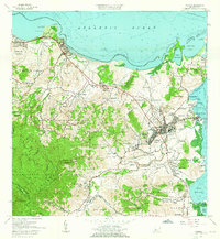
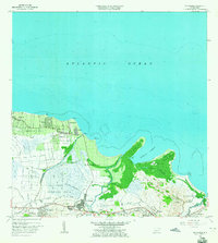
 1947 Rio Grande1947 Print · USGSThe northeastern coast of Puerto Rico is captured here in the mid-1940s, highlighting a landscape defined by river deltas and sugar colonias. Genealogists and historians can trace family locations in settlements like Poblado Honduras and Colonia Fortuna.3 unique versions available
 - 1947 Map of El Yunque SE
 1947 El Yunque SE1947 Print · USGSNaguabo and the surrounding peaks are shown during the late 1940s when the forest was managed under its former name. Trace the early trails and landmarks of the Caribbean National Forest, from the summit of Pico El Yunque to the Area Recreo de la Mina.
 - 1950 Map of Rio Grande SE
 1950 Rio Grande SE1950 Print · USGSThe coastal plains and foothills of northeast Puerto Rico are detailed here at the midpoint of the century. Genealogists and historians can trace family-named landmarks and rural infrastructure from Colonia Carmelita to the Escuela Picudas.
 - 1952 Map of El Yunque, 1953 Print
 1952 El Yunque1953 Print · USGSThe peaks of the Sierra de Luquillo are mapped here in the early fifties during a period of expanding forest management and rural education. Researchers can locate early forest facilities like the Area Recreo de la Mina and local landmarks like Escuela Malpica.2 unique versions available
 - 1952 Map of Fajardo, 1953 Print
 1952 Fajardo1953 Print · USGSNortheastern Puerto Rico in the early fifties reveals a landscape dominated by the sugar industry and coastal development. Genealogists and historians can locate numerous family-named estates like Colonia San Miguel or Colonia Josefa, and trace the path of the FAJARDO DEVELOPMENT railroad.2 unique versions available
 - 1956 Map of Rio Grande, 1958 Print
 1956 Rio Grande1958 Print · USGSCoastal Puerto Rico comes to life in the 1950s, showing a landscape of sugar-era settlements and river deltas. Genealogists can locate specific homesteads at Poblado Honduras or trace community roots at Colonia Dolores and Comunidad Dolores.
 - 1958 Map of El Yunque, 1960 Print
 1958 El Yunque1960 Print · USGSThe rainforest peaks and coastal valleys of eastern Puerto Rico are captured here in the late fifties. Genealogists and researchers can trace rural life at Mameyes or locate local landmarks like the Escuela Malpica and the old Mina workings.
 - 1958 Map of Fajardo, 1960 Print
 1958 Fajardo1960 Print · USGSThe northeastern coast of Puerto Rico in the late fifties shows a landscape of growing port towns and deep-rooted agricultural barrios. Researchers can trace family ties through Pueblo Norte, find coastal landmarks like Playa Sardinera, and locate the early boundaries of the Roosevelt Roads Naval Reservation.
 - 1962 Map of Fajardo, 1965 Print
 1962 Fajardo1965 Print · USGSCoastal Fajardo and Luquillo appear in the early 1960s as the region balanced its fishing and maritime heritage with growing federal and municipal infrastructure. Trace the early boundaries of Puerto Real, the Roosevelt Roads Naval Reservation, and local schools like Escuela Rio Chiquito.6 unique versions available
 - 1963 Map of Rio Grande, 1965 Print
 1963 Rio Grande1965 Print · USGSCoastal Puerto Rico in the early sixties shows a landscape of growing barrios and winding rivers before modern development. Genealogists and historians can trace family roots in settlements like Suárez and Mini Mini or locate the Escuela Luis Calderón.4 unique versions available
 - 1967 Map of El Yunque, 1969 Print
 1967 El Yunque1969 Print · USGSThe Luquillo Mountains of Puerto Rico appear here in the late sixties as the island’s mountain interior and coastal barrios continued to develop. Researchers can trace rural school locations like Escuela Morovis and forest landmarks like Pico El Yunque.4 unique versions available
 - 2013 Map of El Yunque, 2013 Print
 2013 El Yunque2013 Print · USGSCovers Mameyes II, including Sector Rosado, Palma Sola, and other nearby areas
 - 2013 Map of Rio Grande, 2013 Print
 2013 Rio Grande2013 Print · USGSCovers Mameyes II, including Río Grande, Lindo Mar, and other nearby areas
 - 2013 Map of Fajardo, 2013 Print
 2013 Fajardo2013 Print · USGSCovers Mameyes II, including Fajardo, Ceiba, and other nearby areas
 - 2018 Map of El Yunque, 2018 Print
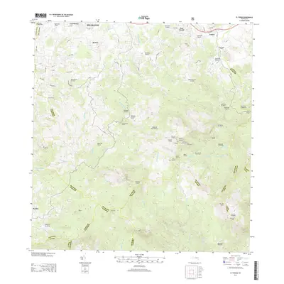
 2018 El Yunque2018 Print · USGSCovers Mameyes II, including Sector Rosado, Palma Sola, and other nearby areas
 - 2018 Map of Fajardo, 2018 Print
 2018 Fajardo2018 Print · USGSCovers Mameyes II, including Fajardo, Ceiba, and other nearby areas
 - 2018 Map of Rio Grande, 2018 Print
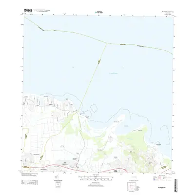
 2018 Rio Grande2018 Print · USGSCovers Mameyes II, including Río Grande, Lindo Mar, and other nearby areas
 - 2024 Map of Fajardo, 2024 Print
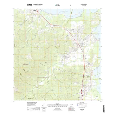
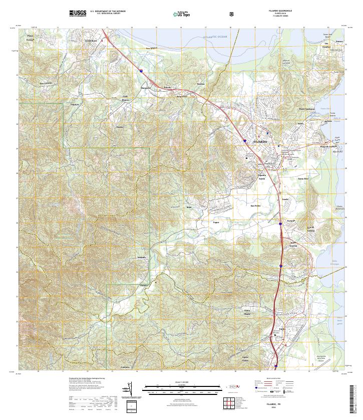 2024 Fajardo2024 Print · USGSNortheast Puerto Rico is shown in great detail here, from the heights of the national forest to the bustling coastal docks. Researchers can locate specific neighborhoods like Espanta Sueño, trace the Quebrada Fajardo, or find the Cementerio De Ceiba.
 - 2024 Map of El Yunque, 2024 Print
 2024 El Yunque2024 Print · USGSEastern Puerto Rico's tropical highlands are mapped here in the modern era, showing the intersection of coastal settlements and mountain wilderness. Researchers can trace local landmarks like Cementerio Municipal Palmer and Campamento Eliza Colberg alongside the peaks of Pico El Yunque.
 - 2024 Map of Rio Grande, 2024 Print
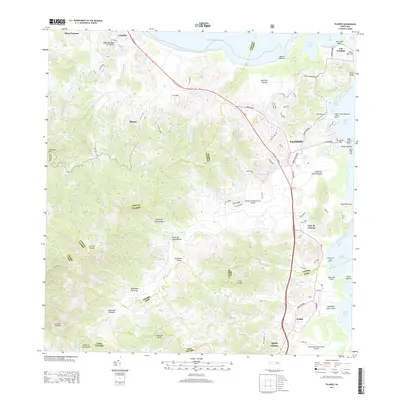
 2024 Rio Grande2024 Print · USGSCoastal Puerto Rico comes alive in this contemporary survey of the area between the Atlantic and the northern foothills. Trace the development of Río Grande and its outlying barrios, from the riverside community of Blasina to the heights of Cerro El Faro.
End of results
Showing maps 1-25 of 25
Frequently asked questions
- What are the different types of historical maps available for Mameyes II?
- What is the oldest map of Mameyes II?
- Where can I purchase historical maps of Mameyes II for my home or office?
- Where can I download high-res historical maps of Mameyes II?
- Are there historical topographic maps available for Mameyes II?
- Is there historical aerial imagery available for Mameyes II?
- Where are historical maps of Mameyes II sourced from?