Old Maps of Minillas, San Germán
Explore 25 old maps of Minillas, spanning from 1937 to today. These high-resolution historic maps reveal how streets, neighborhoods, landmarks, and natural features evolved over time — perfect for genealogy, metal detecting, research, and local history exploration.
What you can do with these maps:
- See how Minillas changed over time: Compare historical maps to modern-day views to trace roads, homesites, rail lines & more.
- View detailed metadata: Each map includes creators, publishers, year, scale, and archive source.
- Overlay maps with satellite & LiDAR: Visualize the past alongside modern tools to explore terrain & human change.
- Trusted historical sources: Maps sourced from the USGS, Library of Congress, and other archives.
- Access maps your way: View online, download high-res files, or order prints for personal or research use.
Start exploring old maps of Minillas to uncover forgotten places, hidden landmarks, and the deep history beneath your feet.
Minillas, San Germán maps
(25)- 1937 Map of San German
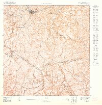
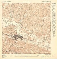
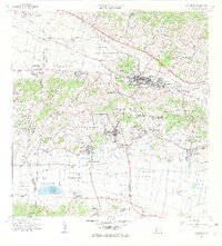
 1937 San German1937 Print · USGSSan Germán and the surrounding valleys of southwestern Puerto Rico are captured here in the mid-1930s during a period of significant agricultural and educational growth. Researchers can trace ancestral connections through named estates like Hacienda Luisa, local landmarks such as the Polytechnic Institute, and the rail stops of the American Railroad of Puerto Rico.
 - 1937 Map of Sabana Grande
 1937 Sabana Grande1937 Print · USGSThe Sabana Grande region in the mid-1930s shows a landscape of mountain ridges and fertile valley floors during a period of agricultural expansion. Genealogists and researchers can locate dozens of named rural schools and trace the American Railroad through Estacion Limon and Estacion Santa Rita.2 unique versions available
 - 1941 Map of San German
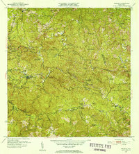
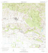
 1941 San German1941 Print · USGSThe hills and valleys surrounding San Germán come alive in this early 1940s survey, showing the peak of the railroad era in southwest Puerto Rico. Researchers can trace the American Railroad of Porto Rico through a landscape of historic estates like Hacienda Beatriz Soledad and Hacienda Resolucion.5 unique versions available
 - 1941 Map of Sabana Grande
 1941 Sabana Grande1941 Print · USGSSouthwest Puerto Rico in the late 1930s shows a landscape of rail-dependent agriculture and highland settlements. Researchers can trace the American Railroad of Porto Rico through stops at Estacion Limon and Fraternidad near the edge of the Laguna de Guanica.5 unique versions available
 - 1946 Map of Maricao
 1946 Maricao1946 Print · USGSMaricao and the western ridges of the Cordillera Central are shown in detail during the 1940s, highlighting the island's traditional plantation culture. Researchers can locate numerous family estates like Hacienda San Antonio and schools such as the Segunda Unidad Escuela Vocacional Francisco Vicenty.3 unique versions available
 - 1947 Map of Maricao SO
 1947 Maricao SO1947 Print · USGSMaricao and the high Cordillera Central are captured here in the late 1940s, highlighting a landscape of steep coffee-growing ridges and mountain camps. Trace the heritage of old estates like Hacienda Santa Rita and the isolated Campamento Santana.
 - 1949 Map of San German SE
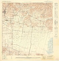 1949 San German SE1949 Print · USGSThe Lajas Valley in the late 1940s is shown as a thriving agricultural and rail corridor before modern development changed the landscape. Genealogists and historians can trace the American R.R. tracks through Estación Lajas and locate family landmarks like Hacienda Beatriz Soledad.
 - 1949 Map of Sabana Grande SO
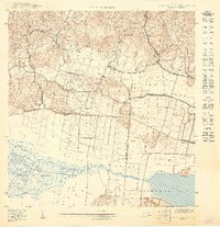 1949 Sabana Grande SO1949 Print · USGSSouthwestern Puerto Rico at mid-century reveals a landscape of industrial rail and coastal wetlands stretching from Lajas toward the Caribbean. Researchers can trace the American Railroad Company line through Estación La Plata and the shores of Laguna de Guánica.
 - 1949 Map of Sabana Grande NO
 1949 Sabana Grande NO1949 Print · USGSThe town of Sabana Grande and its surrounding valleys are captured in the late 1940s as the local rail and agricultural systems shaped the landscape. Researchers can trace the path of the American Railroad of Porto Rico and locate local landmarks like the Escuela Hostos or Cementerio Municipal.
 - 1950 Map of San German NE
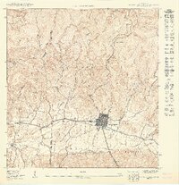
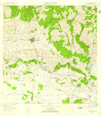
 1950 San German NE1950 Print · USGSSan Germán and its surrounding highlands are captured here at mid-century, showing the town's expansion and its vital transportation links. Researchers can trace the path of the American RR and locate historical sites like the Instituto Politecnico and Lomas de Santa Marta.
 - 1952 Map of Maricao, 1953 Print
 1952 Maricao1953 Print · USGSWestern Puerto Rico’s coffee country is mapped in the early fifties, showing a landscape defined by traditional haciendas and emerging mid-century infrastructure. Genealogists and historians can trace family-named estates like Hacienda Lealtad and Hacienda Santa Rita alongside landmarks like the Criadero Insular de Peces.2 unique versions available
 - 1956 Map of Sabana Grande, 1959 Print
 1956 Sabana Grande1959 Print · USGSSabana Grande and the surrounding mountain barrios are shown here in the mid-fifties, just as the valley irrigation systems were transforming the landscape. Trace old community roots at the Iglesia de Sagrada Corazon de Jesus or along the Antigua Via del Ferrocarril.
 - 1957 Map of San German, 1959 Print
 1957 San German1959 Print · USGSSan Germán and the surrounding agricultural valleys are captured in the late fifties, showing the transition from traditional rail to modern infrastructure. Researchers can trace historic sugar haciendas like Hacienda Julia or locate local landmarks like the Instituto Politécnico and Laguna Cartagena.
 - 1960 Map of Maricao, 1961 Print
 1960 Maricao1961 Print · USGSThe mountains of western Puerto Rico are captured here in the early sixties, showing the agricultural heritage of Maricao. Genealogists can trace family lands across Hacienda Lealtad, Hacienda Santa Rita, and Pueblo Nuevo.3 unique versions available
 - 1966 Map of San German, 1969 Print
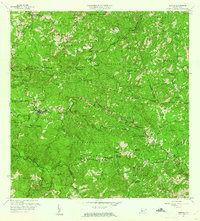
 1966 San German1969 Print · USGSSan Germán and the surrounding Lajas Valley are captured here in the mid-sixties, showing a landscape defined by historic haciendas and rising urban centers. Genealogists and historians can trace family estates like Hacienda Resolución or locate local landmarks including the Cementerio de San Germán and Lajas Arriba.4 unique versions available
 - 1966 Map of Sabana Grande, 1969 Print
 1966 Sabana Grande1969 Print · USGSSabana Grande and the surrounding southwestern highlands are captured here during a period of significant rural development in the mid-sixties. Researchers can trace the Antigua Via del Ferrocarril and locate landmarks like the Capilla del Pozo de la Virgen and Aeropuerto Santa Rita.3 unique versions available
 - 2013 Map of Maricao, 2013 Print
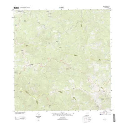 2013 Maricao2013 Print · USGSCovers Minillas, including Maricao, Yauco, and other nearby areas
 - 2013 Map of Sabana Grande, 2013 Print
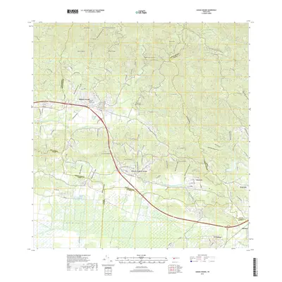
 2013 Sabana Grande2013 Print · USGSCovers Minillas, including Sabana Grande, Villa Juanita, and other nearby areas
 - 2013 Map of San German, 2013 Print
 2013 San German2013 Print · USGSCovers Minillas, including San Germán, Lajas, and other nearby areas
 - 2018 Map of San German, 2018 Print
 2018 San German2018 Print · USGSCovers Minillas, including San Germán, Lajas, and other nearby areas
 - 2018 Map of Sabana Grande, 2018 Print
 2018 Sabana Grande2018 Print · USGSCovers Minillas, including Sabana Grande, Villa Juanita, and other nearby areas
 - 2018 Map of Maricao, 2018 Print
 2018 Maricao2018 Print · USGSCovers Minillas, including Maricao, Yauco, and other nearby areas
 - 2024 Map of San German, 2024 Print
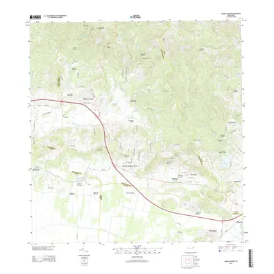
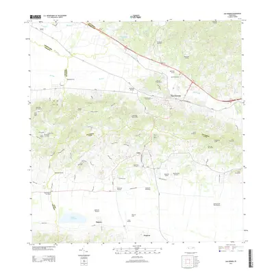
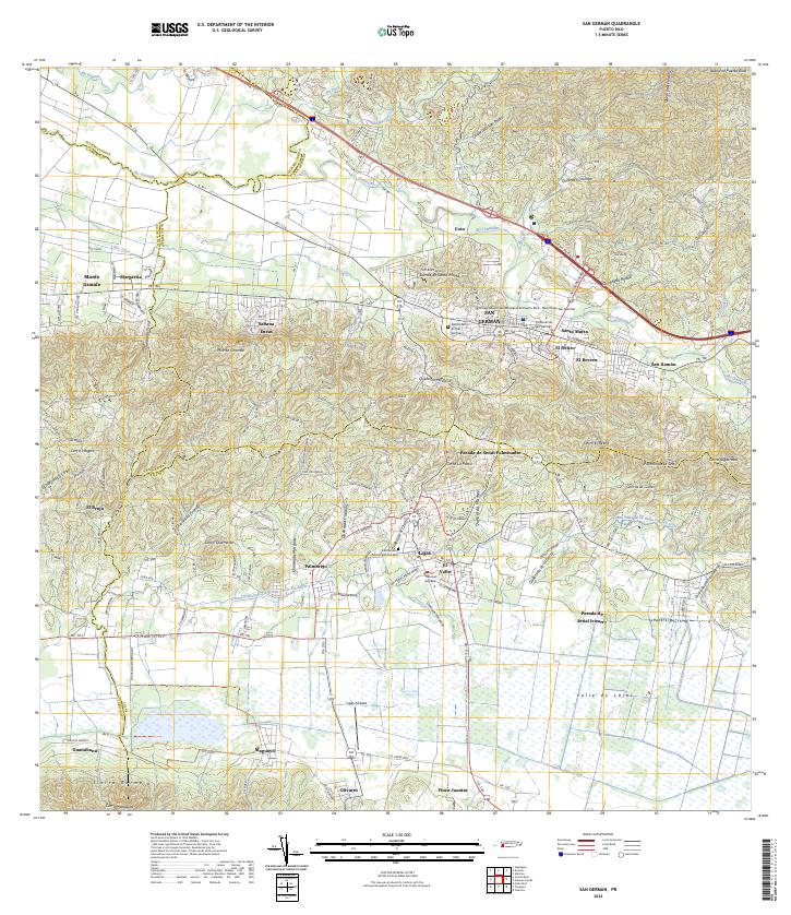 2024 San German2024 Print · USGSSan Germán and the surrounding Lajas Valley are depicted in detail during the early twenty-first century. Researchers can trace the layout of the Universidad Interamericana and locate family sites near Sabana Eneas or the Lajas Cemetery.
 - 2024 Map of Maricao, 2024 Print
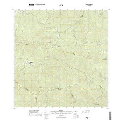
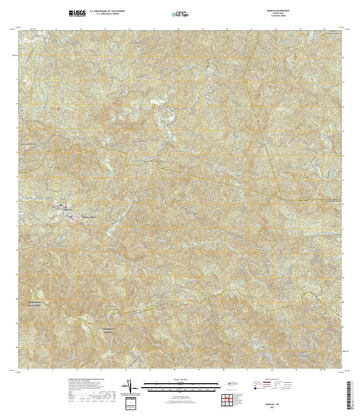 2024 Maricao2024 Print · USGSMaricao and the surrounding highlands are captured in this recent survey of western Puerto Rico. Researchers can trace local landmarks and residential sites like Pueblo Nuevo, Campamento Santana, and the Cementerio Municipal De Maricao.
 - 2024 Map of Sabana Grande, 2024 Print
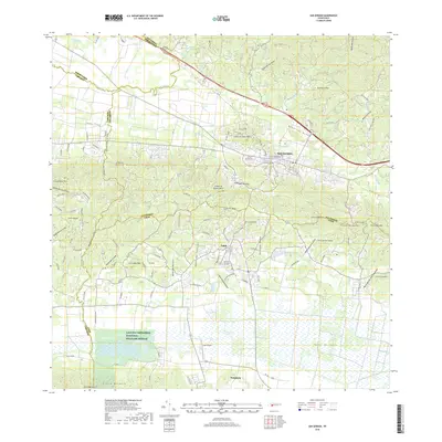
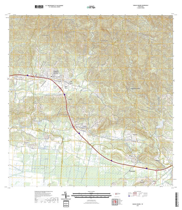 2024 Sabana Grande2024 Print · USGSSabana Grande and the surrounding valley are captured here in the contemporary era as they transition from mountain foothills to fertile plains. Researchers can locate specific neighborhoods like San Isidro and La Pica, or trace the vital Canal Principal De Riego Valle De Lajas.
End of results
Showing maps 1-25 of 25
Frequently asked questions
- What are the different types of historical maps available for Minillas?
- What is the oldest map of Minillas?
- Where can I purchase historical maps of Minillas for my home or office?
- Where can I download high-res historical maps of Minillas?
- Are there historical topographic maps available for Minillas?
- Is there historical aerial imagery available for Minillas?
- Where are historical maps of Minillas sourced from?