Old Maps of South Slob, Saint Croix District for Metal Detecting
Plan your next treasure hunt with 3 historic maps of South Slob. Find old homesites, ghost towns, trails, and gathering spots that may be lost to time — perfect for identifying promising metal detecting locations.
- Locate forgotten sites: Uncover places like long-lost settlements, abandoned rail lines, or gathering spots.
- Plan better hunts: Use map overlays combined with LiDAR or satellite views to narrow in on historically rich areas.
- Made for detectorists: Thousands of hobbyists use these maps to discover relics, coins, and hidden history.
Use these historic maps to boost your research and find new opportunities beneath the surface of South Slob.
South Slob, Saint Croix District maps
(3)- 1958 Map of East Point, 1959 Print
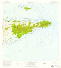 1958 East Point1959 Print · USGSThe eastern reaches of Saint Croix are captured in the late fifties, showing a landscape of traditional estates and rugged coastal topography. Genealogists can trace family landholdings and small settlements like All for the Better, Sallys Fancy, and Madame Carty.5 unique versions available
 - 2013 Map of Grass Point, 2013 Print
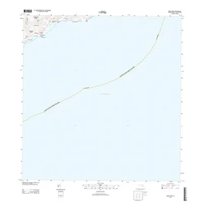 2013 Grass Point2013 Print · USGSCovers South Slob, including Yellow Cliff, Hope and Cartlon Hill, and other nearby areas
 - 2024 Map of Grass Point, 2024 Print
 2024 Grass Point2024 Print · USGSThe southeastern coast of Saint Croix is documented here as it stands today, showing the intersection of coastal topography and contemporary residency. Trace local landmarks like Catharinas Hope and the shoreline at Grapetree Bay or Grassy Point Beach.
End of results
Showing maps 1-3 of 3
Frequently asked questions
- What are the different types of historical maps available for South Slob?
- What is the oldest map of South Slob?
- Where can I purchase historical maps of South Slob for my home or office?
- Where can I download high-res historical maps of South Slob?
- Are there historical topographic maps available for South Slob?
- Is there historical aerial imagery available for South Slob?
- Where are historical maps of South Slob sourced from?