Old Maps of Contant, Saint Thomas - Saint John District for Academic Research
Study the evolution of Contant with 3 high-resolution historic maps. Whether you're teaching, researching, or modeling changes in land use, these maps provide essential visual documentation of urban, environmental, and geographic change.
- Analyze long-term change: Track patterns in development, transportation, and natural features.
- Ideal for environmental or urban studies: Support academic projects with primary historical map data.
- Use in the classroom or lab: Educators and researchers rely on these maps to bring historical context to life.
These maps are a powerful tool for teaching, research, and visualizing how Contant has changed over the decades.
Contant, Saint Thomas - Saint John District maps
(3)- 1958 Map of Western St. John, 1959 Print
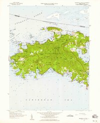 1958 Western St. John1959 Print · USGSSt. John in the late fifties shows a transition between traditional island life and the establishment of the Virgin Islands National Park. Genealogists and historians can trace family locations at Herman Farm, the settlement of Enighed, and the historic Emmaus church.6 unique versions available
 - 2013 Map of Cruz Bay, 2013 Print
 2013 Cruz Bay2013 Print · USGSCovers Contant, including Anna's Retreat, Cruz Bay, and other nearby areas
 - 2024 Map of Cruz Bay, 2024 Print
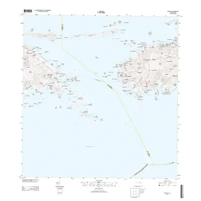
 2024 Cruz Bay2024 Print · USGSThe waters and hills of Saint John and eastern Saint Thomas are shown in their current form, including the entire Virgin Islands National Park boundary. Trace the heritage of the islands through old estate names and burial sites like L'Esperance and the Beverhoudt Cem.
End of results
Showing maps 1-3 of 3
Frequently asked questions
- What are the different types of historical maps available for Contant?
- What is the oldest map of Contant?
- Where can I purchase historical maps of Contant for my home or office?
- Where can I download high-res historical maps of Contant?
- Are there historical topographic maps available for Contant?
- Is there historical aerial imagery available for Contant?
- Where are historical maps of Contant sourced from?