Old Maps of Crossville, Alabama for Academic Research
Study the evolution of Crossville with 35 high-resolution historic maps. Whether you're teaching, researching, or modeling changes in land use, these maps provide essential visual documentation of urban, environmental, and geographic change.
- Analyze long-term change: Track patterns in development, transportation, and natural features.
- Ideal for environmental or urban studies: Support academic projects with primary historical map data.
- Use in the classroom or lab: Educators and researchers rely on these maps to bring historical context to life.
These maps are a powerful tool for teaching, research, and visualizing how Crossville has changed over the decades.
Crossville, AL maps
(35)- 1885 Map of Gadsden
 1885 Gadsden1885 Print · USGSNortheast Alabama in the mid-1880s was a landscape of river-side landings and emerging rail towns. Genealogists and historians can trace the early foundations of Guntersville and Gadsden while locating rural landmarks like Hillian Store, Cottonville, and Law Landing.
 - 1888 Map of Gadsden
 1888 Gadsden1888 Print · USGSNorth Alabama's river valleys and plateau lands are captured here in the late nineteenth century as the region transitioned from river landings to rail transport. Researchers can locate early post offices and commerce centers like Hillian's Store, Guntersville, and the ferry at Ft Deposit.
 - 1892 Map of Gadsden
 1892 Gadsden1892 Print · USGSNorth Alabama's river-and-rail economy is captured here in the late nineteenth century as Guntersville and Gadsden emerge as regional hubs. Genealogists and historians can trace the routes of the Birmingham Mineral R. R. or locate old community centers like Cottonville and Mt Zion.
 - 1893 Map of Fort Payne
 1893 Fort Payne1893 Print · USGSNortheast Alabama is shown here in the late nineteenth century as the rail network transformed the valley floor. Genealogists and historians can trace family-named crossroads like Hoge's X Roads and vital river crossings including Coker Ferry and Sewell Ferry.
 - 1895 Map of Gadsden
 1895 Gadsden1895 Print · USGSNortheast Alabama at the close of the century was a landscape of river landings and mountain gaps where the Tennessee River met growing rail hubs. Genealogists can trace family holdings near Hillian Store, Cottonville, and the remote heights of Lookout Mountain.
 - 1898 Map of Fort Payne, 1964 Print
 1898 Fort Payne1964 Print · USGSDeKalb and Cherokee counties in the late 1890s are defined by the steep ridges of Lookout Mountain and a bustling network of river ferries. Genealogists can trace family roots through numerous river crossings like Hardwick Ferry and early industrial sites such as Sloan Mill or Abernathy Mill.
 - 1900 Map of Fort Payne
 1900 Fort Payne1900 Print · USGSNortheast Alabama is defined by its deep ridges and river valleys in the late nineteenth century. Researchers can trace the era's ferry network across the Coosa River and find old family-run landmarks like Wagners Store and Santy Mills.6 unique versions available
 - 1903 Map of Gadsden
 1903 Gadsden1903 Print · USGSNorthern Alabama in the late nineteenth century centers on the busy Tennessee River corridor and its surrounding ridges. Trace old family sites and transport hubs like Hillian Store, Lovelace Landing, and the Mt Zion church.4 unique versions available
 - 1936 Map of Painter
 1936 Painter1936 Print · USGSDeKalb and Marshall counties are shown here during the mid-1930s, documenting a landscape of plateau farms and essential creek crossings. Genealogists can trace family roots through landmarks like Blessing Sch, Dalrymple Cem, and rural centers like Whiton and Lathamville.
 - 1936 Map of Crossville
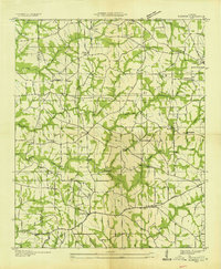
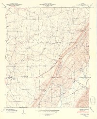
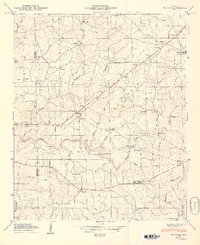
 1936 Crossville1936 Print · USGSDeKalb County and the Sand Mountain area are shown here in the mid-1930s as a thriving rural community of small crossroads and family-named landmarks. Researchers can trace the locations of Orphir Sch, Friendship Ch, and early businesses like Gilbert Store.
 - 1947 Map of Painter, 1973 Print
 1947 Painter1973 Print · USGSDeKalb and Marshall counties are captured here in the late 1940s, showing the settled ridges of Sand Mountain. Genealogists can trace early homesteads near Painter and Geraldine, or locate sites like Gilbreath Chapel and Colvin Bridge.2 unique versions available
 - 1949 Map of Crossville
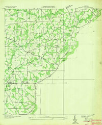
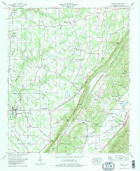
 1949 Crossville1949 Print · USGSDeKalb County enters the post-war era as a thriving agricultural plateau centered on Sand Mountain and the Tennessee Valley. Genealogists can trace family footprints through numerous country churches and cemeteries like Pilgrim Rest Ch and Nicholson Cem.2 unique versions available
 - 1949 Map of Painter
 1949 Painter1949 Print · USGSDe Kalb County settlements are spread across the plateau of Sand Mountain in the years following World War II. Researchers can trace rural lineages through numerous family sites and country parishes like Dalrymple Cem, Lathamville, and Concord Ch.2 unique versions available
 - 1955 Map of Rome
 1955 Rome1955 Print · USGSThe tri-state borderlands of Georgia, Alabama, and Tennessee appear in the mid-fifties as a landscape of ridge-and-valley industry and river navigation. Genealogists can trace family footprints near Chattanooga, the iron works of Gadsden, and textile towns like Trion or Summerville.
 - 1956 Map of Gadsden, 1966 Print
 1956 Gadsden1966 Print · USGSNorth Alabama in the mid-1950s shows a region transformed by river engineering and federal industry. Genealogists and local historians can trace the development of the Tennessee Valley through the growth of Huntsville, the sprawling Redstone Arsenal, and the expansive Guntersville Lake.3 unique versions available
 - 1958 Map of Gadsden
 1958 Gadsden1958 Print · USGSNorth Alabama comes alive in the late 1950s as the Tennessee Valley Authority’s massive river projects and the rise of the space industry reshaped the landscape. Researchers can trace the mid-century footprints of Huntsville, Redstone Arsenal, and the riverside rail networks of the Southern railroad.
 - 1958 Map of Rome, 1966 Print
 1958 Rome1966 Print · USGSNorthwest Georgia and neighboring Tennessee and Alabama are captured here in the late fifties, showcasing a landscape of high ridges and river valleys. Researchers can trace historic rail lines like the Seaboard Air Line RR and explore the bounds of Cloudland Canyon State Park or Fort Oglethorpe.3 unique versions available
 - 1960 Map of Gadsden
 1960 Gadsden1960 Print · USGSNorthern Alabama in the mid-1950s is defined by the mighty Tennessee River and its massive reservoirs. Trace the development of Huntsville and Redstone Arsenal or explore the vast William B Bankhead National Forest.2 unique versions available
 - 1961 Map of Rome
 1961 Rome1961 Print · USGSNorthwest Georgia and neighboring Tennessee and Alabama are shown here at a moment of significant mid-century growth. Researchers can trace the rail networks of the Central of Georgia or locate landmarks within Chickamauga and Chattanooga Nat Military Park.
 - 1963 Map of Rome
 1963 Rome1963 Print · USGSThe tri-state corner of Georgia, Alabama, and Tennessee is captured here during a period of massive reservoir expansion and post-war growth. Genealogists and historians can trace the rail corridors of the Southern Ry or locate landmarks like Fort Oglethorpe and Cloudland Canyon State Park.
 - 1963 Map of Gadsden
 1963 Gadsden1963 Print · USGSNorthern Alabama underwent a dramatic mid-century transformation as the Tennessee Valley became a hub for defense and industry. Researchers can trace the development of the Redstone Arsenal, the route of the Natchez Trace Parkway, and long-standing rail lines like the Southern Railway.
 - 1975 Map of Crossville, 1977 Print
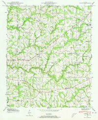
 1975 Crossville1977 Print · USGSDeKalb County communities sit atop the Sand Mountain plateau and descend into Big Wills Valley during the mid-seventies. Genealogists can trace family names through the Red Hill Cem and Nicholson Cem or locate rural landmarks like Skirum and Liberty Hill Ch.2 unique versions available
 - 1981 Map of Rome, 1982 Print
 1981 Rome1982 Print · USGSNorthwest Georgia and the Alabama borderlands come into focus in the early eighties, defined by the winding Coosa River and the high ridges of Lookout Mountain. Researchers can trace the rail-and-river economy through Rome, Gadsden, and Cedartown, alongside natural landmarks like Yellow Creek Falls.2 unique versions available
 - 1984 Map of Guntersville, 1985 Print
 1984 Guntersville1985 Print · USGSNorthern Alabama at the start of the eighties shows a landscape shaped by massive TVA impoundments and a robust rail network. Genealogists and historians can trace family land across Brindley Mountain or near old rail stops on the Louisville and Nashville RR and Southern Ry.2 unique versions available
 - 2011 Map of Painter, 2011 Print
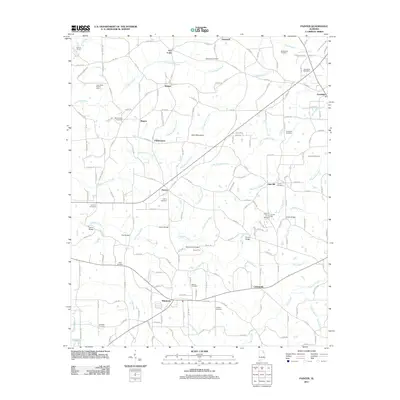 2011 Painter2011 Print · USGSCovers Crossville, including Geraldine, Painter, and other nearby areas
Showing maps 1-25 of 35
Top cities near Crossville
- Gadsden historical maps
- Albertville historical maps
- Fort Payne historical maps
- Boaz historical maps
- Guntersville historical maps
- Rainsville historical maps
See more
Top neighborhoods of Crossville
Frequently asked questions
- What are the different types of historical maps available for Crossville?
- What is the oldest map of Crossville?
- Where can I purchase historical maps of Crossville for my home or office?
- Where can I download high-res historical maps of Crossville?
- Are there historical topographic maps available for Crossville?
- Is there historical aerial imagery available for Crossville?
- Where are historical maps of Crossville sourced from?