Old Maps of Piney Grove, Alabama for Genealogy
Trace your family roots with 16 historic maps of Piney Grove. These high-res maps reveal old neighborhoods, homesites, landmarks, and streets — helping you uncover where your ancestors lived and how the area evolved over time.
- Explore historic neighborhoods: Identify where your relatives may have lived in the 1800s or 1900s.
- Compare maps over time: Trace the changes in streets, buildings, and landmarks for multi-generational research.
- Perfect for genealogy & ancestry research: Used by family historians and researchers to map out lineage and migration.
These maps are an incredible resource for exploring your personal connection to Piney Grove's past.
Piney Grove, AL maps
(16)- 1935 Map of Danville
 1935 Danville1935 Print · USGSIn the mid-thirties, the borderlands of Lawrence and Morgan counties featured a landscape of remote stores and hilltop churches. Genealogists can trace family footprints at Strauge Crossroads or locate the ancient Indian Mounds near Oakville.2 unique versions available
 - 1936 Map of Mc Kendry
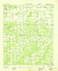 1936 Mc Kendry1936 Print · USGSThe rural highlands of North Alabama come into focus in the mid-1930s as a network of ridge-top settlements and forest boundaries. Genealogists can trace family connections through numerous rural landmarks like Andrews Chapel, Blairs Store, and the scattered homes of McKendry.
 - 1938 Map of Danville
 1938 Danville1938 Print · USGSNorthern Alabama’s uplands are captured here in the mid-1930s, showing the early boundaries of the Black Warrior National Forest. Researchers can locate rural schools and churches like Speake Sch and Evergreen Ch or trace old crossings at McDaniel Bridge.2 unique versions available
 - 1956 Map of Gadsden, 1966 Print
 1956 Gadsden1966 Print · USGSNorth Alabama in the mid-1950s shows a region transformed by river engineering and federal industry. Genealogists and local historians can trace the development of the Tennessee Valley through the growth of Huntsville, the sprawling Redstone Arsenal, and the expansive Guntersville Lake.3 unique versions available
 - 1958 Map of Gadsden
 1958 Gadsden1958 Print · USGSNorth Alabama comes alive in the late 1950s as the Tennessee Valley Authority’s massive river projects and the rise of the space industry reshaped the landscape. Researchers can trace the mid-century footprints of Huntsville, Redstone Arsenal, and the riverside rail networks of the Southern railroad.
 - 1960 Map of Gadsden
 1960 Gadsden1960 Print · USGSNorthern Alabama in the mid-1950s is defined by the mighty Tennessee River and its massive reservoirs. Trace the development of Huntsville and Redstone Arsenal or explore the vast William B Bankhead National Forest.2 unique versions available
 - 1960 Map of Massey, 1961 Print
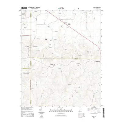
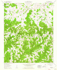 1960 Massey1961 Print · USGSNorthern Alabama hill country in the early sixties is shown here in detail as it transitions into the William B Bankhead National Forest. Genealogists can trace family names through landmarks like Penn Cem, Andrews Chapel, and the community of Battleground.4 unique versions available
 - 1963 Map of Gadsden
 1963 Gadsden1963 Print · USGSNorthern Alabama underwent a dramatic mid-century transformation as the Tennessee Valley became a hub for defense and industry. Researchers can trace the development of the Redstone Arsenal, the route of the Natchez Trace Parkway, and long-standing rail lines like the Southern Railway.
 - 1980 Map of Haleyville, 1983 Print
 1980 Haleyville1983 Print · USGSNorthwest Alabama at the start of the eighties shows a landscape of deep forests and new reservoirs as modern infrastructure settled into the hills. Researchers can trace the rail lines of the Southern and Illinois Central Gulf through towns like Haleyville, Moulton, and Natural Bridge.
 - 2000 Map of Massey, 2003 Print
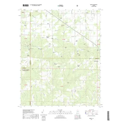
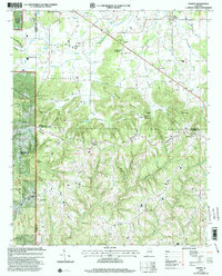 2000 Massey2003 Print · USGSUpper Alabama at the close of the century shows a landscape defined by the ridges of Brindley Mountain and the deep woods of the William B Bankhead National Forest. Genealogists and historians can trace numerous rural landmarks, from Battleground to Andrews Chapel Cem and McKendree Ch.
 - 2011 Map of Massey, 2011 Print
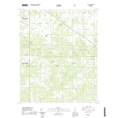
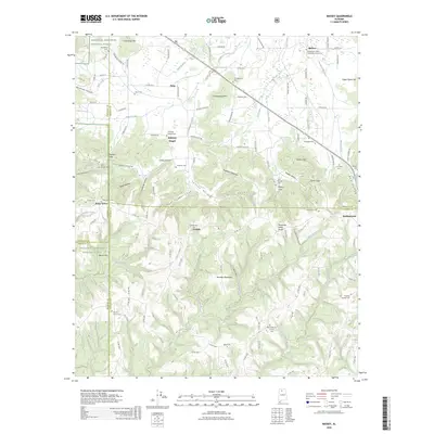
 2011 Massey2011 Print · USGSCovers Piney Grove, including Clifty, Corinth, and other nearby areas
 - 2014 Map of Massey, 2014 Print
 2014 Massey2014 Print · USGSCovers Piney Grove, including Clifty, Corinth, and other nearby areas
 - 2018 Map of Massey, 2018 Print
 2018 Massey2018 Print · USGSCovers Piney Grove, including Clifty, Corinth, and other nearby areas
 - 2021 Map of Massey, 2021 Print
 2021 Massey2021 Print · USGSCovers Piney Grove, including Clifty, Corinth, and other nearby areas
 - 2024 Map of Massey, 2024 Print
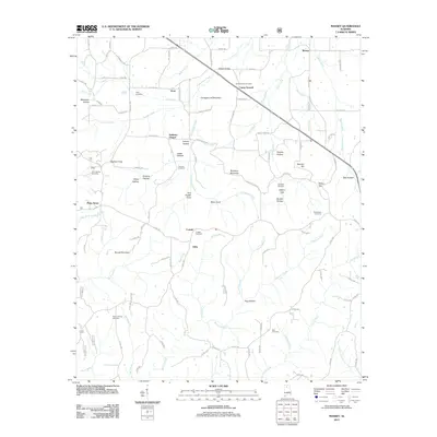
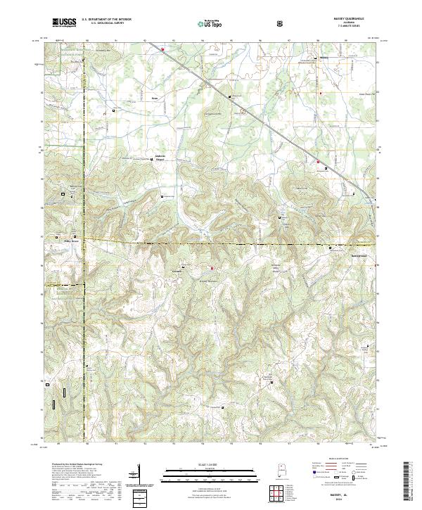 2024 Massey2024 Print · USGSThe Cullman and Morgan county borders meet in this upland region during the mid-2020s, showing a landscape of forest and small rural settlements. Family historians can locate numerous burial sites and churches, from McKendree United Methodist Church Cem to the high ground of Battleground and Andrews Chapel.
 - 2026 Map of Massey, 2026 Print
 2026 Massey2026 Print · USGSCovers Piney Grove, including Clifty, Corinth, and other nearby areas
End of results
Showing maps 1-16 of 16
Top cities near Piney Grove
- Huntsville historical maps
- Decatur historical maps
- Cullman historical maps
- Hartselle historical maps
- Priceville historical maps
- Moulton historical maps
See more
Frequently asked questions
- What are the different types of historical maps available for Piney Grove?
- What is the oldest map of Piney Grove?
- Where can I purchase historical maps of Piney Grove for my home or office?
- Where can I download high-res historical maps of Piney Grove?
- Are there historical topographic maps available for Piney Grove?
- Is there historical aerial imagery available for Piney Grove?
- Where are historical maps of Piney Grove sourced from?