Old Maps of Tunnel Springs, Alabama for Genealogy
Trace your family roots with 10 historic maps of Tunnel Springs. These high-res maps reveal old neighborhoods, homesites, landmarks, and streets — helping you uncover where your ancestors lived and how the area evolved over time.
- Explore historic neighborhoods: Identify where your relatives may have lived in the 1800s or 1900s.
- Compare maps over time: Trace the changes in streets, buildings, and landmarks for multi-generational research.
- Perfect for genealogy & ancestry research: Used by family historians and researchers to map out lineage and migration.
These maps are an incredible resource for exploring your personal connection to Tunnel Springs's past.
Tunnel Springs, AL maps
(10)- 1953 Map of Andalusia, 1965 Print
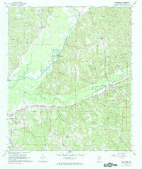
 1953 Andalusia1965 Print · USGSSouth Alabama in the mid-twentieth century remains a land of pine forests and river-fed settlements. You can trace the vital rail corridors of the Louisville & Nashville and locate regional centers such as Andalusia, Brewton, and Monroeville.3 unique versions available
 - 1957 Map of Andalusia
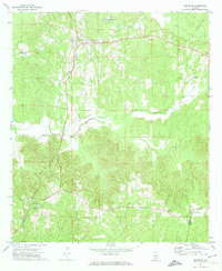
 1957 Andalusia1957 Print · USGSSouthern Alabama in the mid-1950s was a landscape defined by timbered stretches and the rhythmic flow of the Alabama River. Researchers can trace the legacy of the rail era through the Central of Georgia tracks and the storied river bluffs at Choctaw Bluff.
 - 1967 Map of Beatrice, 1984 Print
 1967 Beatrice1984 Print · USGSLamar County's rural heartland is captured here in the late sixties, where the river and rail lines shaped community life. Genealogists can trace family landmarks like Olive Hill Cem, Stanford Cem, and the railroad siding at Crews.
 - 1971 Map of Beatrice, 1974 Print
 1971 Beatrice1974 Print · USGSMonroe County, Alabama, in the early seventies was a landscape of rail-connected settlements and winding creek valleys. Genealogists can trace family footprints near Beatrice and Tunnel Springs or locate the Antioch Ch and Greer Jr High Sch.2 unique versions available
 - 1986 Map of Monroeville
 1986 Monroeville1986 Print · USGSMonroe and Clarke counties are captured here in the mid-eighties, centered on the river valleys of the Alabama River and Tombigbee River. Genealogists and local historians can trace legacy settlements like Burnt Corn, Whatley, and the river site of Claiborne.2 unique versions available
 - 2011 Map of Beatrice, 2011 Print
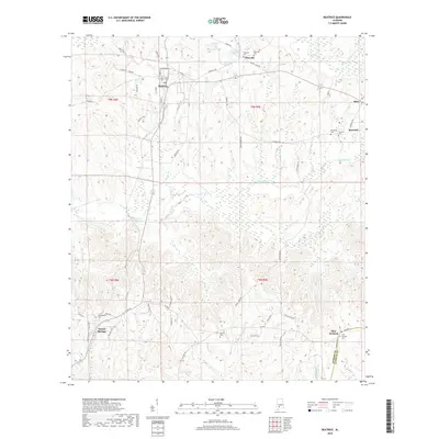
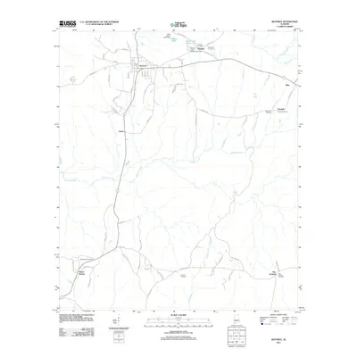 2011 Beatrice2011 Print · USGSCovers Tunnel Springs, including Beatrice, Kalem, and other nearby areas
 - 2014 Map of Beatrice, 2014 Print
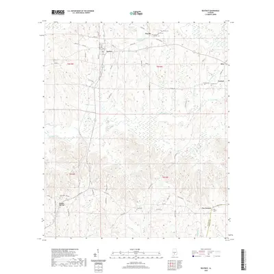
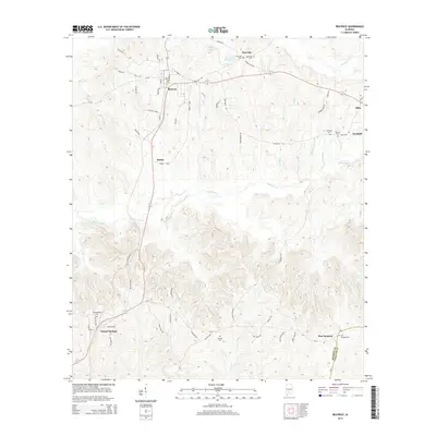 2014 Beatrice2014 Print · USGSCovers Tunnel Springs, including Beatrice, Kalem, and other nearby areas
 - 2018 Map of Beatrice, 2018 Print
 2018 Beatrice2018 Print · USGSCovers Tunnel Springs, including Beatrice, Kalem, and other nearby areas
 - 2020 Map of Beatrice, 2020 Print
 2020 Beatrice2020 Print · USGSCovers Tunnel Springs, including Beatrice, Kalem, and other nearby areas
 - 2024 Map of Beatrice, 2024 Print
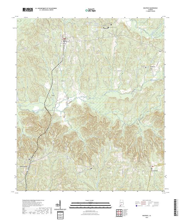 2024 Beatrice2024 Print · USGSMonroe County’s rural uplands are shown in high detail at this current moment, centered on the historic town of Beatrice. Researchers can locate several family and community landmarks, including Antioch Cem, Pine Orchard, and the creek-side settlement of Turnbull.
End of results
Showing maps 1-10 of 10
Top cities near Tunnel Springs
- Monroeville historical maps
- Evergreen historical maps
- Frisco City historical maps
- Excel historical maps
- Vredenburgh historical maps
- Beatrice historical maps
Frequently asked questions
- What are the different types of historical maps available for Tunnel Springs?
- What is the oldest map of Tunnel Springs?
- Where can I purchase historical maps of Tunnel Springs for my home or office?
- Where can I download high-res historical maps of Tunnel Springs?
- Are there historical topographic maps available for Tunnel Springs?
- Is there historical aerial imagery available for Tunnel Springs?
- Where are historical maps of Tunnel Springs sourced from?