Old Maps of Garden District, Montgomery
Explore 14 old maps of Garden District, spanning from 1927 to today. These high-resolution historic maps reveal how streets, neighborhoods, landmarks, and natural features evolved over time — perfect for genealogy, metal detecting, research, and local history exploration.
What you can do with these maps:
- See how Garden District changed over time: Compare historical maps to modern-day views to trace roads, homesites, rail lines & more.
- View detailed metadata: Each map includes creators, publishers, year, scale, and archive source.
- Overlay maps with satellite & LiDAR: Visualize the past alongside modern tools to explore terrain & human change.
- Trusted historical sources: Maps sourced from the USGS, Library of Congress, and other archives.
- Access maps your way: View online, download high-res files, or order prints for personal or research use.
Start exploring old maps of Garden District to uncover forgotten places, hidden landmarks, and the deep history beneath your feet.
Garden District, Montgomery maps
(14)- 1927 Map of Montgomery
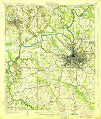
 1927 Montgomery1927 Print · USGSThe Alabama state capital and its river-bend surroundings are seen here in the late twenties during a period of growth. Researchers can trace the footprints of Maxwell Aviation Field, the Masonic Home, and rural sites like Stones Cem.
 - 1930 Map of Montgomery
 1930 Montgomery1930 Print · USGSThe Alabama state capital is seen here as a bustling rail and river crossroads in the late twenties. Trace the historic growth of the city and its surrounding rural communities through sites like Maxwell Aviation Field, Kilby Prison, and Oakwood Cemetery.4 unique versions available
 - 1953 Map of Montgomery, 1964 Print
 1953 Montgomery1964 Print · USGSCentral Alabama's river-and-rail corridor is mapped here in the mid-fifties, showing the vital connections between the capital and the Black Belt. Genealogists and historians can trace rail depots and crossroads from Marion Junction to Wetumpka, alongside landmarks like Craig AFB.4 unique versions available
 - 1956 Map of Montgomery
 1956 Montgomery1956 Print · USGSCentral Alabama in the mid-1950s shows a landscape defined by its great river systems and a booming military aviation presence. Genealogists and historians can trace the rail corridors of the Southern Railway and locate tactical bases like Maxwell AFB and Craig AFB.
 - 1957 Map of Montgomery
 1957 Montgomery1957 Print · USGSCentral Alabama in the mid-fifties is defined by the winding Alabama River and a strategic network of military bases and rail lines. Trace family roots in Montgomery and Selma, or locate landmarks like Craig AFB and the State Capitol before the interstate era.
 - 1958 Map of Montgomery, 1959 Print
 1958 Montgomery1959 Print · USGSThe state capital and its surrounding river bends are captured here during the late fifties, a period of significant military and urban growth. Researchers can trace historic institutions like Alabama State College and the extensive grounds of Maxwell Air Force Base.2 unique versions available
 - 1958 Map of Montgomery South, 1959 Print
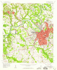
 1958 Montgomery South1959 Print · USGSMontgomery's southern expansion is visible in the mid-fifties as urban neighborhoods give way to the wetlands of the Catoma Creek basin. Genealogists and historians can trace the footprint of several local landmarks, from Greenwood Cemetery and Lincoln Cem to Lanier High Sch and the Masonic Home.5 unique versions available
 - 1975 Map of Montgomery South, 1977 Print
 1975 Montgomery South1977 Print · USGSThe southern expansion of the Alabama capital is captured here during the mid-seventies, showing the urban edge meeting the countryside. Researchers can trace the development of Lynndale or locate early rural holdings near Hope Hull and the banks of Catoma Creek.
 - 1986 Map of Montgomery
 1986 Montgomery1986 Print · USGSCentral Alabama's river-and-rail corridor is captured in the mid-1980s, centered on the state capital and its surrounding rural counties. Researchers can trace ancestral landmarks like Oakwood Cemetery, military sites like Maxwell Air Force Base, and small towns such as Lowndesboro.2 unique versions available
 - 2011 Map of Montgomery South, 2011 Print
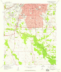
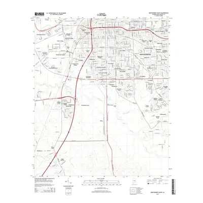
 2011 Montgomery South2011 Print · USGSCovers Garden District, including Montgomery, Bellemeade, and other nearby areas
 - 2014 Map of Montgomery South, 2014 Print
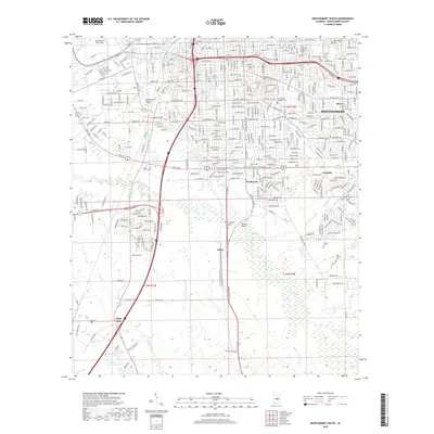
 2014 Montgomery South2014 Print · USGSCovers Garden District, including Montgomery, Bellemeade, and other nearby areas
 - 2018 Map of Montgomery South, 2018 Print
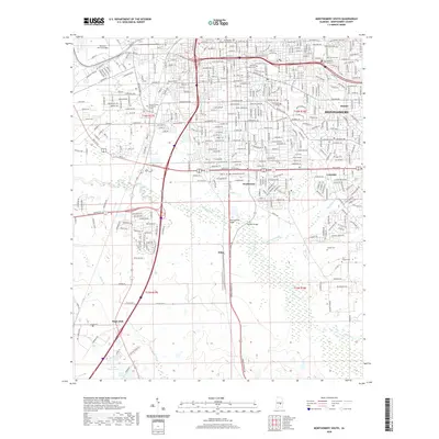
 2018 Montgomery South2018 Print · USGSCovers Garden District, including Montgomery, Bellemeade, and other nearby areas
 - 2020 Map of Montgomery South, 2020 Print
 2020 Montgomery South2020 Print · USGSCovers Garden District, including Montgomery, Bellemeade, and other nearby areas
 - 2024 Map of Montgomery South, 2024 Print
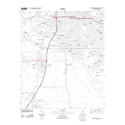
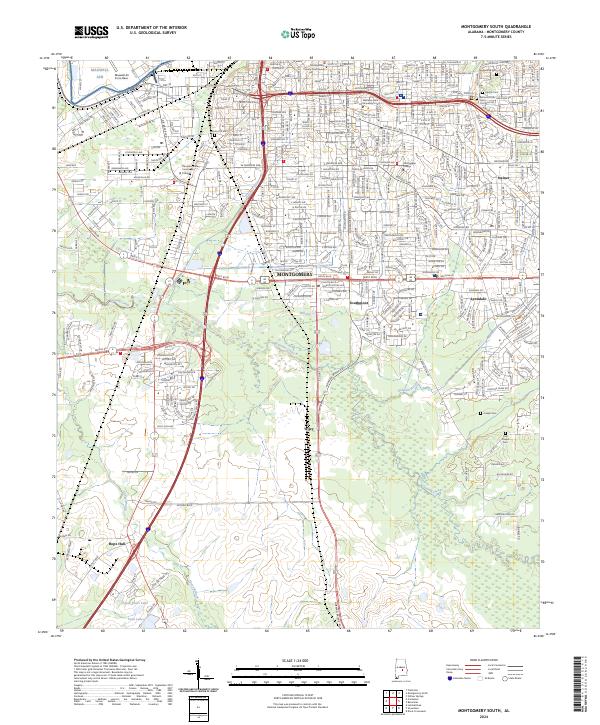 2024 Montgomery South2024 Print · USGSThe southern reaches of Alabama's capital are captured here at a modern moment of suburban and industrial growth. Genealogists and local historians can locate family burial sites at Greenwood Cemetery or Troy Chapel Cem and trace the development of Hope Hull and Southmont.
End of results
Showing maps 1-14 of 14
Frequently asked questions
- What are the different types of historical maps available for Garden District?
- What is the oldest map of Garden District?
- Where can I purchase historical maps of Garden District for my home or office?
- Where can I download high-res historical maps of Garden District?
- Are there historical topographic maps available for Garden District?
- Is there historical aerial imagery available for Garden District?
- Where are historical maps of Garden District sourced from?