Old Maps of Mount Meigs, Alabama
Explore 12 old maps of Mount Meigs, spanning from 1953 to today. These high-resolution historic maps reveal how streets, neighborhoods, landmarks, and natural features evolved over time — perfect for genealogy, metal detecting, research, and local history exploration.
What you can do with these maps:
- See how Mount Meigs changed over time: Compare historical maps to modern-day views to trace roads, homesites, rail lines & more.
- View detailed metadata: Each map includes creators, publishers, year, scale, and archive source.
- Overlay maps with satellite & LiDAR: Visualize the past alongside modern tools to explore terrain & human change.
- Trusted historical sources: Maps sourced from the USGS, Library of Congress, and other archives.
- Access maps your way: View online, download high-res files, or order prints for personal or research use.
Start exploring old maps of Mount Meigs to uncover forgotten places, hidden landmarks, and the deep history beneath your feet.
Mount Meigs, AL maps
(12)- 1953 Map of Montgomery, 1964 Print
 1953 Montgomery1964 Print · USGSCentral Alabama's river-and-rail corridor is mapped here in the mid-fifties, showing the vital connections between the capital and the Black Belt. Genealogists and historians can trace rail depots and crossroads from Marion Junction to Wetumpka, alongside landmarks like Craig AFB.4 unique versions available
 - 1956 Map of Montgomery
 1956 Montgomery1956 Print · USGSCentral Alabama in the mid-1950s shows a landscape defined by its great river systems and a booming military aviation presence. Genealogists and historians can trace the rail corridors of the Southern Railway and locate tactical bases like Maxwell AFB and Craig AFB.
 - 1957 Map of Montgomery
 1957 Montgomery1957 Print · USGSCentral Alabama in the mid-fifties is defined by the winding Alabama River and a strategic network of military bases and rail lines. Trace family roots in Montgomery and Selma, or locate landmarks like Craig AFB and the State Capitol before the interstate era.
 - 1958 Map of Mount Meigs, 1959 Print
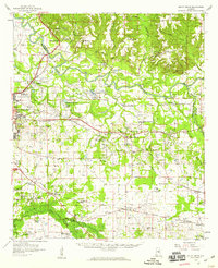 1958 Mount Meigs1959 Print · USGSMontgomery County was a hive of rail and river activity in the late fifties as the state capital expanded eastward. Researchers can trace family-named sites and rural institutions like Pike Road, Our Lady of Fatima Sch, and the riverside Indian Mounds.2 unique versions available
 - 1975 Map of Mount Meigs SE, 1977 Print
 1975 Mount Meigs SE1977 Print · USGSThe rural landscape east of Montgomery is captured in high detail in the mid-1970s, showcasing the agricultural patterns of central Alabama. Researchers can trace the exact footprints of settlements like Mount Meigs, Pike Road, and Waugh across the varied terrain.
 - 1986 Map of Montgomery
 1986 Montgomery1986 Print · USGSCentral Alabama's river-and-rail corridor is captured in the mid-1980s, centered on the state capital and its surrounding rural counties. Researchers can trace ancestral landmarks like Oakwood Cemetery, military sites like Maxwell Air Force Base, and small towns such as Lowndesboro.2 unique versions available
 - 1987 Map of Mount Meigs
 1987 Mount Meigs1987 Print · USGSEastern Montgomery County is captured in the late eighties as its rural crossroads began to evolve. Genealogists can trace family landmarks like Antioch Cem and Birch Hill Cem alongside the tracks of the SOUTHERN and CSX railroads.
 - 2012 Map of Mount Meigs, 2012 Print
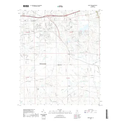
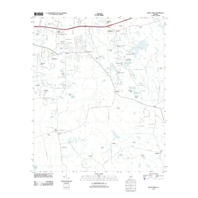 2012 Mount Meigs2012 Print · USGSCovers Mount Meigs, including Montgomery, Pike Road, and other nearby areas
 - 2014 Map of Mount Meigs, 2014 Print
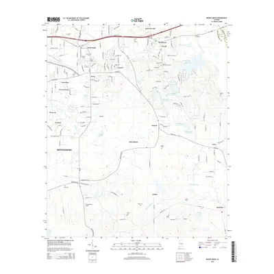 2014 Mount Meigs2014 Print · USGSCovers Mount Meigs, including Montgomery, Pike Road, and other nearby areas
 - 2018 Map of Mount Meigs, 2018 Print
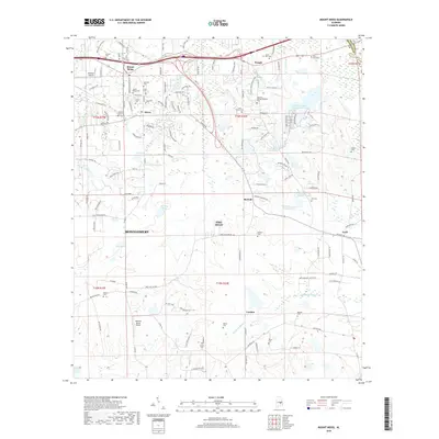 2018 Mount Meigs2018 Print · USGSCovers Mount Meigs, including Montgomery, Pike Road, and other nearby areas
 - 2020 Map of Mount Meigs, 2020 Print
 2020 Mount Meigs2020 Print · USGSCovers Mount Meigs, including Montgomery, Pike Road, and other nearby areas
 - 2024 Map of Mount Meigs, 2024 Print
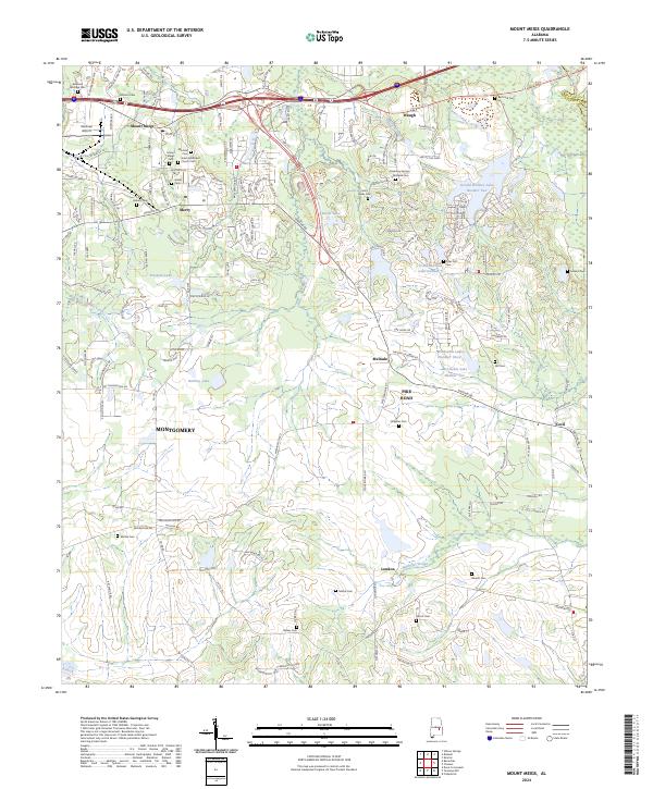 2024 Mount Meigs2024 Print · USGSThe rural outskirts of Montgomery are meticulously mapped in the current era, showing the intersection of suburban growth and historic landscapes. Genealogists can locate numerous small burial sites like Mitchell Cem and Gilder Cem near the town of Mount Meigs.
End of results
Showing maps 1-12 of 12
Top cities near Mount Meigs
- Montgomery historical maps
- Pike Road historical maps
- Wetumpka historical maps
- Tallassee historical maps
- Emerald Mountain historical maps
- Blue Ridge historical maps
See more
Frequently asked questions
- What are the different types of historical maps available for Mount Meigs?
- What is the oldest map of Mount Meigs?
- Where can I purchase historical maps of Mount Meigs for my home or office?
- Where can I download high-res historical maps of Mount Meigs?
- Are there historical topographic maps available for Mount Meigs?
- Is there historical aerial imagery available for Mount Meigs?
- Where are historical maps of Mount Meigs sourced from?