1900s (20th Century) Maps of Morgan County, Alabama
Explore 64 historic maps of Morgan County from the 1900s (20th Century). These maps offer a rare glimpse into what life looked like during the 1900s — showing old roads, neighborhoods, homes, and landmarks that have changed or disappeared over time.
Whether you're researching your family's past, planning a metal detecting trip, or studying how Morgan County's landscape evolved across the 1900s, these high-resolution maps are a powerful tool for exploring the history of this region.
- Focus on a specific era: All maps on this page are from the 1900s, giving you a focused view of this time period.
- See what’s changed: Compare century-old streets, trails, and buildings to today's modern landscape using overlays and satellite layers.
- Research with precision: Use these maps for genealogy, historical research, land use analysis, or educational projects.
- View, download, or print: Maps are fully viewable online in high resolution, and can be downloaded or printed for your own records.
Start exploring Morgan County's history through authentic maps from the 1900s. This is your window into the past.
Morgan County, AL maps
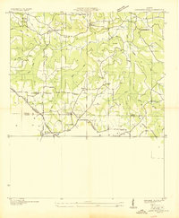
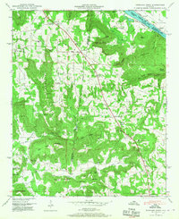
(64)- 1927 Map of Falkville
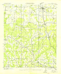 1927 Falkville1927 Print · USGSMorgan and Cullman counties are captured in the mid-1930s, showing the early infrastructure of the Tennessee Valley Authority. Genealogists can locate family landmarks like Wilhites Cem or community hubs such as Roundtop Ch and Panama Sch.
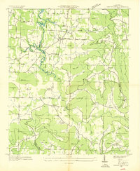
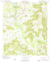
 - 1935 Map of Danville
 1935 Danville1935 Print · USGSIn the mid-thirties, the borderlands of Lawrence and Morgan counties featured a landscape of remote stores and hilltop churches. Genealogists can trace family footprints at Strauge Crossroads or locate the ancient Indian Mounds near Oakville.2 unique versions available
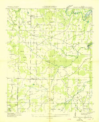
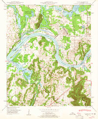
 - 1936 Map of Triana
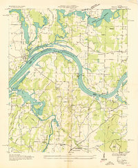 1936 Triana1936 Print · USGSThe Tennessee River bend near the Madison and Morgan county line is captured here just as the Tennessee Valley Authority era began. Researchers can trace the layout of early rural school districts like Horton Sch and Union Sch or locate congregations at Mt Mariah Ch and Talucah Ch.
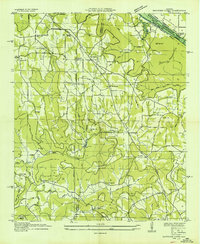
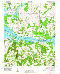
 - 1936 Map of Hulaco
 1936 Hulaco1936 Print · USGSDuring the mid-1930s, this portion of northern Alabama was a landscape of mountain crossroads and rural congregations. Genealogists and researchers can trace family landmarks like Crawford Cem, Harvells Store, and local schools including Hulaco Sch.
 - 1936 Map of Mc Kendry
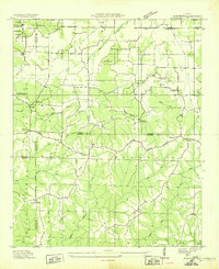 1936 Mc Kendry1936 Print · USGSThe rural highlands of North Alabama come into focus in the mid-1930s as a network of ridge-top settlements and forest boundaries. Genealogists can trace family connections through numerous rural landmarks like Andrews Chapel, Blairs Store, and the scattered homes of McKendry.
 - 1936 Map of Hartselle
 1936 Hartselle1936 Print · USGSHartselle and the surrounding Morgan County countryside are captured here during the mid-1930s as the Tennessee Valley Authority began reshaping the landscape. Genealogists and local historians can trace rural communities through CCC Camp No 3485, Natural Bridge Sch, and Liberty Cem.
 - 1936 Map of Decatur
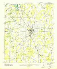
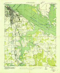 1936 Decatur1936 Print · USGSDecatur and the Tennessee River valley are captured here during the transformative years of the Tennessee Valley Authority. Trace early neighborhoods and rural landmarks like Blackwell Cem, Priceville Sch, and the Brick Kilns.
 - 1936 Map of Stewart Cross Roads
 1936 Stewart Cross Roads1936 Print · USGSThe Tennessee River valley underwent a massive transformation in the mid-1930s as the new reservoir flooded the lowlands. You can trace submerged riverbanks and find upland landmarks like Stewart Cross Roads, Beulah Land, and St Luke Sch.
 - 1936 Map of Trinity
 1936 Trinity1936 Print · USGSThe Tennessee River valley near the Lawrence and Morgan county line is captured here just as the new reservoir system was taking shape. Genealogists can trace family names at Roselawn Cem, find old rural schools like Means Sch, and locate the historic Kirby Bridge.
 - 1936 Map of Eva
 1936 Eva1936 Print · USGSThe Morgan and Cullman county line was a landscape of ridge-top settlements and creek valleys in the mid-1930s. Genealogists can trace family footprints at Dripping Spring Sch, Hamby Chapel, and the Morris Cem near the railroad.
 - 1936 Map of Somerville
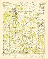
 1936 Somerville1936 Print · USGSMorgan County is captured here in the mid-1930s, showing the rural network of schools and churches that bound these Alabama communities together. Researchers can locate family landmarks like Winton Cem, Ward Chapel, and the old County Farm near the slopes of Wilson Mountain.
 - 1936 Map of Lawrence Cove
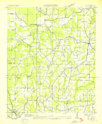
 1936 Lawrence Cove1936 Print · USGSMorgan County rural life is captured here in the mid-1930s, showing a landscape of small farming communities and ridge-top churches. Trace the local genealogy of Lawrence Cove through landmarks like Lawrence Cove Sch, Pine Burr Ch, and Bethel Ch.
 - 1936 Map of Center Grove
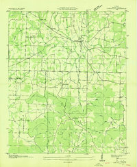
 1936 Center Grove1936 Print · USGSMorgan County rural life is captured in the mid-1930s as the Wheeler Reservoir begins to shape the landscape. Local historians can trace old community hubs like Woodland Mills and remote sites such as Blue Springs Ch.
 - 1936 Map of Mason Ridge
 1936 Mason Ridge1936 Print · USGSThe Tennessee River valley underwent a total transformation in the mid-1930s as the new Wheeler Reservoir filled. Researchers can trace displaced landmarks like Cane Landing or visit upland sites like Needmore Sch and Kolb Cem.
 - 1936 Map of Tanner
 1936 Tanner1936 Print · USGSLimestone County is captured during the transformative years of the Tennessee Valley Authority project. Researchers can trace family sites and rural landmarks like Mooresville, Taylor Pride Cem, and the Alabama State Farm near the rising waters of Wheeler Reservoir.
 - 1936 Map of Farley
 1936 Farley1936 Print · USGSThe Tennessee River valley is captured here in the mid-1930s during its transformation by the TVA. Researchers can trace historic family names and early rural sites like Gaines Chapel, Whitesburg, and the Old Chickasaw Boundary.
 - 1936 Map of Stroups Crossroads
 1936 Stroups Crossroads1936 Print · USGSIn the mid-1930s, this portion of Morgan County was defined by its transition toward a reservoir-based economy near Stroups Crossroads. Researchers can locate old community landmarks like Rocky Ford Sch, the Means Bridge, and the Danville Pond.
 - 1936 Map of Newsome Sinks
 1936 Newsome Sinks1936 Print · USGSMarshall County is captured here during the 1930s as the Tennessee Valley Authority began flooding the valley for the new reservoir. Researchers can trace family homesteads near Old Rescue and Oleander or locate rural landmarks like Science Hill Sch and Mt Tabor Ch.
 - 1938 Map of Tanner
 1938 Tanner1938 Print · USGSLimestone County in the late thirties shows a landscape transformed by the new Wheeler Reservoir and its rising waters. Genealogists can trace family holdings and community hubs like Anderson Plantation, Taylor Pride Cem, and Mooresville.
 - 1938 Map of Danville
 1938 Danville1938 Print · USGSNorthern Alabama’s uplands are captured here in the mid-1930s, showing the early boundaries of the Black Warrior National Forest. Researchers can locate rural schools and churches like Speake Sch and Evergreen Ch or trace old crossings at McDaniel Bridge.2 unique versions available
 - 1947 Map of Farley, 1956 Print
 1947 Farley1956 Print · USGSThe Tennessee River valley north of Laceys Spring is captured here just after the war, showing the expansion of federal reservations. Trace family roots at Laceys Spring Cem or locate old community hubs like St Lukes Church and the Cherokee School.
 - 1947 Map of Newsome Sinks, 1967 Print
 1947 Newsome Sinks1967 Print · USGSIn the mid-1940s, this area of Marshall County was a landscape of high ridges and deep coves where the Huntsville Meridian defines the local grid. Researchers can trace rural life through landmarks like Clarksville Landing, Pleasant Valley Church, and the New Horton School.3 unique versions available
 - 1947 Map of Center Grove, 1977 Print
 1947 Center Grove1977 Print · USGSMorgan County, Alabama, was a landscape of upland coves and new reservoir waters in the years following the war. Genealogists can locate family landmarks like Roach Back, Blue Springs Church, and the Morrow Cem along the slopes of Brindlee Mountain.3 unique versions available
 - 1948 Map of Triana, 1963 Print
 1948 Triana1963 Print · USGSThe Tennessee River valley in the late 1940s reveals the massive military footprint of Huntsville Arsenal alongside traditional river life. Researchers can trace historic family burial sites like Draper Cem and Grantland Cem or locate the rural crossroads at Talucah and Winton.
 - 1949 Map of Mason Ridge, 1964 Print
 1949 Mason Ridge1964 Print · USGSNorthern Alabama’s river bottomlands are captured here in the mid-century, where the Tennessee River valley transitions into rural farmsteads. Trace family history through Swancott, Brooksville, and numerous burial sites like Kolb Cem and Thatch Cem.4 unique versions available
Showing maps 1-25 of 64
Top cities of Morgan County
- Decatur historical maps
- Hartselle historical maps
- Priceville historical maps
- Trinity historical maps
- Falkville historical maps
- Somerville historical maps
See more
Frequently asked questions
- What are the different types of historical maps available for Morgan County?
- What is the oldest map of Morgan County?
- Where can I purchase historical maps of Morgan County for my home or office?
- Where can I download high-res historical maps of Morgan County?
- Are there historical topographic maps available for Morgan County?
- Is there historical aerial imagery available for Morgan County?
- Where are historical maps of Morgan County sourced from?