Old Maps of Herendeen Bay, Alaska for Metal Detecting
Plan your next treasure hunt with 4 historic maps of Herendeen Bay. Find old homesites, ghost towns, trails, and gathering spots that may be lost to time — perfect for identifying promising metal detecting locations.
- Locate forgotten sites: Uncover places like long-lost settlements, abandoned rail lines, or gathering spots.
- Plan better hunts: Use map overlays combined with LiDAR or satellite views to narrow in on historically rich areas.
- Made for detectorists: Thousands of hobbyists use these maps to discover relics, coins, and hidden history.
Use these historic maps to boost your research and find new opportunities beneath the surface of Herendeen Bay.
Herendeen Bay, AK maps
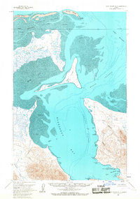
(4)- 1953 Map of Port Moller
 1953 Port Moller1953 Print · USGSThe Alaska Peninsula during the early fifties reveals a maritime landscape of canneries, volcanic peaks, and strategic naval reserves. Researchers can trace remote Cabins, the Nelson Lagoon Cannery, and historical Ruins along the shores of Beaver Bay.3 unique versions available
 - 1963 Map of Port Moller D-3, 1967 Print
 1963 Port Moller D-31967 Print · USGSThe remote Alaska Peninsula coastline comes into focus during the early sixties, showing the complex interaction of land and sea. Researchers can trace early geography through industrial and family landmarks like Mine Harbor, Lundgren Creek, and Coal Valley.2 unique versions available
 - 1988 Map of Port Moller, 1991 Print
 1988 Port Moller1991 Print · USGSThe remote reaches of the Alaska Peninsula and the Shumagin Islands are detailed here as they appeared in the late twentieth century. Researchers can trace the maritime hubs of Sand Point and Squaw Harbor or find isolated outposts like Nelson Lagoon Village and Miner.
 - 2020 Map of Port Moller D-3 SE, 2020 Print
 2020 Port Moller D-3 SE2020 Print · USGSThe coastal wilds of the Alaska Peninsula are captured here in the contemporary era, highlighting the transition from the rugged shoreline to inland peaks. Researchers can trace historical resource sites like Mine Harbor or find coastal landmarks such as Crow Point and Coal Bluff.
End of results
Showing maps 1-4 of 4
Frequently asked questions
- What are the different types of historical maps available for Herendeen Bay?
- What is the oldest map of Herendeen Bay?
- Where can I purchase historical maps of Herendeen Bay for my home or office?
- Where can I download high-res historical maps of Herendeen Bay?
- Are there historical topographic maps available for Herendeen Bay?
- Is there historical aerial imagery available for Herendeen Bay?
- Where are historical maps of Herendeen Bay sourced from?