Old Maps of Templewood Units, Anchorage for Hiking & Exploration
Hike through history with 10 historic maps of Templewood Units. Explore old trails, ghost towns, and forgotten backroads — perfect for outdoor adventurers and local explorers.
- Rediscover forgotten places: Map out old mining camps, roads, and footpaths that no longer exist on modern maps.
- Layer with modern tools: Combine with LiDAR or satellite views to plan hikes through historical terrain.
- Made for exploration: Popular among hikers, overlanders, and local history lovers.
Use these maps to find adventure and explore the hidden past of Templewood Units.
Templewood Units, Anchorage maps
(10)- 1951 Map of Anchorage
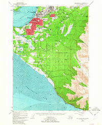
 1951 Anchorage1951 Print · USGSMid-century Anchorage and the Matanuska Valley are seen here during a period of rapid strategic growth. Trace the development of Fort Richardson, early rail stops at Wasilla, and established mining operations like the Independence Mine or Premier Mine.4 unique versions available
 - 1952 Map of Anchorage A-8, 1963 Print
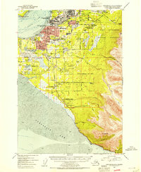
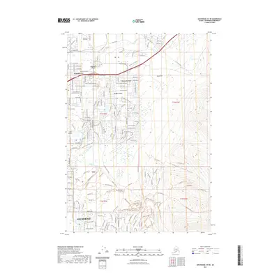
 1952 Anchorage A-81963 Print · USGSAnchorage and its surrounding military hubs are shown here during a period of rapid mid-century expansion. Trace the early footprints of Spenard and Mountain View, or locate landmarks like the International Airport and the Alaska Railroad.4 unique versions available
 - 1953 Map of Anchorage A-8, 1954 Print
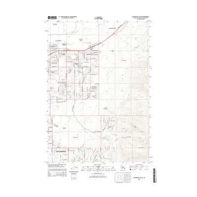
 1953 Anchorage A-81954 Print · USGSAnchorage during the early 1950s reveals a city rapidly expanding around its military bases and new aviation hubs. Researchers can trace the development of early neighborhoods like Spenard, the operations of the Alaska Railroad, and local landmarks like the Prison Farm.2 unique versions available
 - 1962 Map of Anchorage, 1966 Print
 1962 Anchorage1966 Print · USGSThe Anchorage bowl and Matanuska Valley appear in this mid-century survey during a period of significant military and industrial expansion. Researchers can trace the Alaska Railroad through Sutton and Jonesville or locate historic stops like Meekins Roadhouse and the Watertower Inn.6 unique versions available
 - 1979 Map of Anchorage, 1980 Print
 1979 Anchorage1980 Print · USGSThe Anchorage bowl and Matanuska Valley appear in the late seventies as the region's transportation and military infrastructure matured. Genealogists and historians can trace rail and road evolution through Wasilla, the Matanuska Branch line, and Jonesville.
 - 1979 Map of Anchorage A-8 NE, 1980 Print
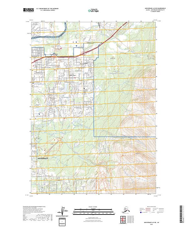
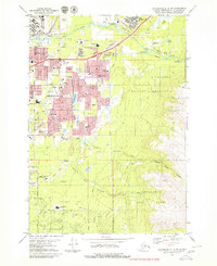 1979 Anchorage A-8 NE1980 Print · USGSAnchorage expands toward the mountains during the late seventies as residential districts and military bases consolidate. Researchers can trace the development of local neighborhoods and schools like Ursa Minor Sch or locate the Alaska Methodist Univ campus and Cheney Lake.3 unique versions available
 - 1994 Map of Anchorage A-8, 2002 Print
 1994 Anchorage A-82002 Print · USGSAnchorage during the mid-nineties shows a city defined by its military bases, university campuses, and bustling aviation hubs. Researchers can trace the development of suburban neighborhoods and major landmarks like the Diamond Center Shopping Mall, Wilson Village, and the Fort Richardson Cem.
 - 2015 Map of Anchorage A-8 NE, 2015 Print
 2015 Anchorage A-8 NE2015 Print · USGSCovers Templewood Units, including Anchorage, United States, and other nearby areas
 - 2021 Map of Anchorage A-8 NE, 2021 Print
 2021 Anchorage A-8 NE2021 Print · USGSCovers Templewood Units, including Anchorage, United States, and other nearby areas
 - 2023 Map of Anchorage A-8 NE, 2023 Print
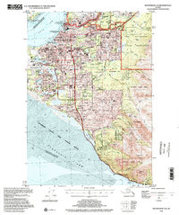
 2023 Anchorage A-8 NE2023 Print · USGSAnchorage's eastern edge meets the mountain foothills in this recent survey of its evolving neighborhoods and military lands. Trace the legacy of Campbell Airstrip, find Alaska Pacific University, and explore trails leading to Near Point or through Campbell Creek Canyon.
End of results
Showing maps 1-10 of 10
Frequently asked questions
- What are the different types of historical maps available for Templewood Units?
- What is the oldest map of Templewood Units?
- Where can I purchase historical maps of Templewood Units for my home or office?
- Where can I download high-res historical maps of Templewood Units?
- Are there historical topographic maps available for Templewood Units?
- Is there historical aerial imagery available for Templewood Units?
- Where are historical maps of Templewood Units sourced from?