Old Maps of Point MacKenzie, Alaska
Explore 11 old maps of Point MacKenzie, spanning from 1951 to today. These high-resolution historic maps reveal how streets, neighborhoods, landmarks, and natural features evolved over time — perfect for genealogy, metal detecting, research, and local history exploration.
What you can do with these maps:
- See how Point MacKenzie changed over time: Compare historical maps to modern-day views to trace roads, homesites, rail lines & more.
- View detailed metadata: Each map includes creators, publishers, year, scale, and archive source.
- Overlay maps with satellite & LiDAR: Visualize the past alongside modern tools to explore terrain & human change.
- Trusted historical sources: Maps sourced from the USGS, Library of Congress, and other archives.
- Access maps your way: View online, download high-res files, or order prints for personal or research use.
Start exploring old maps of Point MacKenzie to uncover forgotten places, hidden landmarks, and the deep history beneath your feet.
Point MacKenzie, AK maps
(11)- 1951 Map of Anchorage
 1951 Anchorage1951 Print · USGSMid-century Anchorage and the Matanuska Valley are seen here during a period of rapid strategic growth. Trace the development of Fort Richardson, early rail stops at Wasilla, and established mining operations like the Independence Mine or Premier Mine.4 unique versions available
 - 1952 Map of Anchorage B-8, 1965 Print
 1952 Anchorage B-81965 Print · USGSNorth of Anchorage in the early fifties, the landscape transitions from the historic Iditarod Trail at Knik to the rising military infrastructure of Elmendorf Air Force Base. Trace early transportation routes like the Alaska Railroad and Glenn Highway as they cross the Eagle River Flats.
 - 1953 Map of Anchorage B-8, 1954 Print
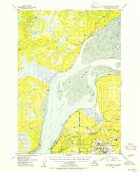 1953 Anchorage B-81954 Print · USGSThe Knik Arm and upper Cook Inlet region show a mix of historic dog-team routes and Cold War military growth in the early fifties. You can trace the Iditarod Trail near Knik or locate early landmarks like Sandpiper Lodge and the Kermit Roosevelt Memorial Cem.2 unique versions available
 - 1962 Map of Anchorage, 1966 Print
 1962 Anchorage1966 Print · USGSThe Anchorage bowl and Matanuska Valley appear in this mid-century survey during a period of significant military and industrial expansion. Researchers can trace the Alaska Railroad through Sutton and Jonesville or locate historic stops like Meekins Roadhouse and the Watertower Inn.6 unique versions available
 - 1965 Map of Anchorage B-8
 1965 Anchorage B-81965 Print · USGSThe northern reaches of Cook Inlet are shown in the mid-twentieth century as military installations and rail lines expanded across the glacial moraine. Modern researchers can trace the historic Iditarod Trail, the settlement of Knik, and the early infrastructure of Elmendorf Air Force Base.
 - 1979 Map of Anchorage, 1980 Print
 1979 Anchorage1980 Print · USGSThe Anchorage bowl and Matanuska Valley appear in the late seventies as the region's transportation and military infrastructure matured. Genealogists and historians can trace rail and road evolution through Wasilla, the Matanuska Branch line, and Jonesville.
 - 1979 Map of Anchorage B-8 SW, 1980 Print
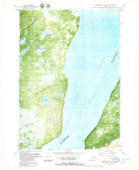 1979 Anchorage B-8 SW1980 Print · USGSThe northern reaches of the Anchorage area and the Knik Arm are captured in the late seventies as military and recreational sites expanded. Local historians can trace the development of Elmendorf Air Force Base, the Hillberg Ski Area, and the settlement at Tuomi.2 unique versions available
 - 1994 Map of Anchorage B-8, 2002 Print
 1994 Anchorage B-82002 Print · USGSThe Matanuska-Susitna region and the northern reaches of Anchorage meet here in the 1990s, where the historic Iditarod path intersects with modern military airfields. Researchers can trace the National Historic Trail (Iditarod) near Knik or locate the Ursa Major Sch within Elmendorf Air Force Base.
 - 2015 Map of Anchorage B-8 SW, 2015 Print
 2015 Anchorage B-8 SW2015 Print · USGSCovers Point MacKenzie, including Tuomi, Matanuska-Susitna, and other nearby areas
 - 2021 Map of Anchorage B-8 SW, 2021 Print
 2021 Anchorage B-8 SW2021 Print · USGSCovers Point MacKenzie, including Tuomi, Matanuska-Susitna, and other nearby areas
 - 2023 Map of Anchorage B-8 SW, 2023 Print
 2023 Anchorage B-8 SW2023 Print · USGSThe Knik Arm coastline comes into focus in this contemporary survey of the Point MacKenzie area. Researchers can trace the military boundaries of Joint Base Elmendorf-Richardson or locate local landmarks like MacKenzie Country Airpark and Cairn Point.
End of results
Showing maps 1-11 of 11
Top cities near Point MacKenzie
Frequently asked questions
- What are the different types of historical maps available for Point MacKenzie?
- What is the oldest map of Point MacKenzie?
- Where can I purchase historical maps of Point MacKenzie for my home or office?
- Where can I download high-res historical maps of Point MacKenzie?
- Are there historical topographic maps available for Point MacKenzie?
- Is there historical aerial imagery available for Point MacKenzie?
- Where are historical maps of Point MacKenzie sourced from?