Old Maps of Big Lake, Alaska
Explore 9 old maps of Big Lake, spanning from 1950 to today. These high-resolution historic maps reveal how streets, neighborhoods, landmarks, and natural features evolved over time — perfect for genealogy, metal detecting, research, and local history exploration.
What you can do with these maps:
- See how Big Lake changed over time: Compare historical maps to modern-day views to trace roads, homesites, rail lines & more.
- View detailed metadata: Each map includes creators, publishers, year, scale, and archive source.
- Overlay maps with satellite & LiDAR: Visualize the past alongside modern tools to explore terrain & human change.
- Trusted historical sources: Maps sourced from the USGS, Library of Congress, and other archives.
- Access maps your way: View online, download high-res files, or order prints for personal or research use.
Start exploring old maps of Big Lake to uncover forgotten places, hidden landmarks, and the deep history beneath your feet.
Big Lake, AK maps
(9)- 1950 Map of Anchorage C-8, 1958 Print
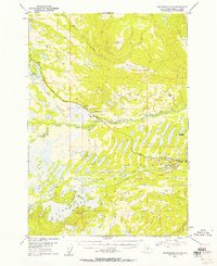 1950 Anchorage C-81958 Print · USGSThe Matanuska-Susitna valley comes alive in the early statehood era as a hub of rail-side industry and wilderness settlement. Genealogists and historians can trace early residents near Houston and Pittman, or locate industrial landmarks like the Coal Mine and Alaska Railroad.3 unique versions available
 - 1951 Map of Anchorage
 1951 Anchorage1951 Print · USGSMid-century Anchorage and the Matanuska Valley are seen here during a period of rapid strategic growth. Trace the development of Fort Richardson, early rail stops at Wasilla, and established mining operations like the Independence Mine or Premier Mine.4 unique versions available
 - 1952 Map of Anchorage C-8
 1952 Anchorage C-81952 Print · USGSThe Matanuska-Susitna region's rail and mining corridor comes alive in the early fifties as the postwar economy expands. Researchers can trace the industrial footprint of the Coal Mine at Houston and the vast lake systems of Big Lake and Nancy Lake.2 unique versions available
 - 1962 Map of Anchorage, 1966 Print
 1962 Anchorage1966 Print · USGSThe Anchorage bowl and Matanuska Valley appear in this mid-century survey during a period of significant military and industrial expansion. Researchers can trace the Alaska Railroad through Sutton and Jonesville or locate historic stops like Meekins Roadhouse and the Watertower Inn.6 unique versions available
 - 1979 Map of Anchorage, 1980 Print
 1979 Anchorage1980 Print · USGSThe Anchorage bowl and Matanuska Valley appear in the late seventies as the region's transportation and military infrastructure matured. Genealogists and historians can trace rail and road evolution through Wasilla, the Matanuska Branch line, and Jonesville.
 - 1979 Map of Anchorage C-8 SW, 1980 Print
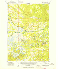
 1979 Anchorage C-8 SW1980 Print · USGSBig Lake and the Houston boundary appear here during the late seventies as the region's recreational and transport hubs were taking shape. Researchers can trace the path of The Alaska RR and locate early aviation landmarks like the Big Lake No 2 Airport and several lakeside campgrounds.5 unique versions available
 - 1994 Map of Anchorage C-8, 2002 Print
 1994 Anchorage C-82002 Print · USGSThe Matanuska-Susitna valley comes into focus during the mid-nineties, showing the critical transport links between Houston and Pittman. Researchers can trace the development of lakeside communities and recreation sites like Big Lake and the Nancy Lake State Recreation Area.
 - 2016 Map of Anchorage C-8 SW, 2016 Print
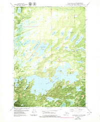
 2016 Anchorage C-8 SW2016 Print · USGSCovers Big Lake, including Houston, Matanuska-Susitna, and other nearby areas
 - 2023 Map of Anchorage C-8 SW, 2023 Print
 2023 Anchorage C-8 SW2023 Print · USGSThe Matanuska-Susitna Borough comes alive in this contemporary survey of its lake-strewn wilderness and aviation outposts. Genealogists and historians can trace residential growth around Big Lake or locate local airstrips like Kucera Residence Airport and Big Lake Airport.
End of results
Showing maps 1-9 of 9
Top cities near Big Lake
Frequently asked questions
- What are the different types of historical maps available for Big Lake?
- What is the oldest map of Big Lake?
- Where can I purchase historical maps of Big Lake for my home or office?
- Where can I download high-res historical maps of Big Lake?
- Are there historical topographic maps available for Big Lake?
- Is there historical aerial imagery available for Big Lake?
- Where are historical maps of Big Lake sourced from?