1990s Maps of Arizona Sky Village, Cochise County
Explore 3 historic maps of Arizona Sky Village from the 1990s. These maps offer a rare glimpse into what life looked like during the 1990s — showing old roads, neighborhoods, homes, and landmarks that have changed or disappeared over time.
Whether you're researching your family's past, planning a metal detecting trip, or studying how Arizona Sky Village's landscape evolved across the 1990s, these high-resolution maps are a powerful tool for exploring the history of this region.
- Focus on a specific era: All maps on this page are from the 1990s, giving you a focused view of this time period.
- See what’s changed: Compare century-old streets, trails, and buildings to today's modern landscape using overlays and satellite layers.
- Research with precision: Use these maps for genealogy, historical research, land use analysis, or educational projects.
- View, download, or print: Maps are fully viewable online in high resolution, and can be downloaded or printed for your own records.
Start exploring Arizona Sky Village's history through authentic maps from the 1990s. This is your window into the past.
Arizona Sky Village, Cochise County maps
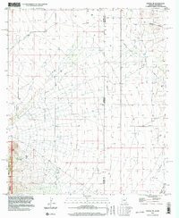
(3)- 1994 Map of Chiricahua Peak
 1994 Chiricahua Peak1994 Print · USGSSoutheast Arizona in the mid-nineties shows a land of high sky islands and broad cattle valleys transitioning into New Mexico. Trace the legacy of old mining camps and railroad stops from Pearce and Gleeson to the canyons of the Chiricahua Mountains.2 unique versions available
 - 1996 Map of Portal NE, 2003 Print
 1996 Portal NE2003 Print · USGSThe Arizona and New Mexico borderlands come into focus in the mid-1990s, showcasing the high-desert transition from the Peloncillo Mountains to the valley. Researchers can locate the Landing Strip near the state line or trace the old Mine Shaft and GLO Station 5 survey markers.
 - 1998 Map of Portal, 2003 Print
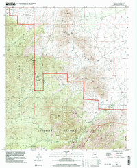 1998 Portal2003 Print · USGSThe eastern Chiricahua Mountains are captured here in the late twentieth century, showing a landscape defined by old mining sites and national forest conservation. Genealogists and researchers can locate the Galeyville townsite, the mountain community of Paradise, and the isolated Cem in Graveyard Canyon.
End of results
Showing maps 1-3 of 3
Frequently asked questions
- What are the different types of historical maps available for Arizona Sky Village?
- What is the oldest map of Arizona Sky Village?
- Where can I purchase historical maps of Arizona Sky Village for my home or office?
- Where can I download high-res historical maps of Arizona Sky Village?
- Are there historical topographic maps available for Arizona Sky Village?
- Is there historical aerial imagery available for Arizona Sky Village?
- Where are historical maps of Arizona Sky Village sourced from?