1900s (20th Century) Maps of Marble Canyon, Arizona
Explore 7 historic maps of Marble Canyon from the 1900s (20th Century). These maps offer a rare glimpse into what life looked like during the 1900s — showing old roads, neighborhoods, homes, and landmarks that have changed or disappeared over time.
Whether you're researching your family's past, planning a metal detecting trip, or studying how Marble Canyon's landscape evolved across the 1900s, these high-resolution maps are a powerful tool for exploring the history of this region.
- Focus on a specific era: All maps on this page are from the 1900s, giving you a focused view of this time period.
- See what’s changed: Compare century-old streets, trails, and buildings to today's modern landscape using overlays and satellite layers.
- Research with precision: Use these maps for genealogy, historical research, land use analysis, or educational projects.
- View, download, or print: Maps are fully viewable online in high resolution, and can be downloaded or printed for your own records.
Start exploring Marble Canyon's history through authentic maps from the 1900s. This is your window into the past.
Marble Canyon, AZ maps
(7)- 1954 Map of Lees Ferry SW, 1955 Print
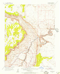
 1954 Lees Ferry SW1955 Print · USGSNorthern Arizona's river-cut plateaus are revealed in the mid-1950s just as canyon travel was modernizing. Trace the early tourism infrastructure at Marble Canyon Lodge and find the remote Airstrip near the Navajo Indian Reservation.
 - 1954 Map of Lees Ferry, 1956 Print
 1954 Lees Ferry1956 Print · USGSThe Colorado River corridor near the Utah state line is captured here in the mid-fifties, showing the vital crossing at the Lees Ferry site. Researchers can trace early roads and river access points like the Landing Strip, Ferry Swale, and Vermilion Cliffs Lodge.4 unique versions available
 - 1956 Map of Marble Canyon, 1964 Print
 1956 Marble Canyon1964 Print · USGSNorthern Arizona and the borderlands of Utah are mapped here in the mid-fifties, showing a landscape defined by traditional trading posts and early uranium mining. Trace old routes between Tuba City and Kayenta, and locate historic sites like Lees Ferry and Inscription House Trading Post.4 unique versions available
 - 1959 Map of Marble Canyon
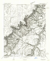
 1959 Marble Canyon1959 Print · USGSNorthern Arizona in the late fifties is a vast landscape of tribal lands and desert plateaus defined by the carving of the Colorado River. Trace family roots and regional history at Tuba City, the Chilchinbito Trading Post, or the ancient Inscription House Ruin.
 - 1961 Map of Marble Canyon
 1961 Marble Canyon1961 Print · USGSThe northern Arizona desert in the early sixties reveals a landscape of tribal lands and canyon crossings. Trace the old river life at Lees Ferry, find the Uranium mill at Tuba City, and locate the iconic Elephant Feet landmarks.
 - 1984 Map of Glen Canyon Dam
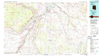 1984 Glen Canyon Dam1984 Print · USGSThe Colorado River corridor near the Utah border is captured here in the mid-eighties, centered on the rise of modern infrastructure in the desert. Researchers can trace the development of Page alongside historic sites like Lees Ferry and the Copper Mine Trading Post.2 unique versions available
 - 1985 Map of Navajo Bridge
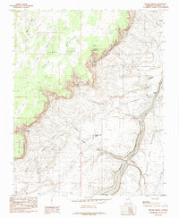 1985 Navajo Bridge1985 Print · USGSCoconino County in the mid-eighties shows the sheer verticality of the river corridor where the Navajo Indian Reservation meets the Vermilion Cliffs. You can trace the crossing at Navajo Bridge, locate the Vermilion Cliffs Lodge, and find remote water sources like Dutchman Spring.2 unique versions available
End of results
Showing maps 1-7 of 7
Top cities near Marble Canyon
Frequently asked questions
- What are the different types of historical maps available for Marble Canyon?
- What is the oldest map of Marble Canyon?
- Where can I purchase historical maps of Marble Canyon for my home or office?
- Where can I download high-res historical maps of Marble Canyon?
- Are there historical topographic maps available for Marble Canyon?
- Is there historical aerial imagery available for Marble Canyon?
- Where are historical maps of Marble Canyon sourced from?