1960s Maps of Parque Vista Estates, Phoenix
Explore 3 historic maps of Parque Vista Estates from the 1960s. These maps offer a rare glimpse into what life looked like during the 1960s — showing old roads, neighborhoods, homes, and landmarks that have changed or disappeared over time.
Whether you're researching your family's past, planning a metal detecting trip, or studying how Parque Vista Estates's landscape evolved across the 1960s, these high-resolution maps are a powerful tool for exploring the history of this region.
- Focus on a specific era: All maps on this page are from the 1960s, giving you a focused view of this time period.
- See what’s changed: Compare century-old streets, trails, and buildings to today's modern landscape using overlays and satellite layers.
- Research with precision: Use these maps for genealogy, historical research, land use analysis, or educational projects.
- View, download, or print: Maps are fully viewable online in high resolution, and can be downloaded or printed for your own records.
Start exploring Parque Vista Estates's history through authentic maps from the 1960s. This is your window into the past.
Parque Vista Estates, Phoenix maps
(3)- 1960 Map of Phoenix
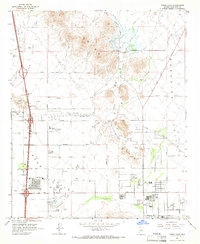
 1960 Phoenix1960 Print · USGSCentral Arizona in the mid-fifties reveals a landscape of rapid suburban growth alongside enduring desert mining and ranching. Genealogists and historians can trace rail-side settlements like Vicksburg Junction and Waddell, or locate the Vulture Mine and early sites like Agua Fria School.
 - 1964 Map of Union Hills, 1966 Print
 1964 Union Hills1966 Print · USGSMid-century development is reshaping the Arizona desert in the 1960s as suburban reaches extend toward the peaks. Researchers can trace early residential tracts like Village Meadows and industrial markers including the Union Mine and Deer Valley Airport.4 unique versions available
 - 1969 Map of Phoenix, 1970 Print
 1969 Phoenix1970 Print · USGSCentral Arizona is seen at a technological turning point in the late sixties, using Apollo 9 space photography to map the desert landscape. Researchers can trace the growth of Sun City, locate old workings at Vulture Mine, and follow the Gila River past Buckeye.2 unique versions available
End of results
Showing maps 1-3 of 3
Frequently asked questions
- What are the different types of historical maps available for Parque Vista Estates?
- What is the oldest map of Parque Vista Estates?
- Where can I purchase historical maps of Parque Vista Estates for my home or office?
- Where can I download high-res historical maps of Parque Vista Estates?
- Are there historical topographic maps available for Parque Vista Estates?
- Is there historical aerial imagery available for Parque Vista Estates?
- Where are historical maps of Parque Vista Estates sourced from?