Old Maps of Spur Cross, Queen Creek for Genealogy
Trace your family roots with 15 historic maps of Spur Cross. These high-res maps reveal old neighborhoods, homesites, landmarks, and streets — helping you uncover where your ancestors lived and how the area evolved over time.
- Explore historic neighborhoods: Identify where your relatives may have lived in the 1800s or 1900s.
- Compare maps over time: Trace the changes in streets, buildings, and landmarks for multi-generational research.
- Perfect for genealogy & ancestry research: Used by family historians and researchers to map out lineage and migration.
These maps are an incredible resource for exploring your personal connection to Spur Cross's past.
Spur Cross, Queen Creek maps
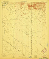
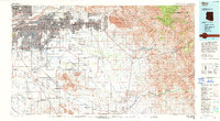
(15)- 1904 Map of Desert Well, 1958 Print
 1904 Desert Well1958 Print · USGSCovers Spur Cross, including Mesa, Gilbert, and other nearby areas
 - 1906 Map of Desert Well
 1906 Desert Well1906 Print · USGSCovers Spur Cross, including Mesa, Gilbert, and other nearby areas3 unique versions available
 - 1907 Map of Sacaton
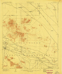 1907 Sacaton1907 Print · USGSCovers Spur Cross, including Gilbert, San Tan Valley, and other nearby areas4 unique versions available
 - 1954 Map of Mesa, 1968 Print
 1954 Mesa1968 Print · USGSCovers Spur Cross, including Phoenix, Mesa, and other nearby areas4 unique versions available
 - 1956 Map of Sacaton NE, 1959 Print
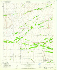
 1956 Sacaton NE1959 Print · USGSCovers Spur Cross, including San Tan Valley, Queen Creek, and other nearby areas4 unique versions available
 - 1956 Map of Desert Well, 1959 Print
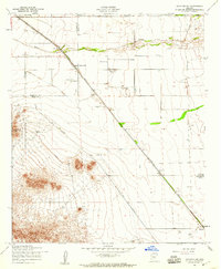
 1956 Desert Well1959 Print · USGSCovers Spur Cross, including Mesa, Queen Creek, and other nearby areas4 unique versions available
 - 1957 Map of Mesa
 1957 Mesa1957 Print · USGSCovers Spur Cross, including Phoenix, Mesa, and other nearby areas
 - 1958 Map of Mesa
 1958 Mesa1958 Print · USGSCovers Spur Cross, including Phoenix, Mesa, and other nearby areas
 - 1960 Map of Mesa
 1960 Mesa1960 Print · USGSCovers Spur Cross, including Phoenix, Mesa, and other nearby areas
 - 1964 Map of Mesa
 1964 Mesa1964 Print · USGSCovers Spur Cross, including Phoenix, Mesa, and other nearby areas
 - 1971 Map of Sacaton NE, 1972 Print
 1971 Sacaton NE1972 Print · USGSCovers Spur Cross, including San Tan Valley, Queen Creek, and other nearby areas
 - 1971 Map of Desert Well, 1972 Print
 1971 Desert Well1972 Print · USGSCovers Spur Cross, including Mesa, Queen Creek, and other nearby areas
 - 1994 Map of Mesa
 1994 Mesa1994 Print · USGSCovers Spur Cross, including Phoenix, Mesa, and other nearby areas2 unique versions available
 - 2021 Map of Desert Well, 2021 Print
 2021 Desert Well2021 Print · USGSCovers Spur Cross, including Mesa, Queen Creek, and other nearby areas
 - 2021 Map of Sacaton NE, 2021 Print
 2021 Sacaton NE2021 Print · USGSCovers Spur Cross, including San Tan Valley, Queen Creek, and other nearby areas
End of results
Showing maps 1-15 of 15
Frequently asked questions
- What are the different types of historical maps available for Spur Cross?
- What is the oldest map of Spur Cross?
- Where can I purchase historical maps of Spur Cross for my home or office?
- Where can I download high-res historical maps of Spur Cross?
- Are there historical topographic maps available for Spur Cross?
- Is there historical aerial imagery available for Spur Cross?
- Where are historical maps of Spur Cross sourced from?