1970s Maps of Surprise, Arizona
Explore 5 historic maps of Surprise from the 1970s. These maps offer a rare glimpse into what life looked like during the 1970s — showing old roads, neighborhoods, homes, and landmarks that have changed or disappeared over time.
Whether you're researching your family's past, planning a metal detecting trip, or studying how Surprise's landscape evolved across the 1970s, these high-resolution maps are a powerful tool for exploring the history of this region.
- Focus on a specific era: All maps on this page are from the 1970s, giving you a focused view of this time period.
- See what’s changed: Compare century-old streets, trails, and buildings to today's modern landscape using overlays and satellite layers.
- Research with precision: Use these maps for genealogy, historical research, land use analysis, or educational projects.
- View, download, or print: Maps are fully viewable online in high resolution, and can be downloaded or printed for your own records.
Start exploring Surprise's history through authentic maps from the 1970s. This is your window into the past.
Surprise, AZ maps
(5)- 1971 Map of Phoenix
 1971 Phoenix1971 Print · USGSCentral Arizona at the start of the seventies shows a desert metropolis expanding toward the Sun Valley retirement boom. Trace the growth of Sun City and Glendale, or locate remote historic sites like the Vulture Gold Mine and Nottbusch Cemetery.
 - 1971 Map of El Mirage
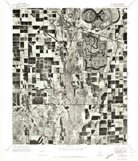 1971 El Mirage1971 Print · USGSMaricopa County underwent a dramatic transformation in the early seventies as planned retirement communities rose from the desert. Trace the early layouts of Sun City and Youngtown alongside the active flight lines of Luke Air Force Base.
 - 1971 Map of Calderwood Butte, 1972 Print
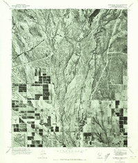 1971 Calderwood Butte1972 Print · USGSMaricopa County underwent a dramatic transformation in the early seventies as desert land transitioned into planned communities. Trace the early boundaries of Surprise and Sun City alongside the natural course of the Agua Fria River.
 - 1971 Map of McMicken Dam, 1972 Print
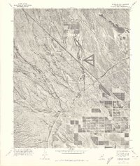 1971 McMicken Dam1972 Print · USGSMaricopa County agriculture and desert water management are captured in this early 1970s aerial survey. Trace the intersection of the Beardsley Canal with the Mc Micken Dam and the emerging street grids near Beardsley.
 - 1971 Map of Waddell, 1972 Print
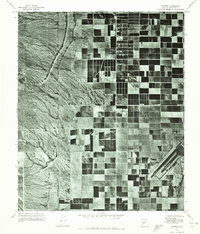 1971 Waddell1972 Print · USGSMaricopa County agriculture and military operations are captured in the early seventies, showing a landscape defined by desert irrigation. Trace the growth of Waddell and Citrus Park alongside the runways of Luke Air Force Base.
End of results
Showing maps 1-5 of 5
Top cities near Surprise
- Phoenix historical maps
- Glendale historical maps
- Peoria historical maps
- Buckeye historical maps
- Avondale historical maps
- Goodyear historical maps
See more
Top neighborhoods of Surprise
- the Grand historical maps
- Taos historical maps
- Asante historical maps
- Sun Village historical maps
- Surprise Original Townsite historical maps
- Hacienda historical maps
See more
Frequently asked questions
- What are the different types of historical maps available for Surprise?
- What is the oldest map of Surprise?
- Where can I purchase historical maps of Surprise for my home or office?
- Where can I download high-res historical maps of Surprise?
- Are there historical topographic maps available for Surprise?
- Is there historical aerial imagery available for Surprise?
- Where are historical maps of Surprise sourced from?