Old Maps of Colorado City, Arizona
Explore 45 old maps of Colorado City, spanning from 1885 to today. These high-resolution historic maps reveal how streets, neighborhoods, landmarks, and natural features evolved over time — perfect for genealogy, metal detecting, research, and local history exploration.
What you can do with these maps:
- See how Colorado City changed over time: Compare historical maps to modern-day views to trace roads, homesites, rail lines & more.
- View detailed metadata: Each map includes creators, publishers, year, scale, and archive source.
- Overlay maps with satellite & LiDAR: Visualize the past alongside modern tools to explore terrain & human change.
- Trusted historical sources: Maps sourced from the USGS, Library of Congress, and other archives.
- Access maps your way: View online, download high-res files, or order prints for personal or research use.
Start exploring old maps of Colorado City to uncover forgotten places, hidden landmarks, and the deep history beneath your feet.
Colorado City, AZ maps
(45)- 1885 Map of St. George
 1885 St. George1885 Print · USGSSouthern Utah’s high deserts and river valleys are captured here during the mid-1880s, an era of mining expansion and early settlement. Researchers can trace the layout of pioneer towns like Silver Reef, Virgin City, and the historic site of Mountain Meadows.
 - 1886 Map of Kanab
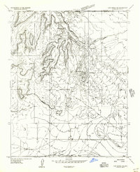
 1886 Kanab1886 Print · USGSSouthern Utah in the late nineteenth century remains a frontier of deep canyons and high plateaus. Researchers can trace early pioneer outposts and river settlements like Orderville, Mt. Carmel, and Kanab tucked beneath the Vermilion Cliffs.5 unique versions available
 - 1886 Map of Mt. Trumbull
 1886 Mt. Trumbull1886 Print · USGSMohave County in the late nineteenth century was a territory of extreme verticality and scarce water. Historians can trace early routes through the Arizona Strip via vital water stops like Pierce Ferry, Witches Pool, and Pakoon Spring.
 - 1886 Map of Kaibab, 1900 Print
 1886 Kaibab1900 Print · USGSThe northern Arizona frontier is captured in the late 1880s as early surveyors mapped the deep canyonlands and plateau systems. Researchers can locate critical water sources like Pipe Spring and early landmarks including Shivas Temple and Point Sublime.9 unique versions available
 - 1891 Map of St. George
 1891 St. George1891 Print · USGSSouthwestern Utah in the early 1890s was a landscape of pioneer outposts and mining ventures at the edge of the Escalante Desert. Genealogists and historians can trace the early footprints of St George, the mining camp at Silver Reef, and the now-quiet site of Iron City.4 unique versions available
 - 1892 Map of Mt. Trumbull
 1892 Mt. Trumbull1892 Print · USGSNorthwestern Arizona in the late nineteenth century was a frontier of isolated springs and massive plateaus. You can trace early routes across the Colorado River at Pierce Ferry and locate vital water at Pakoon Spring or Witch Pool.6 unique versions available
 - 1953 Map of Cedar City, 1966 Print
 1953 Cedar City1966 Print · USGSSouthwestern Utah's high plateaus and desert basins are mapped here during the mid-fifties, showing the region before the modern interstate system. Researchers can trace historic mining at Silver Reef, follow the Union Pacific line, and locate early settlements like Kanarraville and Toquerville.3 unique versions available
 - 1953 Map of Grand Canyon, 1967 Print
 1953 Grand Canyon1967 Print · USGSArizona's northern frontier is captured here in the mid-twentieth century, from the high plateaus to the desert basins. Trace early routes like Arizona 67, explore the isolated Moccasin settlement, or locate early landmarks such as Mount Trumbull.3 unique versions available
 - 1954 Map of La Verkin 4 SE
 1954 La Verkin 4 SE1954 Print · USGSThe high desert plateaus of the Utah-Arizona border are captured here in the mid-1950s. Researchers can trace the layout of the Canaan Ranch, locate water sources like Canaan Wash, and identify landmarks from Smithsonian Butte to Canaan Gap.2 unique versions available
 - 1954 Map of Short Creek NW, 1956 Print
 1954 Short Creek NW1956 Print · USGSThe Arizona Strip during the mid-1950s reveals a landscape of isolated ranching outposts and dramatic geological formations. Genealogists and local historians can locate early structures in Short Creek and Cane Beds, or trace water sources like Formaster Tank.
 - 1954 Map of Lost Spring Mtn, 1958 Print
 1954 Lost Spring Mtn1958 Print · USGSThe Arizona Strip and the Utah borderlands are shown here in the mid-fifties, during a time of active ranching and water prospecting. Trace the locations of family-named sites like Burts Well, the Harolds Reservoir, and the remote settlement of Lydel.2 unique versions available
 - 1954 Map of Short Creek, 1959 Print
 1954 Short Creek1959 Print · USGSArizona’s high desert borderlands are mapped here in the mid-1950s, showing the early layouts of remote Mormon and tribal settlements. Genealogists and historians can locate early family-named sites like Esplins Corral, Moccasin, and the Cemetery at Short Creek.2 unique versions available
 - 1956 Map of Lost Spring NE
 1956 Lost Spring NE1956 Print · USGSThe Arizona-Utah borderlands in the mid-fifties reveal a landscape shaped by remote water sources and high desert geography. Researchers can trace the drainage of Short Creek and locate isolated landmarks like Wells Spring and Point Rock.
 - 1956 Map of Springdale SW
 1956 Springdale SW1956 Print · USGSHigh plateau country along the Utah-Arizona border is captured in the mid-fifties during this preliminary survey. Researchers can trace the drainage of Short Creek and locate remote landmarks like Goat Springs and Maxwell Canyon.
 - 1957 Map of Grand Canyon
 1957 Grand Canyon1957 Print · USGSNorthern Arizona in the mid-fifties presents a sparsely settled expanse of high plateaus and ranching outposts surrounding the great canyon. Genealogists and historians can trace family land at Diamond Butte Ranch, locate the Moccasin settlement, or study the magnesium works at Black Diamond Mine.
 - 1958 Map of Grand Canyon
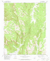
 1958 Grand Canyon1958 Print · USGSNorthern Arizona in the late fifties was a landscape of remote cattle ranches and timber operations spanning from the Virgin Mountains to the Kaibab Forest. Researchers can locate family outposts like Bundy Ranch, trace the Temple Trail, or find the Parashant Lumber Mill.
 - 1958 Map of Cedar City
 1958 Cedar City1958 Print · USGSSouthwestern Utah in the late fifties was a land of mineral extraction and monumental landscapes. Genealogists and historians can trace pioneer-era settlements like Grafton and Parowan alongside industrial sites such as the Silver Reef Mine.2 unique versions available
 - 1960 Map of Grand Canyon
 1960 Grand Canyon1960 Print · USGSThe Arizona strip and the Colorado River corridor appear in the 1950s as a vast network of isolated plateaus and remote outposts. Researchers can trace historic ranching and tribal lands including Supai, the Kaibab Indian Reservation, and the Mt Trumbull Post Office.
 - 1962 Map of Cedar City
 1962 Cedar City1962 Print · USGSSouthern Utah in the early sixties showcases a landscape of dramatic plateaus and historic mining outposts. Trace the early settlement patterns at the Silver Reef (ruins), locate the Iron Mine near the Hurricane Cliffs, or find the Fort Harmony Monument.
 - 1980 Map of Hildale
 1980 Hildale1980 Print · USGSThe borderlands of Utah and Arizona are captured here in the late seventies, showing the development of Hildale against the Vermilion Cliffs. Follow old routes like the Pack Trail to find backcountry water sources like Cappies Rock Spring and Goat Springs.2 unique versions available
 - 1980 Map of St. George, 1981 Print
 1980 St. George1981 Print · USGSThe St. George region underwent significant expansion in the early eighties as ranching traditions met new modern development. Researchers can trace the heritage of the Virgin River valley through sites like Grafton, the Apex Mine, and Snow Canyon State Park.2 unique versions available
 - 1980 Map of Kanab, 1981 Print
 1980 Kanab1981 Print · USGSSouthern Utah in the late seventies is a landscape of massive geologic terraces and isolated ranching towns. Trace the growth of Kanab and Springdale or locate vanished sites like Shunesburg among the White Cliffs and Vermilion Cliffs.
 - 1980 Map of Smithsonian Butte, 1981 Print
 1980 Smithsonian Butte1981 Print · USGSThe high desert borderlands of Washington County and Mohave County are captured here in the early eighties. Researchers can locate remote landmarks like Canaan Ranch and Big Plain Junction or trace water sources like Sawmill Spring.2 unique versions available
 - 1984 Map of Fredonia
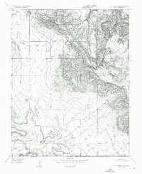
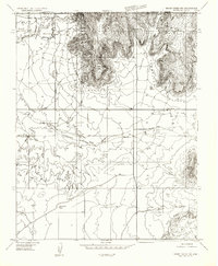
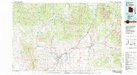
 1984 Fredonia1984 Print · USGSThe Arizona Strip in the mid-1980s reveals a sparse network of settlements and vast public lands. Genealogists and historians can trace the foundations of Fredonia and Colorado City or locate landmarks like Pipe Spring National Monument.2 unique versions available
 - 1987 Map of Littlefield, 1988 Print
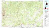
 1987 Littlefield1988 Print · USGSNorthwestern Arizona’s high desert comes into focus in the late eighties, showing the remote ranching and mining country along the Utah border. Researchers can trace the path of the Virgin River and locate vital water sites like Wolf Hole Lake, Mormon Well, and the Hidden Mines.2 unique versions available
Showing maps 1-25 of 45
Top cities near Colorado City
- Centennial Park historical maps
- Hildale historical maps
- Apple Valley historical maps
- Virgin historical maps
- Springdale historical maps
- Cane Beds historical maps
See more
Frequently asked questions
- What are the different types of historical maps available for Colorado City?
- What is the oldest map of Colorado City?
- Where can I purchase historical maps of Colorado City for my home or office?
- Where can I download high-res historical maps of Colorado City?
- Are there historical topographic maps available for Colorado City?
- Is there historical aerial imagery available for Colorado City?
- Where are historical maps of Colorado City sourced from?