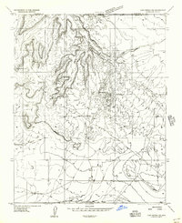
1956 Map of Lost Spring NE
USGS Topo · Published 1956About this map
The borderlands of the Utah-Arizona state line define this 1956 survey, where the high desert terrain transitions between Washington and Mohave counties. The landscape is dominated by complex drainage systems and isolated water sources crucial for local survival and ranching in the mid-century era. Key water features include the Wells Spring and the seasonally significant Lakes of Short Creek, while the broader terrain is marked by prominent geological formations such as the Point Rock and the sharp drop-offs of the Ledge.
Find a feature on this map
10 named features on this map. Tap any name to fly to it.
Don’t see what you’re looking for? This feature index may not catch every label — zoom into the map to look around manually.
Map Details
Editions of this 1956 Lost Spring NE Map
This is the sole edition of this map. No revisions or reprints were ever made.
Other maps of this area

1885 · St. George
USGS Topo · 1:250,000

1886 · Kanab
USGS Topo · 1:250,000

1886 · Mt. Trumbull
USGS Topo · 1:250,000

1886 · Kaibab
USGS Topo · 1:250,000

1891 · St. George
USGS Topo · 1:250,000

1892 · Mt. Trumbull
USGS Topo · 1:250,000

1953 · Cedar City
USGS Topo · 1:250,000

1953 · Grand Canyon
USGS Topo · 1:250,000

1954 · La Verkin 4 SE
USGS Topo · 1:24,000

1954 · La Verkin 4 SW
USGS Topo · 1:24,000