Old Maps of Topock, Arizona for Hiking & Exploration
Hike through history with 14 historic maps of Topock. Explore old trails, ghost towns, and forgotten backroads — perfect for outdoor adventurers and local explorers.
- Rediscover forgotten places: Map out old mining camps, roads, and footpaths that no longer exist on modern maps.
- Layer with modern tools: Combine with LiDAR or satellite views to plan hikes through historical terrain.
- Made for exploration: Popular among hikers, overlanders, and local history lovers.
Use these maps to find adventure and explore the hidden past of Topock.
Topock, AZ maps
(14)- 1903 Map of Needles, 1960 Print
 1903 Needles1960 Print · USGSThe Colorado River borderlands in the early 1900s centered on the critical rail crossing at Needles. Genealogists and historians can trace early railroad sidings like Khatoum and Beal or the old Parker Road through the Chemehuevi Valley.
 - 1904 Map of Needles Special
 1904 Needles Special1904 Print · USGSThe Lower Colorado River region at the start of the twentieth century was a vital corridor for western rail expansion and river navigation. Genealogists and historians can trace the rail sidings of the Atchison Topeka and Santa Fe RR and early settlements like Mellen, Franconia, and Needles.7 unique versions available
 - 1943 Map of Topock
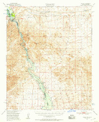
 1943 Topock1943 Print · USGSThe Arizona-California borderlands are captured here during World War II, just as the landscape was being reshaped by the waters of the Colorado. Researchers can trace the original rail line through Topock and locate desert sidings like Franconia and Powell along the Sacramento Wash.
 - 1950 Map of Topock, 1957 Print
 1950 Topock1957 Print · USGSThe Colorado River borderlands in the early postwar era show a desert landscape being reshaped by infrastructure and conservation. Genealogists and historians can trace the rail corridor through Franconia and locate remote mining sites like the Gold Dome Mine or the Jackpot Mine.3 unique versions available
 - 1951 Map of Topock
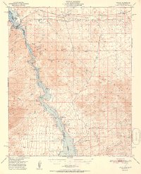 1951 Topock1951 Print · USGSThe Colorado River valley and Mohave Mountains are captured here in the early fifties, showing a landscape defined by desert mining and river life. Trace the path of the National Old Trails Road and locate remote sites like Jackpot Mine or Jops Landing.2 unique versions available
 - 1954 Map of Needles
 1954 Needles1954 Print · USGSThe Mojave Desert at the height of the mid-century era shows a landscape defined by the Atchison Topeka and Santa Fe railroad and the legendary U S Highway 66. Genealogists and historians can trace rail stops like Goffs, mining sites such as the Bonanza King Mine, and the early borders of the Chemehuevi Indian Reservation.
 - 1956 Map of Needles
 1956 Needles1956 Print · USGSThe Mojave Desert and Colorado River come alive in the mid-fifties, showing the intersection of vital rail lines and massive water projects. Trace the Atchison Topeka and Santa Fe line through Amboy or locate remote sites like the Copper World Mine and Rio Vista Guest Ranch.7 unique versions available
 - 1970 Map of Topock, 1973 Print
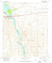 1970 Topock1973 Print · USGSThe Colorado River corridor near the Arizona-California border is shown here at the start of the 1970s, focused on the rail and road crossing at Topock. Trace the old mining claims of the Mohave Mountains, including the Gold Dome Mine and Jackpot Mine.2 unique versions available
 - 1981 Map of Needles, 1987 Print
 1981 Needles1987 Print · USGSThe High Desert and Colorado River valley are seen here in the early 1980s through the unique lens of satellite imagery. Trace the isolated outposts of the AT & SF railroad at Goffs and Essex, or explore the sprawling shores of Lake Havasu.
 - 1985 Map of Needles
 1985 Needles1985 Print · USGSThe Colorado River borderlands in the mid-1980s show a region shaped by major infrastructure and desert transit. Genealogists and historians can trace the path of U S 66 and the Atchison Topeka and Santa Fe through settlements like Needles, Goffs, and Topock.
 - 2011 Map of Topock, 2011 Print
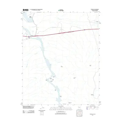 2011 Topock2011 Print · USGSCovers Topock, including Catfish Paradise, San Bernardino County, and other nearby areas
 - 2014 Map of Topock, 2014 Print
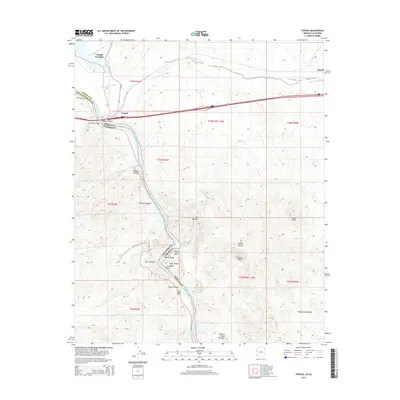 2014 Topock2014 Print · USGSCovers Topock, including Catfish Paradise, San Bernardino County, and other nearby areas
 - 2018 Map of Topock, 2018 Print
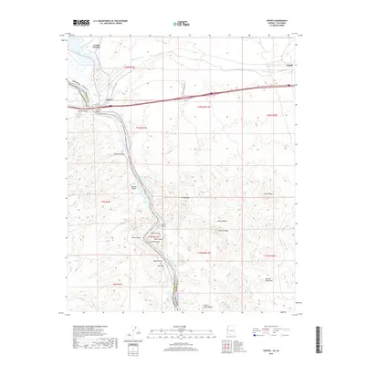 2018 Topock2018 Print · USGSCovers Topock, including Catfish Paradise, San Bernardino County, and other nearby areas
 - 2021 Map of Topock, 2021 Print
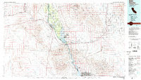
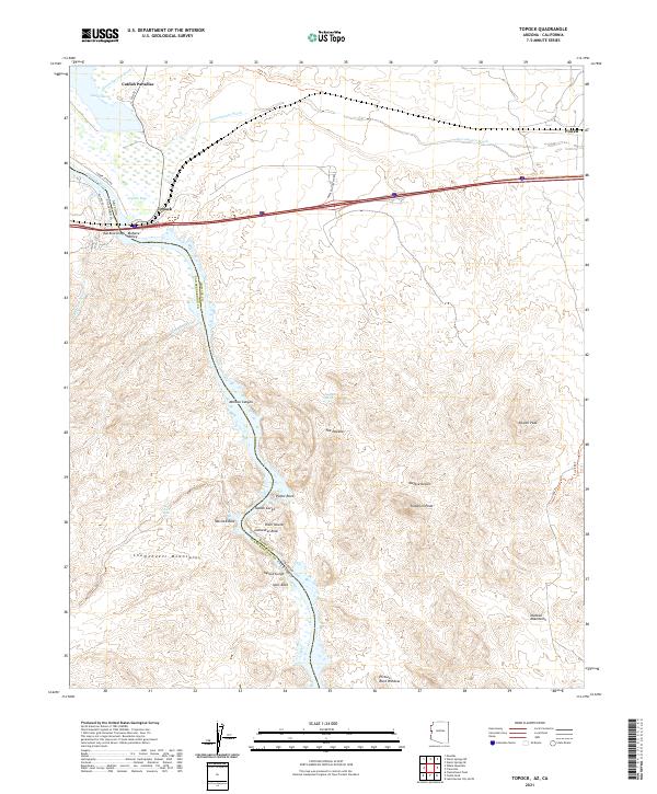 2021 Topock2021 Print · USGSThe Arizona-California border at the Colorado River is mapped here during the early twenty-first century. Researchers can trace the legacy of travel and terrain from Hist Rte 66 and Red Rock Bridge to landmarks like The Needles and Catfish Paradise.
End of results
Showing maps 1-14 of 14
Top cities near Topock
- Lake Havasu City historical maps
- Needles historical maps
- Desert Hills historical maps
- Mohave Valley historical maps
- Golden Shores historical maps
- Willow Valley historical maps
See more
Frequently asked questions
- What are the different types of historical maps available for Topock?
- What is the oldest map of Topock?
- Where can I purchase historical maps of Topock for my home or office?
- Where can I download high-res historical maps of Topock?
- Are there historical topographic maps available for Topock?
- Is there historical aerial imagery available for Topock?
- Where are historical maps of Topock sourced from?