Old Maps of Yucca, Arizona
Explore 11 old maps of Yucca, spanning from 1927 to today. These high-resolution historic maps reveal how streets, neighborhoods, landmarks, and natural features evolved over time — perfect for genealogy, metal detecting, research, and local history exploration.
What you can do with these maps:
- See how Yucca changed over time: Compare historical maps to modern-day views to trace roads, homesites, rail lines & more.
- View detailed metadata: Each map includes creators, publishers, year, scale, and archive source.
- Overlay maps with satellite & LiDAR: Visualize the past alongside modern tools to explore terrain & human change.
- Trusted historical sources: Maps sourced from the USGS, Library of Congress, and other archives.
- Access maps your way: View online, download high-res files, or order prints for personal or research use.
Start exploring old maps of Yucca to uncover forgotten places, hidden landmarks, and the deep history beneath your feet.
Yucca, AZ maps
(11)- 1927 Map of Yucca, 1965 Print
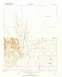 1927 Yucca1965 Print · USGSThe Mojave Desert interior comes into focus during the late 1920s, showing the critical transport corridor through the valley. Trace the early automotive and rail routes that sustained Yucca, including the Old Trails Highway and the Atchison Topeka and Santa Fe Railway.
 - 1929 Map of Yucca
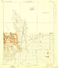 1929 Yucca1929 Print · USGSWestern Arizona in the late 1920s was a landscape of remote rail sidings and early desert highways. Trace the intersection of the Atchison Topeka and Santa Fe Railway and the Old Trails Highway at Yucca, or find the settlement of Haviland along the Sacramento Wash.3 unique versions available
 - 1954 Map of Needles
 1954 Needles1954 Print · USGSThe Mojave Desert at the height of the mid-century era shows a landscape defined by the Atchison Topeka and Santa Fe railroad and the legendary U S Highway 66. Genealogists and historians can trace rail stops like Goffs, mining sites such as the Bonanza King Mine, and the early borders of the Chemehuevi Indian Reservation.
 - 1956 Map of Needles
 1956 Needles1956 Print · USGSThe Mojave Desert and Colorado River come alive in the mid-fifties, showing the intersection of vital rail lines and massive water projects. Trace the Atchison Topeka and Santa Fe line through Amboy or locate remote sites like the Copper World Mine and Rio Vista Guest Ranch.7 unique versions available
 - 1970 Map of Yucca, 1973 Print
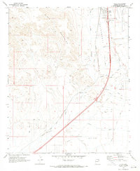 1970 Yucca1973 Print · USGSThe Mohave County desert comes into focus at the start of the 1970s, as regional transportation hubs like Yucca and Haviland anchor the landscape. Genealogists and historians can trace the Atchison Topeka and Santa Fe line, an automotive Proving Ground, and scattered Prospect sites.2 unique versions available
 - 1981 Map of Needles, 1987 Print
 1981 Needles1987 Print · USGSThe High Desert and Colorado River valley are seen here in the early 1980s through the unique lens of satellite imagery. Trace the isolated outposts of the AT & SF railroad at Goffs and Essex, or explore the sprawling shores of Lake Havasu.
 - 1985 Map of Needles
 1985 Needles1985 Print · USGSThe Colorado River borderlands in the mid-1980s show a region shaped by major infrastructure and desert transit. Genealogists and historians can trace the path of U S 66 and the Atchison Topeka and Santa Fe through settlements like Needles, Goffs, and Topock.
 - 2011 Map of Yucca, 2011 Print
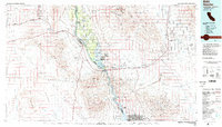
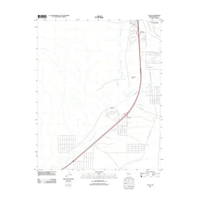 2011 Yucca2011 Print · USGSCovers Yucca, including Mohave County, United States, and other nearby areas
 - 2014 Map of Yucca, 2014 Print
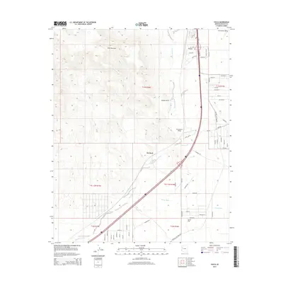 2014 Yucca2014 Print · USGSCovers Yucca, including Mohave County, United States, and other nearby areas
 - 2018 Map of Yucca, 2018 Print
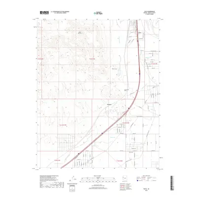 2018 Yucca2018 Print · USGSCovers Yucca, including Mohave County, United States, and other nearby areas
 - 2021 Map of Yucca, 2021 Print
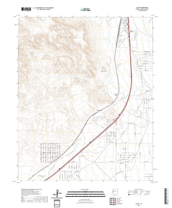 2021 Yucca2021 Print · USGSYucca and the surrounding Mohave County desert are documented here during the early twenty-first century as the landscape transitions into the Sacramento Valley. Researchers can trace the path of the National Old Trails Rd and locate sites like Haviland and Dutch Flat.
End of results
Showing maps 1-11 of 11
Frequently asked questions
- What are the different types of historical maps available for Yucca?
- What is the oldest map of Yucca?
- Where can I purchase historical maps of Yucca for my home or office?
- Where can I download high-res historical maps of Yucca?
- Are there historical topographic maps available for Yucca?
- Is there historical aerial imagery available for Yucca?
- Where are historical maps of Yucca sourced from?