1940s Maps of Nawt Vaya, Schuk Toak District
Explore 2 historic maps of Nawt Vaya from the 1940s. These maps offer a rare glimpse into what life looked like during the 1940s — showing old roads, neighborhoods, homes, and landmarks that have changed or disappeared over time.
Whether you're researching your family's past, planning a metal detecting trip, or studying how Nawt Vaya's landscape evolved across the 1940s, these high-resolution maps are a powerful tool for exploring the history of this region.
- Focus on a specific era: All maps on this page are from the 1940s, giving you a focused view of this time period.
- See what’s changed: Compare century-old streets, trails, and buildings to today's modern landscape using overlays and satellite layers.
- Research with precision: Use these maps for genealogy, historical research, land use analysis, or educational projects.
- View, download, or print: Maps are fully viewable online in high resolution, and can be downloaded or printed for your own records.
Start exploring Nawt Vaya's history through authentic maps from the 1940s. This is your window into the past.
Nawt Vaya, Schuk Toak District maps
(2)- 1941 Map of Cocoraque Butte, 1942 Print
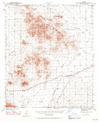 1941 Cocoraque Butte1942 Print · USGSPima County ranching and reservation life are captured here in the early 1940s, just as the local road network began to stabilize. Researchers can trace historic property boundaries and desert outposts like Cocoraque Ranch, Robles Junction, and the indigenous settlement of Viopuli.2 unique versions available
 - 1943 Map of Cocoraque Butte
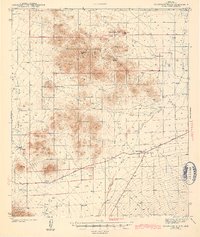 1943 Cocoraque Butte1943 Print · USGSThe Papago Indian Reservation and Pima County ranchlands are documented here in the early 1940s during a period of transition for desert travel. Researchers can trace historic family holdings like Dill Ranch and Cocoraque Ranch or locate the old Three Points Sch.3 unique versions available
End of results
Showing maps 1-2 of 2
Frequently asked questions
- What are the different types of historical maps available for Nawt Vaya?
- What is the oldest map of Nawt Vaya?
- Where can I purchase historical maps of Nawt Vaya for my home or office?
- Where can I download high-res historical maps of Nawt Vaya?
- Are there historical topographic maps available for Nawt Vaya?
- Is there historical aerial imagery available for Nawt Vaya?
- Where are historical maps of Nawt Vaya sourced from?