1940s Maps of Old Glory, Arizona
Explore 3 historic maps of Old Glory from the 1940s. These maps offer a rare glimpse into what life looked like during the 1940s — showing old roads, neighborhoods, homes, and landmarks that have changed or disappeared over time.
Whether you're researching your family's past, planning a metal detecting trip, or studying how Old Glory's landscape evolved across the 1940s, these high-resolution maps are a powerful tool for exploring the history of this region.
- Focus on a specific era: All maps on this page are from the 1940s, giving you a focused view of this time period.
- See what’s changed: Compare century-old streets, trails, and buildings to today's modern landscape using overlays and satellite layers.
- Research with precision: Use these maps for genealogy, historical research, land use analysis, or educational projects.
- View, download, or print: Maps are fully viewable online in high resolution, and can be downloaded or printed for your own records.
Start exploring Old Glory's history through authentic maps from the 1940s. This is your window into the past.
Old Glory, AZ maps
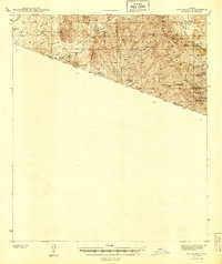
(3)- 1942 Map of Oro Blanco, 1961 Print
 1942 Oro Blanco1961 Print · USGSThe Arizona-Mexico borderlands come to life in this early 1940s survey of Santa Cruz County. Genealogists and historians can trace the legacy of the local mining boom through sites like Oro Blanco and the Old Glory Mine, alongside working spreads such as Garcia Ranch.3 unique versions available
 - 1943 Map of Old Glory
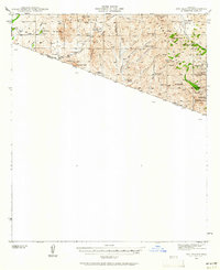
 1943 Old Glory1943 Print · USGSThe Arizona-Mexico borderlands come into focus in this mid-century reconnaissance, capturing the mining and ranching life of the high desert. Researchers can trace the locations of Old Glory Mine, Ruby P.O. (Montana), and historic outposts like Tres Bellotas.
 - 1944 Map of Oro Blanco
 1944 Oro Blanco1944 Print · USGSThe Arizona-Mexico borderlands are captured here in the early 1940s, highlighting a landscape transition from active mining to remote ranching. Genealogists and historians can locate old claims like the Yellow Jacket Mine and family sites like Garcia Ranch.2 unique versions available
End of results
Showing maps 1-3 of 3
Frequently asked questions
- What are the different types of historical maps available for Old Glory?
- What is the oldest map of Old Glory?
- Where can I purchase historical maps of Old Glory for my home or office?
- Where can I download high-res historical maps of Old Glory?
- Are there historical topographic maps available for Old Glory?
- Is there historical aerial imagery available for Old Glory?
- Where are historical maps of Old Glory sourced from?