Old Maps of Verde River Meadows One, Camp Verde for Hiking & Exploration
Hike through history with 12 historic maps of Verde River Meadows One. Explore old trails, ghost towns, and forgotten backroads — perfect for outdoor adventurers and local explorers.
- Rediscover forgotten places: Map out old mining camps, roads, and footpaths that no longer exist on modern maps.
- Layer with modern tools: Combine with LiDAR or satellite views to plan hikes through historical terrain.
- Made for exploration: Popular among hikers, overlanders, and local history lovers.
Use these maps to find adventure and explore the hidden past of Verde River Meadows One.
Verde River Meadows One, Camp Verde maps
(12)- 1887 Map of Verde
 1887 Verde1887 Print · USGSCovers Verde River Meadows One, including Payson, Cottonwood, and other nearby areas
 - 1892 Map of Verde
 1892 Verde1892 Print · USGSCovers Verde River Meadows One, including Payson, Cottonwood, and other nearby areas5 unique versions available
 - 1923 Map of Camp Verde
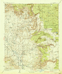
 1923 Camp Verde1923 Print · USGSCovers Verde River Meadows One, including Cottonwood, Camp Verde, and other nearby areas
 - 1932 Map of Camp Verde, 1959 Print
 1932 Camp Verde1959 Print · USGSCovers Verde River Meadows One, including Cottonwood, Camp Verde, and other nearby areas2 unique versions available
 - 1936 Map of Camp Verde
 1936 Camp Verde1936 Print · USGSCovers Verde River Meadows One, including Cottonwood, Camp Verde, and other nearby areas3 unique versions available
 - 1954 Map of Holbrook, 1966 Print
 1954 Holbrook1966 Print · USGSCovers Verde River Meadows One, including Payson, Cottonwood, and other nearby areas3 unique versions available
 - 1957 Map of Holbrook
 1957 Holbrook1957 Print · USGSCovers Verde River Meadows One, including Payson, Cottonwood, and other nearby areas
 - 1958 Map of Holbrook
 1958 Holbrook1958 Print · USGSCovers Verde River Meadows One, including Payson, Cottonwood, and other nearby areas
 - 1960 Map of Holbrook
 1960 Holbrook1960 Print · USGSCovers Verde River Meadows One, including Payson, Cottonwood, and other nearby areas
 - 1969 Map of Camp Verde, 1971 Print
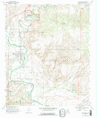 1969 Camp Verde1971 Print · USGSCovers Verde River Meadows One, including Camp Verde, Yavapai County, and other nearby areas2 unique versions available
 - 1980 Map of Sedona, 1996 Print
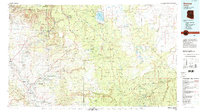 1980 Sedona1996 Print · USGSCovers Verde River Meadows One, including Cottonwood, Camp Verde, and other nearby areas
 - 2023 Map of Camp Verde, 2023 Print
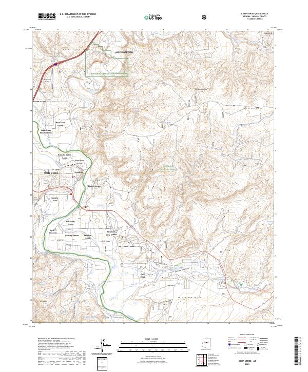 2023 Camp Verde2023 Print · USGSCovers Verde River Meadows One, including Camp Verde, Yavapai County, and other nearby areas
End of results
Showing maps 1-12 of 12
Frequently asked questions
- What are the different types of historical maps available for Verde River Meadows One?
- What is the oldest map of Verde River Meadows One?
- Where can I purchase historical maps of Verde River Meadows One for my home or office?
- Where can I download high-res historical maps of Verde River Meadows One?
- Are there historical topographic maps available for Verde River Meadows One?
- Is there historical aerial imagery available for Verde River Meadows One?
- Where are historical maps of Verde River Meadows One sourced from?