1960s Maps of McGuireville, Arizona
Explore 2 historic maps of McGuireville from the 1960s. These maps offer a rare glimpse into what life looked like during the 1960s — showing old roads, neighborhoods, homes, and landmarks that have changed or disappeared over time.
Whether you're researching your family's past, planning a metal detecting trip, or studying how McGuireville's landscape evolved across the 1960s, these high-resolution maps are a powerful tool for exploring the history of this region.
- Focus on a specific era: All maps on this page are from the 1960s, giving you a focused view of this time period.
- See what’s changed: Compare century-old streets, trails, and buildings to today's modern landscape using overlays and satellite layers.
- Research with precision: Use these maps for genealogy, historical research, land use analysis, or educational projects.
- View, download, or print: Maps are fully viewable online in high resolution, and can be downloaded or printed for your own records.
Start exploring McGuireville's history through authentic maps from the 1960s. This is your window into the past.
McGuireville, AZ maps
(2)- 1960 Map of Holbrook
 1960 Holbrook1960 Print · USGSNorthern Arizona is captured here just as modern highways began to reshape the cattle and timber country of the Colorado Plateau. Genealogists and historians can trace the early footprints of Snowflake, Sedona, and Payson, alongside the Atchison Topeka & Santa Fe RR rail line.
 - 1969 Map of Lake Montezuma, 1972 Print
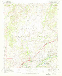 1969 Lake Montezuma1972 Print · USGSYavapai County's high desert landscape comes into focus during the late sixties as residential growth meets ancient landmarks. Trace the early layout of Lake Montezuma and Rimrock alongside historic sites like Montezuma Castle National Monument and Apache Maid Ranch.2 unique versions available
End of results
Showing maps 1-2 of 2
Top cities near McGuireville
Frequently asked questions
- What are the different types of historical maps available for McGuireville?
- What is the oldest map of McGuireville?
- Where can I purchase historical maps of McGuireville for my home or office?
- Where can I download high-res historical maps of McGuireville?
- Are there historical topographic maps available for McGuireville?
- Is there historical aerial imagery available for McGuireville?
- Where are historical maps of McGuireville sourced from?