1900s (20th Century) Maps of Walnut Grove, Arizona
Explore 13 historic maps of Walnut Grove from the 1900s (20th Century). These maps offer a rare glimpse into what life looked like during the 1900s — showing old roads, neighborhoods, homes, and landmarks that have changed or disappeared over time.
Whether you're researching your family's past, planning a metal detecting trip, or studying how Walnut Grove's landscape evolved across the 1900s, these high-resolution maps are a powerful tool for exploring the history of this region.
- Focus on a specific era: All maps on this page are from the 1900s, giving you a focused view of this time period.
- See what’s changed: Compare century-old streets, trails, and buildings to today's modern landscape using overlays and satellite layers.
- Research with precision: Use these maps for genealogy, historical research, land use analysis, or educational projects.
- View, download, or print: Maps are fully viewable online in high resolution, and can be downloaded or printed for your own records.
Start exploring Walnut Grove's history through authentic maps from the 1900s. This is your window into the past.
Walnut Grove, AZ maps
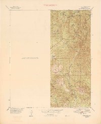
(13)- 1903 Map of Congress, 1962 Print
 1903 Congress1962 Print · USGSYavapai County's high desert mining camps and cattle ranches are captured here at the turn of the century. Genealogists and historians can trace the early rail-and-mine economy through sites like Congress Junction, Octave, and the Walnut Grove Dam.
 - 1904 Map of Congress
 1904 Congress1904 Print · USGSArizona's mining heartland in Yavapai County comes alive during this early boom era. Genealogists and historians can trace the foundations of Congress Junction, the bustling Congress Mine, and the legendary gold camp at Stanton along the Hassayampa River.3 unique versions available
 - 1947 Map of Kirkland, 1959 Print
 1947 Kirkland1959 Print · USGSArizona's mining and ranching frontier is frozen in time during the late 1940s as the Prescott National Forest was being mapped in detail. Researchers can locate the Die Rebel Mine, the Walnut Grove School, and family outposts like T K Bar Ranch.2 unique versions available
 - 1948 Map of Kirkland
 1948 Kirkland1948 Print · USGSYavapai County's high desert terrain is captured here in the late 1940s, showing a transition from remote ranching outposts to established mining operations. Researchers can trace family history through the Walnut Grove School or locate historic mineral sites like the Climax Mine and Big Rebel Mine.
 - 1950 Map of Kirkland
 1950 Kirkland1950 Print · USGSYavapai County ranching and mining operations are captured in detail at mid-century as the region's rural economy transitioned. Trace family history at the Walnut Grove School or locate old diggings like the Climax Mine and Cooper Crown Mine.
 - 1950 Map of Prescott, 1951 Print
 1950 Prescott1951 Print · USGSArizona's mining and ranching frontiers were in full operation during the early fifties, from the vertical streets of Jerome to the remote western desert. Genealogists and researchers can trace rural life via the Bland School, the United Verde Mine, and stops along the Atchison Topeka and Santa Fe Railway.
 - 1954 Map of Prescott, 1963 Print
 1954 Prescott1963 Print · USGSYavapai County mining and ranching districts are shown in high detail during the mid-twentieth century. Researchers can trace the legacy of remote camps and transport hubs like Swansea, Octave, and the Bagdad Mine along the desert rail lines.4 unique versions available
 - 1958 Map of Prescott
 1958 Prescott1958 Print · USGSCentral Arizona's rugged mining and ranching corridors come alive in the late fifties. Genealogists and historians can trace the remote Trout Creek School, the mining operations at Jerome, and the rail stops at Skull Valley and Kirkland.
 - 1959 Map of Prescott
 1959 Prescott1959 Print · USGSYavapai County and the central Arizona highlands come alive in the late fifties, showcasing a landscape of mountain mining towns and forest outposts. Researchers can trace the industrial footprints of the United Verde Mine, follow the Atchison Topeka and Santa Fe rails, and locate remote settlements like Swansea or Skull Valley.2 unique versions available
 - 1960 Map of Prescott
 1960 Prescott1960 Print · USGSYavapai County and the surrounding high-desert mining districts are captured here during a period of steady industrial and rail activity. Researchers can trace the routes of the Atchison Topeka and Santa Fe Railway and locate historic sites like the United Verde Mine and Bland School.2 unique versions available
 - 1965 Map of Prescott
 1965 Prescott1965 Print · USGSArizona's mining heartland is captured during the mid-sixties, from the copper mines of Jerome to the cattle country of Williamson Valley Wash. Genealogists and historians can trace old mining camps at Octave and Stanton or the historic Whipple Military Reservation.
 - 1969 Map of Walnut Grove, 1971 Print
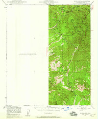
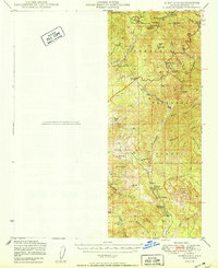
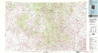
 1969 Walnut Grove1971 Print · USGSYavapai County ranching and mining operations define this high-desert landscape in the late sixties. Genealogists and historians can trace family-named lands like Whitehead Ranch and Carter Ranch or locate the Walnut Grove Cemetery.2 unique versions available
 - 1981 Map of Bradshaw Mts, 1996 Print
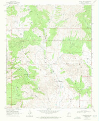
 1981 Bradshaw Mts1996 Print · USGSYavapai County during the early 1980s reveals a high-desert landscape shaped by mining camps and the winding Atchison Topeka and Santa Fe railroad. Researchers can trace historic industrial sites like the Crown King Mine and remote settlements such as Bumble Bee and Cleator.2 unique versions available
End of results
Showing maps 1-13 of 13
Top cities near Walnut Grove
- Wickenburg historical maps
- Wilhoit historical maps
- Yarnell historical maps
- Peeples Valley historical maps
Frequently asked questions
- What are the different types of historical maps available for Walnut Grove?
- What is the oldest map of Walnut Grove?
- Where can I purchase historical maps of Walnut Grove for my home or office?
- Where can I download high-res historical maps of Walnut Grove?
- Are there historical topographic maps available for Walnut Grove?
- Is there historical aerial imagery available for Walnut Grove?
- Where are historical maps of Walnut Grove sourced from?