Old Maps of Saguaro Estates, Yuma for Genealogy
Trace your family roots with 17 historic maps of Saguaro Estates. These high-res maps reveal old neighborhoods, homesites, landmarks, and streets — helping you uncover where your ancestors lived and how the area evolved over time.
- Explore historic neighborhoods: Identify where your relatives may have lived in the 1800s or 1900s.
- Compare maps over time: Trace the changes in streets, buildings, and landmarks for multi-generational research.
- Perfect for genealogy & ancestry research: Used by family historians and researchers to map out lineage and migration.
These maps are an incredible resource for exploring your personal connection to Saguaro Estates's past.
Saguaro Estates, Yuma maps
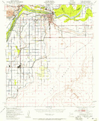
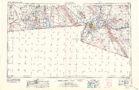
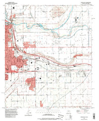
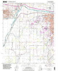
(17)- 1903 Map of Yuma, 1954 Print
 1903 Yuma1954 Print · USGSCovers Saguaro Estates, including Yuma, San Luis, and other nearby areas2 unique versions available
 - 1905 Map of Yuma
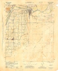
 1905 Yuma1905 Print · USGSCovers Saguaro Estates, including Yuma, San Luis, and other nearby areas5 unique versions available
 - 1940 Map of Yuma, 1956 Print
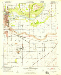
 1940 Yuma1956 Print · USGSCovers Saguaro Estates, including Yuma, San Luis, and other nearby areas3 unique versions available
 - 1942 Map of Yuma
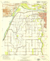
 1942 Yuma1942 Print · USGSCovers Saguaro Estates, including San Luis Río Colorado, Yuma, and other nearby areas
 - 1945 Map of Yuma
 1945 Yuma1945 Print · USGSCovers Saguaro Estates, including Yuma, San Luis, and other nearby areas
 - 1952 Map of Yuma East, 1953 Print
 1952 Yuma East1953 Print · USGSCovers Saguaro Estates, including Yuma, El Prado Estates, and other nearby areas
 - 1952 Map of Yuma West, 1953 Print
 1952 Yuma West1953 Print · USGSCovers Saguaro Estates, including Yuma, Los Algodones, and other nearby areas
 - 1954 Map of El Centro
 1954 El Centro1954 Print · USGSCovers Saguaro Estates, including Mexicali, San Luis Río Colorado, and other nearby areas
 - 1955 Map of El Centro
 1955 El Centro1955 Print · USGSCovers Saguaro Estates, including Mexicali, San Luis Río Colorado, and other nearby areas
 - 1958 Map of El Centro, 1972 Print
 1958 El Centro1972 Print · USGSCovers Saguaro Estates, including Mexicali, San Luis Río Colorado, and other nearby areas4 unique versions available
 - 1961 Map of El Centro
 1961 El Centro1961 Print · USGSCovers Saguaro Estates, including Mexicali, San Luis Río Colorado, and other nearby areas
 - 1964 Map of El Centro
 1964 El Centro1964 Print · USGSCovers Saguaro Estates, including Mexicali, San Luis Río Colorado, and other nearby areas
 - 1965 Map of Yuma East, 1966 Print
 1965 Yuma East1966 Print · USGSCovers Saguaro Estates, including Yuma, El Prado Estates, and other nearby areas3 unique versions available
 - 1965 Map of Yuma West, 1966 Print
 1965 Yuma West1966 Print · USGSCovers Saguaro Estates, including Yuma, Los Algodones, and other nearby areas4 unique versions available
 - 1993 Map of Yuma
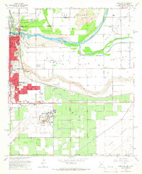
 1993 Yuma1993 Print · USGSCovers Saguaro Estates, including Yuma, Fortuna Foothills, and other nearby areas3 unique versions available
 - 1994 Map of Yuma East, 1998 Print
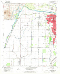
 1994 Yuma East1998 Print · USGSCovers Saguaro Estates, including Yuma, El Prado Estates, and other nearby areas
 - 1997 Map of Yuma West, 2003 Print
 1997 Yuma West2003 Print · USGSCovers Saguaro Estates, including Yuma, Los Algodones, and other nearby areas
End of results
Showing maps 1-17 of 17
Frequently asked questions
- What are the different types of historical maps available for Saguaro Estates?
- What is the oldest map of Saguaro Estates?
- Where can I purchase historical maps of Saguaro Estates for my home or office?
- Where can I download high-res historical maps of Saguaro Estates?
- Are there historical topographic maps available for Saguaro Estates?
- Is there historical aerial imagery available for Saguaro Estates?
- Where are historical maps of Saguaro Estates sourced from?