Old Maps of Sumpter, Arkansas
Explore 15 old maps of Sumpter, spanning from 1934 to today. These high-resolution historic maps reveal how streets, neighborhoods, landmarks, and natural features evolved over time — perfect for genealogy, metal detecting, research, and local history exploration.
What you can do with these maps:
- See how Sumpter changed over time: Compare historical maps to modern-day views to trace roads, homesites, rail lines & more.
- View detailed metadata: Each map includes creators, publishers, year, scale, and archive source.
- Overlay maps with satellite & LiDAR: Visualize the past alongside modern tools to explore terrain & human change.
- Trusted historical sources: Maps sourced from the USGS, Library of Congress, and other archives.
- Access maps your way: View online, download high-res files, or order prints for personal or research use.
Start exploring old maps of Sumpter to uncover forgotten places, hidden landmarks, and the deep history beneath your feet.
Sumpter, AR maps
(15)- 1934 Map of Ingalls
 1934 Ingalls1934 Print · USGSBradley County during the mid-1930s shows a landscape of river-bottom camps and rural parish life. Researchers can trace family roots through numerous local landmarks, from Johnsville and Bogalusa Camp to country schools like Eagle Lake Sch and Broad Sch.
 - 1937 Map of Ingalls
 1937 Ingalls1937 Print · USGSSouth Arkansas timber and river country are mapped here in the mid-1930s as rural life centered on the Ouachita River. Researchers can locate vanished landmarks like Pine Island Landing, Thomas Sch, and the riverside Bogalusa Camp.3 unique versions available
 - 1939 Map of Ingalls, 1941 Print
 1939 Ingalls1941 Print · USGSSoutheast Arkansas in the late 1930s was a landscape of river landings and ridge-top settlements centered on the Saline River. Genealogists can trace early rural life through landmarks like Palestine Ch, Johnsville, and several family-named schoolhouses.
 - 1953 Map of El Dorado, 1967 Print
 1953 El Dorado1967 Print · USGSSouth Arkansas in the mid-1960s was a landscape of industrial growth and river-fed commerce. Researchers can trace the extensive Oil and Gas Fields around Magnolia, the expansive U S Naval Ammunition Depot, and the busy rail lines of the Missouri Pacific.3 unique versions available
 - 1957 Map of El Dorado
 1957 El Dorado1957 Print · USGSSouth Arkansas in the mid-1950s was a critical hub of military logistics and rail-river commerce. Genealogists and historians can trace family land across the Arkansas Louisiana border and locate sites like the U.S. Naval Ammunition Depot or the rail junctions at Magnolia and Camden.
 - 1958 Map of El Dorado
 1958 El Dorado1958 Print · USGSSouthern Arkansas and the Louisiana borderlands are shown during a period of heavy rail traffic and defense industry activity. Researchers can trace the legacy of the U. S. Naval Ammunition Depot or locate family roots in Smackover, Huttig, and Nashville.3 unique versions available
 - 1960 Map of El Dorado
 1960 El Dorado1960 Print · USGSSouth Central Arkansas in the late fifties was a hub of energy production and defense industry. Researchers can trace the extensive Oil and Gas Fields around El Dorado or locate family landmarks like Old Park Cem and New Hope Church.
 - 1971 Map of Sumpter, 1973 Print
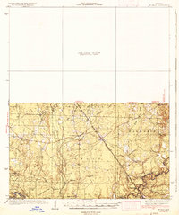
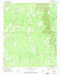 1971 Sumpter1973 Print · USGSThe rural backroads of Bradley and Drew counties come into focus in the early 1970s as the river bottom timberlands meet rising gravel hills. Trace the vanished tracks of the Old Railroad Grade or locate family roots near Pattsville Cem and Sumpter.2 unique versions available
 - 1985 Map of El Dorado, 1986 Print
 1985 El Dorado1986 Print · USGSSouth-central Arkansas and the Louisiana borderlands appear here in the mid-1980s, defined by the energy industry and river bottomlands. Genealogists and historians can locate rural landmarks like Old Parkers Chapel Cem, the Smackover Gas Field, and the El Dorado & Wesson RR.2 unique versions available
 - 1989 Map of El Dorado, 1990 Print
 1989 El Dorado1990 Print · USGSThe Arkansas-Louisiana borderlands in the late eighties show a landscape of heavy industry and wildlife conservation centered on the Ouachita River. Researchers can trace the legacy of timber and transport via the Missouri Pacific RR, Poison Springs State Forest, and the vast Felsenthal Pool.
 - 2011 Map of Sumpter, 2011 Print
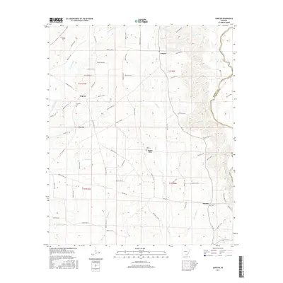
 2011 Sumpter2011 Print · USGSCovers Sumpter, including Mannstown, Mount Olive, and other nearby areas
 - 2014 Map of Sumpter, 2014 Print
 2014 Sumpter2014 Print · USGSCovers Sumpter, including Mannstown, Mount Olive, and other nearby areas
 - 2017 Map of Sumpter, 2017 Print
 2017 Sumpter2017 Print · USGSCovers Sumpter, including Mannstown, Mount Olive, and other nearby areas
 - 2020 Map of Sumpter, 2020 Print
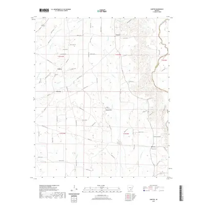 2020 Sumpter2020 Print · USGSCovers Sumpter, including Mannstown, Mount Olive, and other nearby areas
 - 2024 Map of Sumpter, 2024 Print
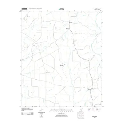
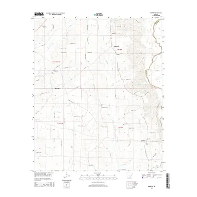
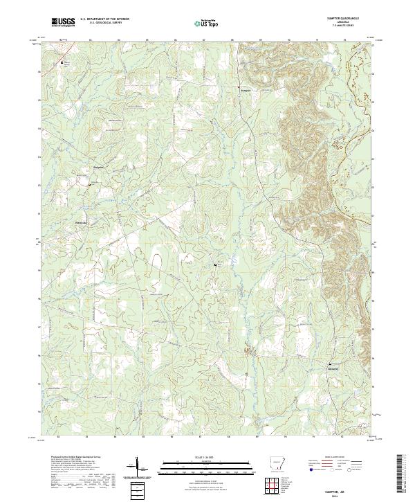 2024 Sumpter2024 Print · USGSBradley County in the modern era maintains its quiet rural character defined by the winding Saline River. Researchers can locate several historic burial grounds like Pattsville Cem and settlements such as Sumpter and Smearny.
End of results
Showing maps 1-15 of 15
Top cities near Sumpter
- Monticello historical maps
- Warren historical maps
- Hermitage historical maps
- Wilmar historical maps
- Fountain Hill historical maps
- Banks historical maps
Frequently asked questions
- What are the different types of historical maps available for Sumpter?
- What is the oldest map of Sumpter?
- Where can I purchase historical maps of Sumpter for my home or office?
- Where can I download high-res historical maps of Sumpter?
- Are there historical topographic maps available for Sumpter?
- Is there historical aerial imagery available for Sumpter?
- Where are historical maps of Sumpter sourced from?