Old Maps of Craighead County, Arkansas for Academic Research
Study the evolution of Craighead County with 147 high-resolution historic maps. Whether you're teaching, researching, or modeling changes in land use, these maps provide essential visual documentation of urban, environmental, and geographic change.
- Analyze long-term change: Track patterns in development, transportation, and natural features.
- Ideal for environmental or urban studies: Support academic projects with primary historical map data.
- Use in the classroom or lab: Educators and researchers rely on these maps to bring historical context to life.
These maps are a powerful tool for teaching, research, and visualizing how Craighead County has changed over the decades.
Craighead County, AR maps
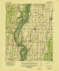
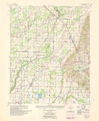
(147)- 1935 Map of Sedgwick, 1936 Print
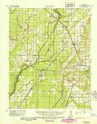 1935 Sedgwick1936 Print · USGSLawrence and Craighead counties are shown here during a period of extensive drainage and rural expansion in the mid-1930s. Genealogists can trace family roots through numerous small landmarks like Three Way Inn, Fifty Six Sch, and Herman Ch & Cem.2 unique versions available
 - 1935 Map of Alicia, 1936 Print
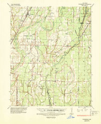
 1935 Alicia1936 Print · USGSThe Black River bottomlands of the 1930s are captured here during a period of transition from river landings to rail and highway transit. Researchers can locate numerous family-named landmarks and vanished schools such as Clover Bend Sch, Vandy Cem, and the Old Martin Mill Place.3 unique versions available
 - 1935 Map of Tuckerman, 1946 Print
 1935 Tuckerman1946 Print · USGSNortheast Arkansas in the mid-thirties was a landscape shaped by the Cache River and a dense network of drainage ditches. Family historians can trace rural roots through numerous combined sites like Antioch Ch & Cem and Green Haw Sch & Cem.2 unique versions available
 - 1939 Map of Weiner, 1941 Print
 1939 Weiner1941 Print · USGSPoinsett County agricultural life centers on the rail corridor during the late thirties, before the modernization of the Delta landscape. Genealogists and historians can locate vanished rural landmarks such as O Bear Siding and schools like Beautiful Home Sch or Ukana Sch.3 unique versions available
 - 1939 Map of Jonesboro, 1942 Print
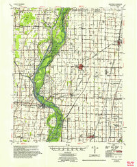
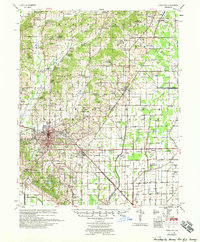
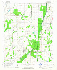
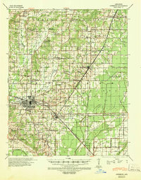 1939 Jonesboro1942 Print · USGSJonesboro and its surrounding farmstead communities are captured in the late thirties, when railroads and rural schools defined the region. Researchers can trace family sites like Higginsbottom Hope Sch or the remote Doss Flag Stop along the rail lines.
 - 1940 Map of Dee, 1942 Print
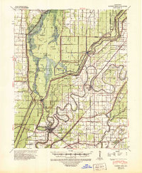
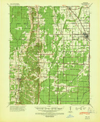 1940 Dee1942 Print · USGSPoinsett County at the start of the 1940s reveals a landscape split between the natural rises of Crowleys Ridge and an expansive system of reclamation drainage. Trace family roots through numerous country schools like Judd Hill Sch or sites like Bolivar Cem.
 - 1941 Map of Leachville, 1943 Print
 1941 Leachville1943 Print · USGSNortheast Arkansas and the Missouri bootheel border region appear here in the early 1940s as a landscape of river-bottom settlements and new drainage canals. Genealogists can trace family roots through numerous local schools like Turkey Run Sch and churches such as Walnut Grove Ch & Cem.
 - 1941 Map of Marked Tree, 1946 Print
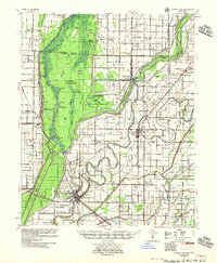
 1941 Marked Tree1946 Print · USGSPoinsett County at the start of the 1940s reveals a landscape of massive drainage projects and river engineering. Trace the early footprints of Marked Tree and Lepanto alongside rural landmarks like Frys Mill, Pilgrims Rest Ch, and the Spear Lake Sch & Cem.2 unique versions available
 - 1953 Map of Memphis, 1966 Print
 1953 Memphis1966 Print · USGSEastern Arkansas and the Memphis riverfront are shown here during the mid-century period of regional growth and river management. Local historians can trace the paths of the Chicago Rock Island & Pacific RR through Forrest City or locate river landmarks like President's Island.3 unique versions available
 - 1956 Map of Leachville
 1956 Leachville1956 Print · USGSThe Arkansas-Missouri borderlands in the mid-1950s show a region shaped by major drainage projects and the railroad economy. Genealogists and historians can trace family locations near Leachville, Black Oak, and several country schools like Milligan Ridge Sch.2 unique versions available
 - 1956 Map of Marked Tree
 1956 Marked Tree1956 Print · USGSThe Arkansas Delta comes into focus in the mid-1950s as drainage projects transformed the Sunk Lands for agriculture. Researchers can trace the junction of the St Louis Southwestern RR and locate local landmarks like the Hatchie Coon Hunting Lodge and Nichols Cem.2 unique versions available
 - 1956 Map of Memphis
 1956 Memphis1956 Print · USGSThe Mississippi Delta and the bluffs of West Tennessee meet in the mid-fifties, showing a landscape defined by massive river systems and rail hubs. Researchers can trace the path of Crowleys Ridge or locate vanished river landings near Centennial Island and Island No 35.
 - 1958 Map of Dee
 1958 Dee1958 Print · USGSThe Poinsett County lowlands and the elevation of Crowleys Ridge are captured here in the late fifties as the regional drainage network reached maturity. Genealogists and local historians can trace family locations near Stacy Store, Bolivar Ch & Cem, and the timber hub of Trumann.
 - 1958 Map of Jonesboro
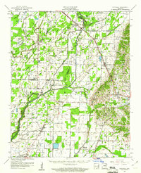
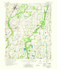
 1958 Jonesboro1958 Print · USGSJonesboro and the surrounding Crowley's Ridge area are captured in the late fifties as the regional center expanded around Arkansas State College. Researchers can trace early rural life through an extensive network of landmarks like Indian Mounds, Nettleton, and the Philadelphia Ch & Cem.2 unique versions available
 - 1959 Map of Weiner, 1961 Print
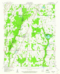 1959 Weiner1961 Print · USGSThe Arkansas Delta near the Poinsett and Craighead border shows a landscape defined by rice farming and rail transit in the late fifties. You can trace family roots at Walker Cem and local churches like Chilson Ch or explore the rail hubs of Weiner and Waldenburg.
 - 1959 Map of Sedgwick, 1961 Print
 1959 Sedgwick1961 Print · USGSNortheast Arkansas in the late fifties shows a landscape of rail-connected farming towns and river bottomlands. Researchers can trace family history through local sites like Egypt Sch, Arnold Cem, and churches such as Little Brown Ch.
 - 1960 Map of Weiner
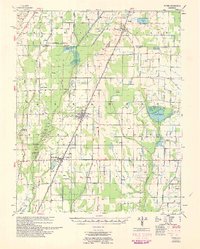 1960 Weiner1960 Print · USGSNortheast Arkansas at the dawn of the 1960s shows a landscape defined by the ST LOUIS SOUTHWESTERN rail line and reclaimed delta bottomlands. Researchers can trace rural life through landmarks like Walker Cem, Chilson Ch, and the sprawling Public Hunting Area.
 - 1960 Map of Sedgwick
 1960 Sedgwick1960 Print · USGSNortheast Arkansas in the late fifties was a landscape of river bottomlands and rail-hub towns like Sedgwick and Bono. Researchers can trace old family burial grounds and country parishes such as Manning Cem, Egypt Sch, and Little Brown Ch.
 - 1965 Map of Grubbs, 1966 Print
 1965 Grubbs1966 Print · USGSNear the Cache River in the mid-1960s, this area of Jackson County shows a landscape of engineered drainage and small farming outposts. Researchers can locate several remote burial grounds and churches, including Denton Island Cem, Hollows Chapel, and the settlement of Grubbs.
 - 1967 Map of Tuckerman
 1967 Tuckerman1967 Print · USGSThe Jackson County lowlands are captured here in the mid-sixties, showing a landscape defined by the Cache River and its sloughs. Trace family history at Gracelawn Cem, find old school sites like Eastside Sch, and locate industrial landmarks like Stringers Mill.
 - 1980 Map of Otwell
 1980 Otwell1980 Print · USGSOtwell and the surrounding Arkansas Delta are captured here in the late 1970s as a landscape of managed waterways and rail transport. Researchers can trace the St Louis Southwestern tracks past Otwell Cem and explore the irrigation networks of Big Creek Ditch and Claypool Reservoir.
 - 1980 Map of Alicia
 1980 Alicia1980 Print · USGSLawrence County and the Arkansas Delta are captured here in the late 1970s as the rail-and-creek economy maintained its traditional footprint. Researchers can trace family history through several burial sites like Clover Bend Cemetery and Davenport Cemetery or locate the community at Hopewell Church.
 - 1980 Map of Cash
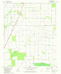
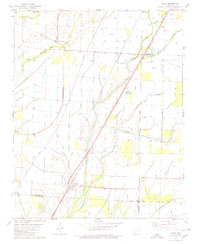
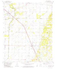
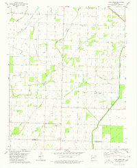
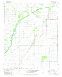 1980 Cash1980 Print · USGSSettlement and agriculture define the Craighead County landscape in the late seventies. Researchers can trace rural landmarks and family histories through sites like Johnson Cem, the community of Little Texas, and the Red Ch near the Fisher area.
 - 1980 Map of Bono
 1980 Bono1980 Print · USGSNortheast Arkansas in the late seventies is marked by the unique topography of Crowleys Ridge and the winding Cache River. Genealogists and historians can trace rural lifeways through several country landmarks like Old Military Cem, Bells Chapel Ch, and the rail stop at Pauls Switch.
 - 1980 Map of Podo Creek
 1980 Podo Creek1980 Print · USGSLawrence and Craighead counties in the late 1970s show a landscape shaped by drainage projects and rail transport. Genealogists can locate family-named sites like Markham Cem and Aldridge Cem or trace the old St Louis-San Francisco line.
Showing maps 1-25 of 147
Top cities of Craighead County
- Jonesboro historical maps
- Bono historical maps
- Lake City historical maps
- Bay historical maps
- Brookland historical maps
- Monette historical maps
See more
Frequently asked questions
- What are the different types of historical maps available for Craighead County?
- What is the oldest map of Craighead County?
- Where can I purchase historical maps of Craighead County for my home or office?
- Where can I download high-res historical maps of Craighead County?
- Are there historical topographic maps available for Craighead County?
- Is there historical aerial imagery available for Craighead County?
- Where are historical maps of Craighead County sourced from?