Old Maps of Van Buren, Arkansas
Explore 20 old maps of Van Buren, spanning from 1879 to today. These high-resolution historic maps reveal how streets, neighborhoods, landmarks, and natural features evolved over time — perfect for genealogy, metal detecting, research, and local history exploration.
What you can do with these maps:
- See how Van Buren changed over time: Compare historical maps to modern-day views to trace roads, homesites, rail lines & more.
- View detailed metadata: Each map includes creators, publishers, year, scale, and archive source.
- Overlay maps with satellite & LiDAR: Visualize the past alongside modern tools to explore terrain & human change.
- Trusted historical sources: Maps sourced from the USGS, Library of Congress, and other archives.
- Access maps your way: View online, download high-res files, or order prints for personal or research use.
Start exploring old maps of Van Buren to uncover forgotten places, hidden landmarks, and the deep history beneath your feet.
Van Buren, AR maps
(20)- 1879 Map of Fort Smith
 1879 Fort Smith1879 Print · USGSCovers Van Buren, including Fort Smith, Alma, and other nearby areas
 - 1887 Map of Van Buren
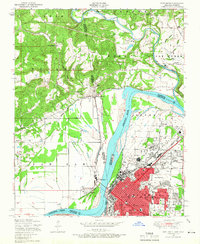
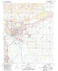
 1887 Van Buren1887 Print · USGSCovers Van Buren, including Fort Smith, Alma, and other nearby areas
 - 1890 Map of Fort Smith
 1890 Fort Smith1890 Print · USGSCovers Van Buren, including Fort Smith, Greenwood, and other nearby areas7 unique versions available
 - 1943 Map of Fort Smith
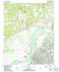
 1943 Fort Smith1943 Print · USGSCovers Van Buren, including Fort Smith, Greenwood, and other nearby areas
 - 1946 Map of Fort Smith
 1946 Fort Smith1946 Print · USGSCovers Van Buren, including Tulsa, Fayetteville, and other nearby areas
 - 1947 Map of Van Buren, 1954 Print
 1947 Van Buren1954 Print · USGSCovers Van Buren, including Fort Smith, Alma, and other nearby areas
 - 1947 Map of Fort Smith, 1966 Print
 1947 Fort Smith1966 Print · USGSCovers Van Buren, including Fort Smith, Roland, and other nearby areas4 unique versions available
 - 1947 Map of Van Buren, 1969 Print
 1947 Van Buren1969 Print · USGSCovers Van Buren, including Fort Smith, Alma, and other nearby areas3 unique versions available
 - 1951 Map of Fort Smith
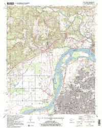
 1951 Fort Smith1951 Print · USGSCovers Van Buren, including Fort Smith, Roland, and other nearby areas2 unique versions available
 - 1951 Map of Van Buren
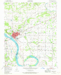
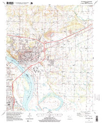
 1951 Van Buren1951 Print · USGSCovers Van Buren, including Fort Smith, Alma, and other nearby areas2 unique versions available
 - 1965 Map of Fort Smith
 1965 Fort Smith1965 Print · USGSCovers Van Buren, including Tulsa, Fayetteville, and other nearby areas
 - 1967 Map of Fort Smith
 1967 Fort Smith1967 Print · USGSCovers Van Buren, including Tulsa, Fayetteville, and other nearby areas
 - 1976 Map of Fort Smith, 1978 Print
 1976 Fort Smith1978 Print · USGSCovers Van Buren, including Fort Smith, Roland, and other nearby areas
 - 1976 Map of Van Buren, 1978 Print
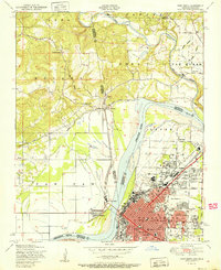
 1976 Van Buren1978 Print · USGSCovers Van Buren, including Fort Smith, Alma, and other nearby areas2 unique versions available
 - 1978 Map of Fort Smith, 1979 Print
 1978 Fort Smith1979 Print · USGSCovers Van Buren, including Tulsa, Fayetteville, and other nearby areas2 unique versions available
 - 1978 Map of Fort Smith, 1979 Print
 1978 Fort Smith1979 Print · USGSCovers Van Buren, including Fort Smith, Greenwood, and other nearby areas2 unique versions available
 - 1987 Map of Van Buren, 1988 Print
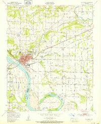
 1987 Van Buren1988 Print · USGSCovers Van Buren, including Fort Smith, Alma, and other nearby areas2 unique versions available
 - 1987 Map of Fort Smith, 1988 Print
 1987 Fort Smith1988 Print · USGSCovers Van Buren, including Fort Smith, Roland, and other nearby areas2 unique versions available
 - 1997 Map of Van Buren, 1999 Print
 1997 Van Buren1999 Print · USGSCovers Van Buren, including Fort Smith, Alma, and other nearby areas
 - 1997 Map of Fort Smith, 1999 Print
 1997 Fort Smith1999 Print · USGSCovers Van Buren, including Fort Smith, Roland, and other nearby areas2 unique versions available
End of results
Showing maps 1-20 of 20
Top cities near Van Buren
- Fort Smith historical maps
- Greenwood historical maps
- Alma historical maps
- Barling historical maps
- Pocola historical maps
- Muldrow historical maps
See more
Top neighborhoods of Van Buren
Frequently asked questions
- What are the different types of historical maps available for Van Buren?
- What is the oldest map of Van Buren?
- Where can I purchase historical maps of Van Buren for my home or office?
- Where can I download high-res historical maps of Van Buren?
- Are there historical topographic maps available for Van Buren?
- Is there historical aerial imagery available for Van Buren?
- Where are historical maps of Van Buren sourced from?