Old Maps of Timberpeg, Conway for Academic Research
Study the evolution of Timberpeg with 14 high-resolution historic maps. Whether you're teaching, researching, or modeling changes in land use, these maps provide essential visual documentation of urban, environmental, and geographic change.
- Analyze long-term change: Track patterns in development, transportation, and natural features.
- Ideal for environmental or urban studies: Support academic projects with primary historical map data.
- Use in the classroom or lab: Educators and researchers rely on these maps to bring historical context to life.
These maps are a powerful tool for teaching, research, and visualizing how Timberpeg has changed over the decades.
Timberpeg, Conway maps
(14)- 1956 Map of Russellville
 1956 Russellville1956 Print · USGSThe Arkansas River valley and the surrounding Boston Mountains are captured here in the mid-fifties, showing a landscape of small timber towns and new reservoirs. Genealogists can trace family roots through upland settlements like Pelsor and Witts Springs or locate the campus of Arkansas Polytechnic College.2 unique versions available
 - 1961 Map of Conway, 1963 Print
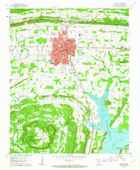 1961 Conway1963 Print · USGSThe college town of Conway and the northern reaches of Lake Conway are captured here in the early sixties as the city expanded along the rail lines. Researchers can locate numerous local landmarks including Hendrix College, Oak Grove Cemetery, and State Teachers College.4 unique versions available
 - 1961 Map of Conway, 1963 Print
 1961 Conway1963 Print · USGSConway and central Arkansas are captured here during a season of mid-century growth and collegiate expansion. Researchers can locate vanished rural landmarks and early infrastructure like Hendrix College, Beaver Fork Lake, and the Drive-in Theater.
 - 1964 Map of Russellville
 1964 Russellville1964 Print · USGSMid-century Central Arkansas is defined here by the river-valley towns and the surrounding mountain ranges before the full expansion of the interstate system. Genealogists and historians can trace rail-town development along the Missouri Pacific Railroad and locate landmarks like Arkansas Polytechnic College or Petit Jean State Park.
 - 1977 Map of Russellville
 1977 Russellville1977 Print · USGSThe Arkansas River Valley and surrounding Ozark Mountains are documented here during a period of significant postwar growth and infrastructure development. Genealogists and researchers can locate family landmarks such as Mount Carmel Cem, St Josephs Church, and several remote Coal Mine sites along the Missouri Pacific RR line.
 - 1983 Map of Conway, 1984 Print
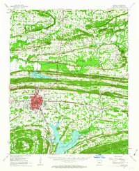
 1983 Conway1984 Print · USGSThe Arkansas River valley in the early eighties shows a landscape of river-bend settlements and expanding wildlife areas. Genealogists and historians can trace the Missouri Pacific RR through old river towns like Toad Suck, Morrilton, and Menifee.
 - 1984 Map of Russellville
 1984 Russellville1984 Print · USGSThe Arkansas River valley was undergoing significant change in the 1950s as transportation and water management reshaped the region from Russellville to Conway. Researchers can trace the era's rail networks like the Missouri Pacific RR and explore landmarks like Magazine Mountain and Petit Jean State Park.
 - 1992 Map of Russellville, 1993 Print
 1992 Russellville1993 Print · USGSCentral Arkansas in the early nineties shows a landscape defined by the Arkansas River valley and the surrounding national forests. Trace the development of river towns like Russellville and Dardanelle alongside landmarks such as Lake Dardanelle and Magazine Mtn.
 - 1994 Map of Conway
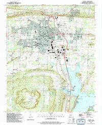 1994 Conway1994 Print · USGSConway emerges as a thriving regional center in the early nineties, balancing its identity as a college town with its position along the Union Pacific line. Researchers can trace historic family plots at Oak Grove Cem and Macedonia Cem or locate old landings along Lake Conway like Brannon Landing.
 - 2011 Map of Conway, 2011 Print
 2011 Conway2011 Print · USGSCovers Timberpeg, including Conway, Mayflower, and other nearby areas
 - 2014 Map of Conway, 2014 Print
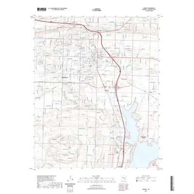
 2014 Conway2014 Print · USGSCovers Timberpeg, including Conway, Mayflower, and other nearby areas
 - 2017 Map of Conway, 2017 Print
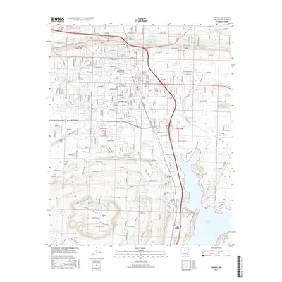 2017 Conway2017 Print · USGSCovers Timberpeg, including Conway, Mayflower, and other nearby areas
 - 2020 Map of Conway, 2020 Print
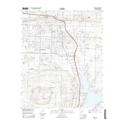
 2020 Conway2020 Print · USGSCovers Timberpeg, including Conway, Mayflower, and other nearby areas
 - 2024 Map of Conway, 2024 Print
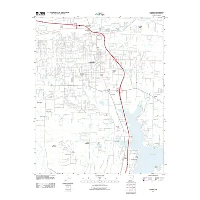
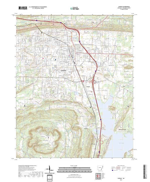 2024 Conway2024 Print · USGSConway and the shores of Lake Conway are shown in the twenty-twenties as the region continues its suburban and academic growth. Researchers can locate family roots at Stone Cem or Macedonia Ch and trace the area's geography from Cadron Ridge down to Mayflower.
End of results
Showing maps 1-14 of 14
Frequently asked questions
- What are the different types of historical maps available for Timberpeg?
- What is the oldest map of Timberpeg?
- Where can I purchase historical maps of Timberpeg for my home or office?
- Where can I download high-res historical maps of Timberpeg?
- Are there historical topographic maps available for Timberpeg?
- Is there historical aerial imagery available for Timberpeg?
- Where are historical maps of Timberpeg sourced from?